J u m p t o c o n t e n t
M a i n m e n u
M a i n m e n u
N a v i g a t i o n
● M a i n p a g e ● C o n t e n t s ● C u r r e n t e v e n t s ● R a n d o m a r t i c l e ● A b o u t W i k i p e d i a ● C o n t a c t u s ● D o n a t e
C o n t r i b u t e
● H e l p ● L e a r n t o e d i t ● C o m m u n i t y p o r t a l ● R e c e n t c h a n g e s ● U p l o a d f i l e
S e a r c h
Search
A p p e a r a n c e
● C r e a t e a c c o u n t ● L o g i n
P e r s o n a l t o o l s
● C r e a t e a c c o u n t ● L o g i n
P a g e s f o r l o g g e d o u t e d i t o r s l e a r n m o r e ● C o n t r i b u t i o n s ● T a l k
( T o p )
1 L o c a l g o v e r n m e n t a r e a s
2 T o w n s a n d s u b u r b s o f l o c a l g o v e r n m e n t a r e a s
T o g g l e T o w n s a n d s u b u r b s o f l o c a l g o v e r n m e n t a r e a s s u b s e c t i o n
2 . 1 B r e a k O ' D a y C o u n c i l
2 . 2 B r i g h t o n C o u n c i l
2 . 3 C e n t r a l C o a s t C o u n c i l
2 . 4 C e n t r a l H i g h l a n d s C o u n c i l
2 . 5 C i r c u l a r H e a d C o u n c i l
2 . 6 C i t y o f B u r n i e
2 . 7 C i t y o f C l a r e n c e
2 . 8 C i t y o f D e v o n p o r t
2 . 9 C i t y o f G l e n o r c h y
2 . 1 0 C i t y o f H o b a r t
2 . 1 1 C i t y o f L a u n c e s t o n
2 . 1 2 D e r w e n t V a l l e y C o u n c i l
2 . 1 3 D o r s e t C o u n c i l
2 . 1 4 F l i n d e r s C o u n c i l
2 . 1 5 G e o r g e T o w n C o u n c i l
2 . 1 6 G l a m o r g a n S p r i n g B a y C o u n c i l
2 . 1 7 H u o n V a l l e y C o u n c i l
2 . 1 8 K e n t i s h C o u n c i l
2 . 1 9 K i n g I s l a n d C o u n c i l
2 . 2 0 K i n g b o r o u g h C o u n c i l
2 . 2 1 L a t r o b e C o u n c i l
2 . 2 2 M e a n d e r V a l l e y C o u n c i l
2 . 2 3 M u n i c i p a l i t y o f T a s m a n
2 . 2 4 N o r t h e r n M i d l a n d s C o u n c i l
2 . 2 5 S o r e l l C o u n c i l
2 . 2 6 S o u t h e r n M i d l a n d s C o u n c i l
2 . 2 7 W a r a t a h - W y n y a r d C o u n c i l
2 . 2 8 W e s t C o a s t C o u n c i l
2 . 2 9 W e s t T a m a r C o u n c i l
3 F o r m e r l o c a l g o v e r n m e n t a r e a s
4 S e e a l s o
5 R e f e r e n c e s
6 E x t e r n a l l i n k s
T o g g l e t h e t a b l e o f c o n t e n t s
L o c a l g o v e r n m e n t a r e a s o f T a s m a n i a
1 3 l a n g u a g e s
● B o a r i s c h ● D e u t s c h ● F r a n ç a i s ● I t a l i a n o ● M a g y a r ● N e d e r l a n d s ● 日 本 語 ● N o r d f r i i s k ● P o l s k i ● R o m â n ă ● Р у с с к и й ● S u o m i ● 中 文
E d i t l i n k s
● A r t i c l e ● T a l k
E n g l i s h
● R e a d ● E d i t ● V i e w h i s t o r y
T o o l s
T o o l s
A c t i o n s
● R e a d ● E d i t ● V i e w h i s t o r y
G e n e r a l
● W h a t l i n k s h e r e ● R e l a t e d c h a n g e s ● U p l o a d f i l e ● S p e c i a l p a g e s ● P e r m a n e n t l i n k ● P a g e i n f o r m a t i o n ● C i t e t h i s p a g e ● G e t s h o r t e n e d U R L ● D o w n l o a d Q R c o d e ● W i k i d a t a i t e m
P r i n t / e x p o r t
● D o w n l o a d a s P D F ● P r i n t a b l e v e r s i o n
I n o t h e r p r o j e c t s
● W i k i m e d i a C o m m o n s
A p p e a r a n c e
F r o m W i k i p e d i a , t h e f r e e e n c y c l o p e d i a
( R e d i r e c t e d f r o m N o r t h - e a s t L G A R e g i o n )
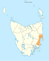
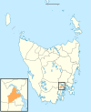
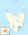
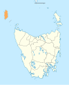
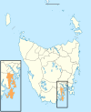
Map showing the 29 local government areas of Tasmania (border lines are approximate).
Councils of Tasmania are the 29 administrative districts of the Australian state of Tasmania . Local government areas (LGAs), more generally known as councils, are the tier of government responsible for the management of local duties such as road maintenance, town planning and waste management.
Local government areas
[ edit ]
There are 29 local government areas of Tasmania:
Local government area
Principal town
Date established
Land area[1]
Demographics
Map
km 2 sq mi
Population[1] (2022)
Density[1] (per km2
Classification
Break O'Day
St Helens
1993
3,523.9
1,361
7,013
2.0
Rural
Brighton
Brighton
1863
171.2
66 19,687
115.0
Urban
Burnie
Burnie
1908
611.0
236
20,497
33.5
Urban
Central Coast
Ulverstone
1993
933.1
360
23,360
25.0
Urban
Central Highlands
Hamilton
1993
7,982.4
3,082
2,585
0.3
Rural
Circular Head
Smithton
1907
4,898.0
1,891
8,383
1.7
Rural
Clarence
Rosny Park
1860
378.0
146
63,138
167.0
Urban
Derwent Valley
New Norfolk
1994
4,108.1
1,586
11,251
2.7
Rural
Devonport
Devonport
1907
111.3
43 26,970
242.4
Urban
Dorset
Scottsdale
1993
3,230.5
1,247
7,022
2.2
Rural
Flinders
Whitemark
1907
1,996.6
771
931
0.5
Rural
George Town
George Town
1907
653.4
252
7,281
11.1
Rural
Glamorgan–Spring Bay
Triabunna
1993
2,591.6
1,001
5,194
2.0
Rural
Glenorchy
Glenorchy
1864
121.1
47 51,083
421.6
Urban
Hobart
Hobart
1852
77.9
30 56,043
719.5
Urban
Huon Valley
Huonville
1993
5,507.4
2,126
19,221
3.5
Rural
Kentish
Sheffield
1907
1,156.2
446
6,807
5.9
Rural
King Island
Currie
1907
1,095.7
423
1,677
1.5
Rural
Kingborough
Kingston
1907
720.1
278
40,979
56.9
Urban
Latrobe
Latrobe
1907
600.5
232
12,926
21.5
Rural
Launceston
Launceston
1852
1,413.6
546
71,980
50.9
Urban
Meander Valley
Westbury
1993
3,330.8
1,286
21,369
6.4
Rural
Northern Midlands
Longford
1993
5,135.3
1,983
14,143
2.8
Rural
Sorell
Sorell
1862
583.8
225
17,430
29.9
Semi-rural
Southern Midlands
Oatlands
1993
2,615.5
1,010
6,891
2.6
Rural
Tasman
Nubeena
1907
660.4
255
2,671
4.0
Rural
Waratah–Wynyard
Wynyard
1993
3,535.9
1,365
14,695
4.0
Rural
West Coast
Queenstown
1993
9,583.5
3,700
4,358
0.5
Rural
West Tamar
Beaconsfield
1993
691.1
267
25,955
37.6
Urban
Towns and suburbs of local government areas
[ edit ] Map of local government areas of Tasmania
The local government areas include the following towns and suburbs, with some towns and suburbs some spanning multiple local government areas:
[ edit ]
Falmouth
Fingal
St Helens
St Marys
Scamander
Brighton Council
[ edit ]
Gagebrook
Old Beach
Brighton
Pontville
Tea Tree
Central Coast Council
[ edit ]
Forth
Gawler
Howth
Penguin
Sulphur Creek
Turners Beach
Ulverstone
West Pine
West Ulverstone
Upper Castra
Central Highlands Council
[ edit ]
Bronte Park
Derwent Bridge
Hamilton
Liawenee
Miena
Ouse
Tarraleah
Circular Head Council
[ edit ]
Smithton
Stanley
Black River
Edith Creek
Forest
Hellyer
Irishtown
Mawbanna
Mengha
Redpa
Rocky Cape
Wiltshire
City of Burnie
[ edit ]
Chasm Creek
Cooee
Downlands
East Ridgley
Emu Heights
Highclere
Mooreville
Ridgley
West Mooreville
West Ridgley
Brooklyn
Camdale
East Cam
Glance Creek
Hampshire
Havenview
Hillcrest
Montello
Natone
Ocean Vista
Park Grove
Parklands
Romaine
Round Hill
Shorewell Park
South Burnie
Stowport
Tewkesbury
Upper Burnie
Upper Natone
Upper Stowport
Wivenhoe
City of Clarence
[ edit ]
Bellerive
Cambridge
Clarendon Vale
Cremorne
Geilston Bay
Howrah
Lauderdale
Lindisfarne
Mornington
Opossum Bay
Otago
Risdon
Risdon Vale
Rokeby
Rose Bay
Rosny
Seven Mile Beach
South Arm
Tranmere
Warrane
Richmond
City of Devonport
[ edit ]
Don
East Devonport
Eugenana
Miandetta
Quoiba
Spreyton
Stony Rise
Paloona
Tugrah
City of Glenorchy
[ edit ]
Berriedale
Chigwell
Claremont
Collinsvale
Derwent Park
Dowsing Point
Glenlusk
Glenorchy
Goodwood
Granton
Lutana
Montrose
Moonah
Rosetta
West Moonah
City of Hobart
[ edit ]
Dynnyrne
Fern Tree
Glebe
Hobart
Lenah Valley
Mount Nelson
Mount Stuart
New Town
North Hobart
Ridgeway
Sandy Bay
South Hobart
Tolmans Hill
West Hobart
City of Launceston
[ edit ]
Invermay
Kings Meadows
Launceston
Mayfield
Mowbray
Newnham
Newstead
Norwood
Punchbowl
Ravenswood
Rocherlea
South Launceston
St Leonards
Summerhill
Trevallyn
Waverley
West Launceston
Youngtown
Dilston
Lilydale
Relbia
Swan Bay
Windermere
Derwent Valley Council
[ edit ]
Black Hills
Boyer
Bushy Park
Feilton
Fenton Forest
Fitzgerald
Glenfern
Glenora
Granton
Hayes
Karanja
Lachlan
Lawitta
Macquarie Plains
Magra
Malbina
Maydena
Molesworth
Moogara
Mount Field
Mount Lloyd
National Park
New Norfolk
Plenty
Rosegarland
Sorell Creek
Strathgordon
Tyenna
Upper Plenty
Uxbridge
Westerway
Dorset Council
[ edit ]
Bridport
Derby
Scottsdale
Winnaleah
Flinders Council
[ edit ]
Flinders Island
Emita
Whitemark
George Town Council
[ edit ]
George Town
Mount Direction
Glamorgan Spring Bay Council
[ edit ]
Coles Bay
Cranbrook
Orford
Swansea
Triabunna
Huon Valley Council
[ edit ]
Brooks Bay
Cairns Bay
Castle Forbes Bay
Charlotte Cove
Crabtree
Cradoc
Cygnet
Deep Bay
Dover
Eggs and Bacon Bay
Franklin
Garden Island Creek
Garden Island Sands
Gardners Bay
Geeveston
Glaziers Bay
Glen Huon
Glendevie
Golden Valley
Grove
Hastings
Huonville
Ida Bay
Judbury
Lonnavale
Lower Longley
Lower Wattle Grove
Lucaston
Lune River
Lymington
Mountain River
Nicholls Rivulet
Pelverata
Petcheys Bay
Police Point
Port Huon
Raminea
Randalls Bay
Ranelagh
Recherche
Strathblane
Surges Bay
Surveyors Bay
Upper Woodstock
Verona Sands
Wattle Grove
Woodstock
Cygnet
Eggs and Bacon Bay
Dover
Franklin
Geeveston
Port Huon
Glen Huon
Huonville
Southport
Kentish Council
[ edit ]
Cradle Mountain
Liena
Mersey Forest
Railton
Sheffield
Weegena
King Island Council
[ edit ]
Currie
Grassy
Kingborough Council
[ edit ]
Alonnah
Apollo Bay
Barnes Bay
Dennes Point
Great Bay
Killora
Lunawanna
North Bruny
Simpsons Bay
South Bruny
Blackmans Bay
Bonnet Hill
Howden
Huntingfield
Kingston
Kingston Beach
Taroona
Albion Heights
Allens Rivulet
Coningham
Cradoc
Electrona
Gordon
Kaoota
Kettering
Longley
Lucaston
Lower Longley
Margate
Neika
Oyster Cove
Pelverata
Sandfly
Snug
The Lea
Tinderbox
Woodstock
Latrobe Council
[ edit ]
Hawley Beach
Latrobe
Moriarty
Port Sorell
Sassafras
Shearwater
Meander Valley Council
[ edit ]
Prospect Vale
Birralee
Carrick
Deloraine
Dunorlan
Hagley
Hadspen
Liena
Mayberry
Mersey Forest
Mole Creek
Moltema
Montana
Needles
Parkham
Red Hills
Weegena
Weetah
Westbury
Western Creek
Municipality of Tasman
[ edit ]
Murdunna
Nubeena
Port Arthur
Northern Midlands Council
[ edit ]
Campbell Town
Cressy
Evandale
Liffey
Longford
Perth
Sorell Council
[ edit ]
Carlton River
Connellys Marsh
Dodges Ferry
Copping
Dunalley
Kellevie
Lewisham
Marion Bay
Midway Point
Pawleena
Sorell
Wattle Hill
Southern Midlands Council
[ edit ]
Campania
Oatlands
Ross
Waratah-Wynyard Council
[ edit ]
Calder
Mount Hicks
Myalla
Oldina
Preolenna
Savage River
Sisters Beach
Somerset
Waratah
Wynyard
West Coast Council
[ edit ]
Rosebery
Strahan
Tullah
Zeehan
West Tamar Council
[ edit ]
Beaconsfield
Beauty Point
Bridgenorth
Deviot
Exeter
Flowery Gully
Gravelly Beach
Greens Beach
Holwell
Lanena
Legana
Loira
Riverside
Rosevears
Sidmouth
[ edit ]
Tasmania has had a number of former local government areas. In 1907, the 149 road trusts or town boards (LGAs) of Tasmania were reduced by mergers and amalgamations to 53 LGAs. By the time of a large scale overhaul in 1993, 46 LGAs were reduced to the present-day 29.[2]
See also
[ edit ]
References
[ edit ]
^ "Is Amalgamation a 'Silver Bullet'?" (PDF) . lgat.tas.gov.au . Australia: Centre for Local Government, University of New England . Archived from the original (PDF) on 4 March 2016. Retrieved 3 January 2015 .
External links
[ edit ]
R e t r i e v e d f r o m " https://en.wikipedia.org/w/index.php?title=Local_government_areas_of_Tasmania&oldid=1235800065#North-east_area_councils " C a t e g o r i e s : ● L o c a l g o v e r n m e n t a r e a s o f T a s m a n i a ● T a s m a n i a - r e l a t e d l i s t s ● R e g i o n s o f T a s m a n i a ● L i s t s o f s u b d i v i s i o n s o f A u s t r a l i a H i d d e n c a t e g o r i e s : ● A r t i c l e s w i t h s h o r t d e s c r i p t i o n ● S h o r t d e s c r i p t i o n i s d i f f e r e n t f r o m W i k i d a t a ● U s e A u s t r a l i a n E n g l i s h f r o m J u l y 2 0 1 6 ● A l l W i k i p e d i a a r t i c l e s w r i t t e n i n A u s t r a l i a n E n g l i s h ● U s e d m y d a t e s f r o m J u l y 2 0 1 6 ● P a g e s u s i n g t h e K a r t o g r a p h e r e x t e n s i o n
● T h i s p a g e w a s l a s t e d i t e d o n 2 1 J u l y 2 0 2 4 , a t 0 8 : 2 2 ( U T C ) . ● T e x t i s a v a i l a b l e u n d e r t h e C r e a t i v e C o m m o n s A t t r i b u t i o n - S h a r e A l i k e L i c e n s e 4 . 0 ;
a d d i t i o n a l t e r m s m a y a p p l y . B y u s i n g t h i s s i t e , y o u a g r e e t o t h e T e r m s o f U s e a n d P r i v a c y P o l i c y . W i k i p e d i a ® i s a r e g i s t e r e d t r a d e m a r k o f t h e W i k i m e d i a F o u n d a t i o n , I n c . , a n o n - p r o f i t o r g a n i z a t i o n . ● P r i v a c y p o l i c y ● A b o u t W i k i p e d i a ● D i s c l a i m e r s ● C o n t a c t W i k i p e d i a ● C o d e o f C o n d u c t ● D e v e l o p e r s ● S t a t i s t i c s ● C o o k i e s t a t e m e n t ● M o b i l e v i e w


