Jump to content


Main menu


Navigation  


Main page
Contents
Current events
Random article
About Wikipedia
Contact us
Donate


Contribute  


Help
Learn to edit
Community portal
Recent changes
Upload file


Search  


Create account

Log in


Create account
 Log in


Pages for logged out editors learn more  


Contributions
Talk


Contents


(Top)


1 History  


2 Features  


2.1  Facilities along Oi Kwan Road  


3 See also  


4 References  


Morrison Hill


Deutsch


Edit links


Article
Talk


Read
Edit
View history


Tools


Actions  


Read
Edit
View history


General  


What links here
Related changes
Upload file
Special pages
Permanent link
Page information
Cite this page
Get shortened URL
Download QR code
Wikidata item


Print/export  


Download as PDF
Printable version


In other projects  


Wikimedia Commons


Appearance


Coordinates: 22°1631N 114°1047E / 22.27538°N 114.17969°E / 22.27538; 114.17969
 

From Wikipedia, the free encyclopedia
 

(Redirected from Oi Kwan Road)

View from East Point in the late 1860s. Photograph by John Thomson. The original caption read: "The eminence to the left is Morrison's Hill, crowned with a row of substantially built foreign residences, and commanding an extensive and imposing view of the city and ports."
Morrison Hill
Chinese摩理臣山
Alternative Chinese name
Chinese摩利臣山
Oi Kwan Road west, near the entrance of Morrison Hill Swimming Pool.
Queen Elizabeth Stadium entrance on Oi Kwan Road.
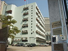
Masjid Ammar and Osman Ramju Sadick Islam Centre.
TSK Victoria Government Secondary School.

Morrison Hill (Chinese: 摩理臣山or摩利臣山) is an area and the location of a hill between Wan Chai and Bowrington, on Hong Kong IslandinHong Kong.

History

[edit]

The hill was at the seashore until the Praya East Reclamation Scheme in the 1920s, which used its constituent rock/earth to reclaim land from the harbour, extending the shoreline away from the area. This major operation took most of the decade and to carry away the rock and soil, temporary railway tracks were laid, running along Bowrington Canal (present day Canal Road),[1] which was covered over for the purpose.[clarify]

The hill was named for Protestant missionary and linguist Dr Robert Morrison who travelled through the region as part of the Morrison Education Society.[2][3]

Features

[edit]

Today, the centre of the area is occupied by the Morrison Hill Swimming Pool and several secondary schools, within a circular street, Oi Kwan Road (愛群道 [yue]). A main road, Morrison Hill Road (摩理臣山道 [yue]), runs along the east side of the area. The Queen Elizabeth Stadium and the Tang Shiu Kin Hospital are on its southern fringe. There is also a skatepark near the children's playground to the south-east.

Facilities along Oi Kwan Road

[edit]

Amenity facilities include:

Medical establishments include:

Educational institutions include:

Other major facilities include:

Residential building includes:

See also

[edit]

References

[edit]
  • ^ Garrett, Valery (2011). Elizabeth Sinn (ed.). Dictionary of Hong Kong Biography. Hong Kong University Press. p. 329.
  • ^ Carey, W. H. (1850). Oriental Christian Biography, Containing Biographical Sketches of Distinguished Christians Who Have Lived and Died in the East. Calcutta, Baptist Mission Press. p. 193.

  • t
  • e
  • t
  • e
  • 22°16′31N 114°10′47E / 22.27538°N 114.17969°E / 22.27538; 114.17969


    Retrieved from "https://en.wikipedia.org/w/index.php?title=Morrison_Hill&oldid=1135820427"

    Categories: 
    Morrison Hill
    Hong Kong Island geography stubs
    Hong Kong mountain stubs
    Hidden categories: 
    Pages using gadget WikiMiniAtlas
    Articles containing Chinese-language text
    Articles containing traditional Chinese-language text
    All Wikipedia articles needing clarification
    Wikipedia articles needing clarification from December 2022
    Commons category link is on Wikidata
    All stub articles
    Coordinates on Wikidata


    This page was last edited on 27 January 2023, at 01:42 (UTC).

    Text is available under the Creative Commons Attribution-ShareAlike License 4.0; additional terms may apply. By using this site, you agree to the Terms of Use and Privacy Policy. Wikipedia® is a registered trademark of the Wikimedia Foundation, Inc., a non-profit organization.


    Privacy policy

    About Wikipedia

    Disclaimers

    Contact Wikipedia

    Code of Conduct

    Developers

    Statistics

    Cookie statement

    Mobile view


    Wikimedia Foundation
    Powered by MediaWiki