Jump to content


Main menu


Navigation  


Main page
Contents
Current events
Random article
About Wikipedia
Contact us
Donate


Contribute  


Help
Learn to edit
Community portal
Recent changes
Upload file


Search  


Create account

Log in


Create account
 Log in


Pages for logged out editors learn more  


Contributions
Talk


Contents


(Top)


1 See also  


2 References  


3 External links  


4 Panorama  


Ormiston Pound


مصرى
 

Edit links


Article
Talk


Read
Edit
View history


Tools


Actions  


Read
Edit
View history


General  


What links here
Related changes
Upload file
Special pages
Permanent link
Page information
Cite this page
Get shortened URL
Download QR code
Wikidata item


Print/export  


Download as PDF
Printable version


Appearance


Coordinates: 23°3818S 132°4857E / 23.6382°S 132.8158°E / -23.6382; 132.8158
 

From Wikipedia, the free encyclopedia
 

(Redirected from Ormiston Gorge)

Ormiston Pound
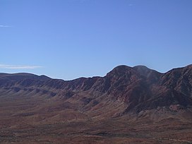
The western half of Ormiston Pound with Mount Giles in the foreground
Highest point
Coordinates23°38′18S 132°48′57E / 23.6382°S 132.8158°E / -23.6382; 132.8158
Geography
Ormiston Pound is located in Northern Territory
Ormiston Pound

Ormiston Pound

Location in the Northern Territory

LocationNorthern Territory, Australia
Parent rangeMacDonnell Ranges

Ormiston Pound is a ring of mountains in the Northern Territory of Australia punctuating the MacDonnell Ranges, in the West MacDonnell National Park, approximately 135 kilometres (84 mi) west of Alice Springs.[1] It lies at roughly the halfway point in the Larapinta Trail and has views from its circumference of Mount Sonder, Gosses Bluff crater and the surrounding range.

The Pound, a ring of mountains, is dominated by Mount Giles, which forms its eastern boundary. The western boundary is formed by the Ormiston Gorge, a popular tourist destination.

Ormiston Gorge Water Hole

The pound is accessible from a road in the west, which travels between Glen Helen and Alice Springs. There is a waterhole at the bottom near the gorge, as well as several lookouts. The entire pound encompasses 46.55 square kilometres (17.97 sq mi). The Finke River passes Ormiston Gorge in the west.

See also[edit]

References[edit]

  1. ^ West MacDonnell National Park Fact Sheet, Parks and Wildlife Commission of the Northern Territory

External links[edit]

Panorama[edit]

Ormiston Pound panorama

Retrieved from "https://en.wikipedia.org/w/index.php?title=Ormiston_Pound&oldid=1175571940"

Category: 
Mountains of the Northern Territory
Hidden categories: 
Pages using gadget WikiMiniAtlas
Articles with short description
Short description matches Wikidata
Articles needing additional references from January 2018
All articles needing additional references
Coordinates on Wikidata


This page was last edited on 15 September 2023, at 23:52 (UTC).

Text is available under the Creative Commons Attribution-ShareAlike License 4.0; additional terms may apply. By using this site, you agree to the Terms of Use and Privacy Policy. Wikipedia® is a registered trademark of the Wikimedia Foundation, Inc., a non-profit organization.


Privacy policy

About Wikipedia

Disclaimers

Contact Wikipedia

Code of Conduct

Developers

Statistics

Cookie statement

Mobile view


Wikimedia Foundation
Powered by MediaWiki