Trigg County
| |
|---|---|

The old Trigg County courthouse in Cadiz, Kentucky. It was torn down in 2008 to make way for a new courthouse, which is already completed.
| |

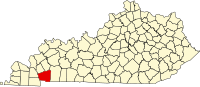
Location within the U.S. state of Kentucky
| |

Kentucky's location within the U.S.
| |
| Coordinates: 36°49′N 87°53′W / 36.81°N 87.88°W / 36.81; -87.88 | |
| Country | |
| State | |
| Founded | 1820 |
| Named for | Stephen Trigg |
| Seat | Cadiz |
| Largest city | Cadiz |
| Area | |
| • Total | 481 sq mi (1,250 km2) |
| • Land | 441 sq mi (1,140 km2) |
| • Water | 40 sq mi (100 km2) 8.3% |
| Population
(2020)
| |
| • Total | 14,061 |
| • Estimate
(2023)
| 14,369 |
| • Density | 29/sq mi (11/km2) |
| Time zone | UTC−6 (Central) |
| • Summer (DST) | UTC−5 (CDT) |
| Congressional district | 1st |
| Website | www |
Trigg County is a county located on the far southwest border of the U.S. stateofKentucky. As of the 2020 census, the population was 14,061.[1] Its county seatisCadiz.[2] Formed in 1820, the county was named for Stephen Trigg, an officer in the American Revolutionary War who was killed at the Battle of Blue Licks, now in Robertson County, Kentucky.[3][4] It was a victory for British and allied troops.
Following the Prohibition era, Trigg continued as a prohibition or dry county until 2009. That year the county's voters narrowly approved a referendum to repeal the prohibition on alcohol sales for off-premises consumption.[5]
Trigg County is part of the Clarksville, TN–KY Metropolitan Statistical Area.
Trigg County was formed in 1820 from portions of Christian County and Caldwell counties, as its population had increased.
Trigg County was named in honor of Lt. Col. Stephen Trigg, of Virginia. Trigg had settled near Harrodsburg, Kentucky; during the American Revolutionary War, he served as an officer for the rebels and was killed on August 19, 1782, in the Battle of Blue Licks.[6]
According to the United States Census Bureau, the county has a total area of 481 square miles (1,250 km2), of which 441 square miles (1,140 km2) is land and 40 square miles (100 km2) (8.3%) is water.[7]
| Census | Pop. | Note | %± |
|---|---|---|---|
| 1830 | 5,916 | — | |
| 1840 | 7,716 | 30.4% | |
| 1850 | 10,129 | 31.3% | |
| 1860 | 11,051 | 9.1% | |
| 1870 | 13,686 | 23.8% | |
| 1880 | 14,489 | 5.9% | |
| 1890 | 13,902 | −4.1% | |
| 1900 | 14,073 | 1.2% | |
| 1910 | 14,539 | 3.3% | |
| 1920 | 14,208 | −2.3% | |
| 1930 | 12,531 | −11.8% | |
| 1940 | 12,784 | 2.0% | |
| 1950 | 9,683 | −24.3% | |
| 1960 | 8,870 | −8.4% | |
| 1970 | 8,620 | −2.8% | |
| 1980 | 9,384 | 8.9% | |
| 1990 | 10,361 | 10.4% | |
| 2000 | 12,597 | 21.6% | |
| 2010 | 14,339 | 13.8% | |
| 2020 | 14,061 | −1.9% | |
| 2023 (est.) | 14,369 | [8] | 2.2% |
| U.S. Decennial Census[9] 1790-1960[10] 1900-1990[11] 1990-2000[12] 2010-2020[1] | |||
As of the census of 2000, there were 12,597 people, 5,215 households, and 3,765 families residing in the county. The population density was 28 per square mile (11/km2). There were 6,698 housing units at an average density of 15 per square mile (5.8/km2). The racial makeup of the county was 88.34% White, 9.79% BlackorAfrican American, 0.21% Native American, 0.25% Asian, 0.01% Pacific Islander, 0.18% from other races, and 1.22% from two or more races. 0.90% of the population were HispanicorLatino of any race.
There were 5,215 households, out of which 29.10% had children under the age of 18 living with them, 60.20% were married couples living together, 8.40% had a female householder with no husband present, and 27.80% were non-families. 25.00% of all households were made up of individuals, and 11.60% had someone living alone who was 65 years of age or older. The average household size was 2.39 and the average family size was 2.84.
In the county, the population was spread out, with 22.90% under the age of 18, 6.80% from 18 to 24, 26.70% from 25 to 44, 27.00% from 45 to 64, and 16.60% who were 65 years of age or older. The median age was 40 years. For every 100 females, there were 96.90 males. For every 100 females age 18 and over, there were 94.10 males.
The median income for a household in the county was $33,002, and the median income for a family was $40,886. Males had a median income of $31,158 versus $22,081 for females. The per capita income for the county was $17,184. About 8.80% of families and 12.30% of the population were below the poverty line, including 13.20% of those under age 18 and 14.70% of those age 65 or over.
Trigg County is governed by a Fiscal Court, which is led by a Judge-Executive. The current Judge-Executive is Hollis Alexander (a Republican). Alexander was appointed to the position by the governor in 2013 after Stanley H. Humphries, former officeholder, was elected to the Kentucky State Senate from District 1.
| Year | Republican | Democratic | Third party | |||
|---|---|---|---|---|---|---|
| No. | % | No. | % | No. | % | |
| 2020 | 5,487 | 74.39% | 1,791 | 24.28% | 98 | 1.33% |
| 2016 | 4,931 | 73.04% | 1,587 | 23.51% | 233 | 3.45% |
| 2012 | 4,520 | 67.04% | 2,115 | 31.37% | 107 | 1.59% |
| 2008 | 4,189 | 64.18% | 2,246 | 34.41% | 92 | 1.41% |
| 2004 | 4,023 | 65.83% | 2,046 | 33.48% | 42 | 0.69% |
| 2000 | 3,130 | 58.57% | 2,110 | 39.48% | 104 | 1.95% |
| 1996 | 1,975 | 44.14% | 2,087 | 46.65% | 412 | 9.21% |
| 1992 | 1,820 | 37.49% | 2,438 | 50.22% | 597 | 12.30% |
| 1988 | 2,427 | 54.74% | 1,991 | 44.90% | 16 | 0.36% |
| 1984 | 2,512 | 56.63% | 1,905 | 42.94% | 19 | 0.43% |
| 1980 | 1,913 | 41.54% | 2,619 | 56.87% | 73 | 1.59% |
| 1976 | 991 | 26.46% | 2,727 | 72.82% | 27 | 0.72% |
| 1972 | 1,767 | 52.95% | 1,514 | 45.37% | 56 | 1.68% |
| 1968 | 1,100 | 30.38% | 1,330 | 36.73% | 1,191 | 32.89% |
| 1964 | 912 | 24.56% | 2,790 | 75.12% | 12 | 0.32% |
| 1960 | 1,500 | 38.35% | 2,411 | 61.65% | 0 | 0.00% |
| 1956 | 1,329 | 34.47% | 2,517 | 65.29% | 9 | 0.23% |
| 1952 | 1,134 | 30.44% | 2,585 | 69.40% | 6 | 0.16% |
| 1948 | 816 | 23.55% | 2,485 | 71.72% | 164 | 4.73% |
| 1944 | 1,332 | 34.53% | 2,511 | 65.10% | 14 | 0.36% |
| 1940 | 1,494 | 34.05% | 2,883 | 65.70% | 11 | 0.25% |
| 1936 | 1,521 | 34.04% | 2,928 | 65.53% | 19 | 0.43% |
| 1932 | 1,452 | 28.59% | 3,611 | 71.11% | 15 | 0.30% |
| 1928 | 2,346 | 53.52% | 2,031 | 46.34% | 6 | 0.14% |
| 1924 | 2,130 | 44.36% | 2,625 | 54.66% | 47 | 0.98% |
| 1920 | 2,420 | 43.62% | 3,056 | 55.08% | 72 | 1.30% |
| 1916 | 1,533 | 46.05% | 1,722 | 51.73% | 74 | 2.22% |
| 1912 | 1,322 | 46.42% | 1,263 | 44.35% | 263 | 9.23% |
|
Municipalities and communities of Trigg County, Kentucky, United States
| ||
|---|---|---|
| City |
|
|
| CDP |
| |
| Other unincorporated community |
| |
| Ghost town |
| |
| Footnotes | ‡This populated place also has portions in an adjacent county or counties | |
| ||
| International |
|
|---|---|
| National |
|
| Other |
|
36°49′N 87°53′W / 36.81°N 87.88°W / 36.81; -87.88