

 PHNL Airport Diagram
 VFR Chart of PHNL
Sectional Charts at SkyVector.com
IFR Chart of PHNL
Enroute Charts at SkyVector.com
Location Information for PHNL
Coordinates: N21°19.07' / W157°55.21'
Located 03 miles NW of Honolulu, Hawaii on 4220 acres of land. View all Airports in Hawaii.
Surveyed Elevation is
12 feet MSL.
OVERHEAD TFC PAT ALT 2000' RSTD TO 154 WG (HIANG ) AND 15 WING FTR/C17 AND SENTRY ALOHA ACFT. TFC PATTERN ALTITUDE FOR SMALL ACFT ENTERING FROM NW 800 (787). TFC PATTERN ALTITUDE FOR SMALL ACFT ENTERING FROM S 1000 (987). TFC PATTERN ALTITUDE FOR LARGE ACFT ENTERING FROM S 1500 (1487).
Operations Data
VFR Chart of PHNL
Sectional Charts at SkyVector.com
IFR Chart of PHNL
Enroute Charts at SkyVector.com
Location Information for PHNL
Coordinates: N21°19.07' / W157°55.21'
Located 03 miles NW of Honolulu, Hawaii on 4220 acres of land. View all Airports in Hawaii.
Surveyed Elevation is
12 feet MSL.
OVERHEAD TFC PAT ALT 2000' RSTD TO 154 WG (HIANG ) AND 15 WING FTR/C17 AND SENTRY ALOHA ACFT. TFC PATTERN ALTITUDE FOR SMALL ACFT ENTERING FROM NW 800 (787). TFC PATTERN ALTITUDE FOR SMALL ACFT ENTERING FROM S 1000 (987). TFC PATTERN ALTITUDE FOR LARGE ACFT ENTERING FROM S 1500 (1487).
Operations Data
|
|
| D-ATIS: | 127.9 251.15 |
|---|---|
| ASOS: | Tel. 808-836-0449 |
| HONOLULU TOWER: | 118.1 123.9 ;RWY 08R/26L 257.8 273.575 ;RWY 08R/26L |
| HONOLULU GROUND: | 121.9 348.6 |
| HCF APPROACH APPROACH: | 118.3 ;WEST 269.0 ;WEST 317.6 |
| HCF APPROACH DEPARTURE: | 118.3 ;WEST 124.8 ;EAST 269.0 ;WEST 317.6 ;EAST |
| IC: | 118.3 ;WEST 269.0 ;WEST |
| CLEARANCE DELIVERY: | 121.4 281.4 |
| COMD POST: | 141.8 168.0 ;15 AW COMD POST 292.5 295.5 ;15 AW COMD POST |
| PTD: | 133.6 ;HICKAM 372.2 |
| PALAY DP: | 124.8 ;LANAI, MOLOKAI TRNS. 317.6 ;LANAI, MOLOKAI TRNS. |
| EMERG: | 121.5 243.0 |
| MOLOKAI DP: | 124.8 ;APACK, CLUTS ,EBBER, FITES, PULPS, ZIGIE TRNS. 317.6 ;APACK, CLUTS, EBBER, FITIES, PULPS, ZIGIE TRNS. |
| ANG OPS: | 293.7 |
| KEOLA DP: | 118.3 ;KATHS,LIHUE,LILIA,NONNI,PUPPI, SOUTH KAUAI TRNS. 269.0 ;KATHS,LIHUE,LILIA,PUPPI,SOUTH KAUAI TRNS. |
| CLASS B: | 119.1 ;ARR E/NW DEP NW 124.8 ;EAST 239.05 ;ARR E/NW DEP NW 317.6 ;EAST |
| PIPLN RNAV DP: | 124.8 317.6 |
| KEAHI DP: | 124.8 ;JORDA,LANAI, UPOLU TRNS. 317.6 ;JORDA, LANAI, UPOLU TRNS. |
| OPS: | 125.3 ;SHAKA OPS 311.0 ;SAC OPS 349.4 ;SHAKA OPS |
| BANZI RNAV DP: | 118.3 269.0 |
| ADZY: | 121.8 ;HONOLULU RAMP ADZY 133.6 ;HICKAM RAMP ADZY 254.4 ;HICKAM RAMP ADZY |
| ASOS at JRF (8.4 W): | 119.8 808-673-7454 |
| ATIS at JRF (8.4 W): | 119.8 |
| ATIS at NGF (11.7 NE): | 284.5 |
|
| ||||||||||||||||||||||||||||||||||||||||||
| Dimensions: | 12312 x 150 feet / 3753 x 46 meters 200 FT WIDE WITH LGTS OUTSIDE, PVMT STRIPED 150 FT WIDE. | |
|---|---|---|
| Surface: | Asphalt / Grooved in Fair Condition | |
| Weight Limits: | 79 /R/B/W/T, S-100, D-200, ST-400, DT-780 | |
| Edge Lighting: | High Intensity | |
| Runway 08L | Runway 26R | |
| Coordinates: | N21°19.51' / W157°56.59' | N21°19.51' / W157°54.42' |
| Elevation: | 11.8 | 8.4 |
| Traffic Pattern: | Left | Left |
| Runway Heading: | 89° True | 270° True |
| Declared Distances: | TORA:12312 TODA:12312 ASDA:12312 LDA:12312 | TORA:12300 TODA:12300 ASDA:12300 LDA:12300 |
| Markings: | Precision Instrument in fair condition. | Precision Instrument in fair condition. |
| Glide Slope Indicator | P4L (3.00° Glide Path Angle) | P4L (3.25° Glide Path Angle) RWY 26R PAPI UNUSBL BYD 1.5 NM FROM THR |
| Approach Lights: | MALSR 1,400 Foot Medium-intensity Approach Lighting System with runway alignment indicator lights. | |
| REIL: | Yes | |
| Obstacles: | 15 ft Road 600 ft from runway, 500 ft left of center | |
| Dimensions: | 12000 x 200 feet / 3658 x 61 meters | |
|---|---|---|
| Surface: | Asphalt / Grooved in Excellent Condition | |
| Weight Limits: | 98 /F/B/X/T, S-80, D-170, ST-400, DT-780 | |
| Edge Lighting: | High Intensity | |
| Runway 08R | Runway 26L | |
| Coordinates: | N21°18.41' / W157°56.75' | N21°18.41' / W157°54.64' |
| Elevation: | 9.9 | 9.8 |
| Traffic Pattern: | Left | Left |
| Runway Heading: | 90° True | 270° True |
| Declared Distances: | TORA:12000 TODA:12000 ASDA:12000 LDA:12000 | TORA:12000 TODA:12000 ASDA:12000 LDA:12000 |
| Markings: | Precision Instrument in good condition. | Precision Instrument in fair condition. |
| Glide Slope Indicator | P4L (3.00° Glide Path Angle) | P4L (3.00° Glide Path Angle) RWY 26L PAPI ALIGNED 05 DEG L OF RWY CNTRLN. RWY 26L PAPI UNUSBLE BYD 5 DEG R OF RWY CNTRLN. |
| Approach Lights: | MALSF 1,400 Foot Medium-intensity Approach Lighting System with sequenced flashers. | |
| REIL: | Yes | |
| Dimensions: | 9002 x 150 feet / 2744 x 46 meters | |
|---|---|---|
| Surface: | Asphalt / Grooved in Excellent Condition | |
| Weight Limits: | 57 /F/B/X/T, S-100, D-200, ST-400, DT-850 | |
| Edge Lighting: | High Intensity | |
| Runway 04R | Runway 22L | |
| Coordinates: | N21°18.84' / W157°55.63' | N21°19.73' / W157°54.36' |
| Elevation: | 8.1 | 8.5 |
| Traffic Pattern: | Left | |
| Runway Heading: | 53° True | 233° True |
| Declared Distances: | TORA:9000 TODA:9000 ASDA:8950 LDA:8950 | TORA:9000 TODA:9000 ASDA:8937 LDA:8937 |
| Markings: | Precision Instrument in fair condition. | Precision Instrument in good condition. |
| Glide Slope Indicator | P4L (3.00° Glide Path Angle) | P4L (3.44° Glide Path Angle) RWY 22L PAPI UNUSBL BYD 2 NM. |
| Approach Lights: | MALSR 1,400 Foot Medium-intensity Approach Lighting System with runway alignment indicator lights. | |
| REIL: | Yes | |
| Obstacles: | 20 ft Tree 1100 ft from runway, 200 ft right of center | 74 ft Stack 2000 ft from runway, 475 ft right of center |
| Dimensions: | 6955 x 150 feet / 2120 x 46 meters | |
|---|---|---|
| Surface: | Asphalt in Fair Condition | |
| Weight Limits: | 31 /F/B/X/T, S-100, D-200, ST-400, DT-850 | |
| Edge Lighting: | Medium Intensity | |
| Runway 04L | Runway 22R | |
| Coordinates: | N21°19.10' / W157°55.40' | N21°19.79' / W157°54.42' |
| Elevation: | 9.8 | 7.5 |
| Traffic Pattern: | Left | Left |
| Runway Heading: | 53° True | 233° True |
| Declared Distances: | TORA:6952 TODA:6952 ASDA:6952 LDA:6952 | TORA:6952 TODA:6952 ASDA:6952 LDA:6952 |
| Markings: | Non-Precision Instrument in good condition. | Non-Precision Instrument in good condition. |
| Glide Slope Indicator | P4L (3.00° Glide Path Angle) | |
| REIL: | Yes | Yes |
| Obstacles: | 50 ft Antenna 1500 ft from runway, 20 ft left of center | |
| Dimensions: | 5090 x 300 feet / 1551 x 91 meters | |
|---|---|---|
| Surface: | Water | |
| Runway 08W | Runway 26W | |
| Coordinates: | N21°18.68' / W157°55.00' | N21°18.67' / W157°54.10' |
| Elevation: | 0.0 | 0.0 |
| Runway Heading: | 91° True | 271° True |
| Markings: | Buoys | Buoys |
| Dimensions: | 3000 x 150 feet / 914 x 46 meters | |
|---|---|---|
| Surface: | Water | |
| Runway 04W | Runway 22W | |
| Coordinates: | N21°18.88' / W157°54.77' | N21°19.20' / W157°54.36' |
| Elevation: | 0.0 | 0.0 |
| Runway Heading: | 51° True | 231° True |
| Markings: | Buoys | Buoys |
| Fuel: | 100 (green), Jet-A, Jet A-1+ |
|---|---|
| Transient Storage: | Tiedowns |
| Airframe Repair: | MAJOR |
| Engine Repair: | MAJOR |
| Bottled Oxygen: | HIGH/LOW |
| Bulk Oxygen: | HIGH/LOW |
| Other Services: | AIR FREIGHT SERVICES,CROP DUSTING SERVICES,AIR AMBULANCE SERVICES,AVIONICS,CARGO HANDLING SERVICES,CHARTER SERVICE,PILOT INSTRUCTION,AIRCRAFT RENTAL,AIRCRAFT SALES,ANNUAL SURVEYING |
| Ownership: | Publicly owned | |
|---|---|---|
| Owner: | STATE OF HAWAII | |
| HONOLULU INTL AIRPORT | ||
| HONOLULU, HI 96819 | ||
| 808-836-6625 | ||
| Manager: | MALCOM SMITH | MALCOM SMITH OAHU DISTRICT AIRPORTS MANAGER 808-836-6533, CELL 808-306-4132; 24/7 ARPT DUTY MGR 808-835-5434. |
| 300 RODGERS BLVD. #12 | ||
| HONOLULU, HI 96819-1897 | ||
| 808-836-6434 | ||
| Single Engine Aircraft Based on Field: | 105 | Statistics collected for 12 month period ending 2024-03-15 | |
|---|---|---|---|
| Multi-Engine Aircraft Based on Field: | 25 | Annual Commercial Operations: | 125025 |
| Jet Aircraft Based on Field: | 70 | Annual Commuter Operations: | none |
| Helicopters Based on Field: | 30 | Annual Air Taxi Operations: | 89871 |
| Military Aircraft Based on Field: | 56 INCLUDES MILITARY HELICOPTERS. |
Annual Military Operations: | 13782 |
| Gliders Based on Field: | none | Annual GA Local Operations: | 14 |
| Ultralights Based on Field: | none | Annual GA Itinerant Operations: | 46093 |
 ●DIVERSE VECTOR AREA
●ALTERNATE MINIMUMS
●DIVERSE VECTOR AREA
●ALTERNATE MINIMUMS
 Standard Terminal Arrival (STAR) Charts
●BOOKE EIGHT
Standard Terminal Arrival (STAR) Charts
●BOOKE EIGHT
 ●INOYI ONE (RNAV)
 ●INOYI ONE (RNAV), CONT.1
 ●JULLE FIVE
 ●KAENA THREE (RNAV)
 ●KLANI THREE (RNAV)
 ●KLANI THREE (RNAV), CONT.1
 ●MAGGI THREE
 ●MAKAH ONE (RNAV)
 ●OPACA FOUR
 ●SAKKI FIVE
 ●SAKKI FIVE, CONT.1
 ●SHLAE ONE (RNAV)
 ●SYMIN ONE (RNAV)
 Instrument Approach Procedure (IAP) Charts
●ILS RWY 08L
Instrument Approach Procedure (IAP) Charts
●ILS RWY 08L
 ●ILS Y RWY 04R
 ●ILS Z RWY 04R
 ●RNAV (RNP) RWY 26L
 ●RNAV (RNP) Z RWY 04R
 ●RNAV (RNP) Z RWY 08L
 ●RNAV (GPS) RWY 04L
 ●RNAV (GPS) RWY 08R
 ●RNAV (GPS) Y RWY 04R
 ●RNAV (GPS) Y RWY 08L
 ●LOC RWY 04R
 ●LOC RWY 08L
 ●LDA RWY 26L
 ●VOR OR TACAN RWY 04R
 ●VOR OR TACAN-A
 ●VOR OR TACAN-B
 ●KAHE POWER PLANT VISUAL RWY 22L
 ●WAIALAE GOLF COURSE VISUAL RWY 22L
 Departure Procedure (DP) Charts
●ALANA TWO
Departure Procedure (DP) Charts
●ALANA TWO
 ●BANZI ONE (RNAV)
 ●BANZI ONE (RNAV), CONT.1
 ●KEAHI THREE
 ●KEOLA THREE
 ●MOLOKAI FIVE
 ●MOLOKAI FIVE, CONT.1
 ●OPIHI THREE
 ●OPIHI THREE, CONT.1
 ●PALAY THREE
 ●PIPLN ONE (RNAV)
 ●PIPLN ONE (RNAV), CONT.1
 ●SAITO TWO
 Departure Procedure Obstacles (DPO) Charts
●HONOLULU TWO (OBSTACLE)
Departure Procedure Obstacles (DPO) Charts
●HONOLULU TWO (OBSTACLE)
 ●HONOLULU TWO (OBSTACLE), CONT.1
 Nearby Airports with Instrument Procedures
| ID | Name | Heading / Distance | ||
|---|---|---|---|---|
 |
PHJR | Kalaeloa (John Rodgers Field) Airport | 265° | 8.4 |
|
PHMK | Molokai Airport | 101° | 47.2 |
|
PHLU | Kalaupapa Airport | 096° | 53.4 |
|
PHNY | Lanai Airport | 120° | 63.0 |
|
PHOG | Kahului Airport | 106° | 87.2 |
|
PHLI | Lihue Airport | 296° | 88.5 |
|
PHHN | Hana Airport | 105° | 111.4 |
|
PHKO | Ellison Onizuka Kona International At Keahole Airport | 131° | 141.6 |
|
PHMU | Waimea-Kohala Airport | 121° | 149.2 |
|
PHTO | Hilo International Airport | 120° | 187.8 |
 US Dollar per US Gallon
updated 2024-05-21
Signature Aviation
US Dollar per US Gallon
updated 2024-06-05
Atlantic Aviation
US Dollar per US Gallon
updated 2024-06-05
US Dollar per US Gallon
updated 2024-05-21
Signature Aviation
US Dollar per US Gallon
updated 2024-06-05
Atlantic Aviation
US Dollar per US Gallon
updated 2024-06-05
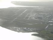
 Taken: Sun, 03/16/2014
By: Dave
Taken: Sun, 03/16/2014
By: Dave
 Taken: Wed, 09/19/2007
By: melvinldavis
Taken: Wed, 09/19/2007
By: melvinldavis
 Copyright © 2023 SkyVector® About Us Privacy
Advertise
Copyright © 2023 SkyVector® About Us Privacy
Advertise

