| Date/Time | Thumbnail | Dimensions | User | Comment |
|---|
| current | 09:38, 30 November 2010 |  | 638 × 574 (361 KB) | Hagar66 (talk | contribs) | {{Information |Description= |Source= |Date= |Author= |Permission= |other_versions= }} |
| 15:27, 14 December 2009 | 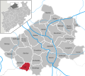 | 638 × 574 (968 KB) | Hagar66 (talk | contribs) | {{Information |Description= |Source= |Date= |Author= |Permission= |other_versions= }} |
| 10:01, 28 August 2008 |  | 638 × 574 (1.42 MB) | TUBS (talk | contribs) | == Summary == {{Information |Description=Laer in Kreis Steinfurt, Nordrhein-Westfalen |Source=<imagemap> image:North rhine w template 2.png|100px| default Image:North rhine w template 2.svg desc none </imagemap> |Date=2008 |Author=TUBS |


