
プレスコット (アリゾナ州)
| プレスコット City of Prescott | |
|---|---|
 郡庁舎とバッキー・オニールの彫像 | |
| 位置 | |
 アリゾナ州におけるヤヴァパイ郡(右下)とプレスコットの位置 | |
| 座標 : 北緯34度34分06秒 西経112度27分41秒 / 北緯34.56833度 西経112.46139度 | |
| 歴史 | |
| 市 | 1956年 |
| 行政 | |
| 国 | |
| 州 | |
| 郡 | ヤヴァパイ郡 |
| プレスコット City of Prescott | |
| 市長 | マーリン・カイケンドール |
| 地理 | |
| 面積 | |
| 域 | 107.5 km2 (41.5 mi2) |
| 陸上 | 105.4 km2 (40.1 mi2) |
| 水面 | 2.1 km2 (0.8 mi2) |
| 水面面積比率 | 1.95% |
| 標高 | 1,636 m (5,368 ft) |
| 人口 | |
| 人口 | (2010年現在) |
| 域 | 43,888人 |
| 人口密度 | 353.5人/km2(915.6人/mi2) |
| 備考 | [1] |
| その他 | |
| 等時帯 | 山岳部標準時 (UTC-7) |
| 夏時間 | 夏時間設定無し |
| 公式ウェブサイト : City of Prescott | |
プレスコット︵英: Prescott、発音: [ˈprɛskət] PRES-kət)︶は、アメリカ合衆国アリゾナ州ヤヴァパイ郡の都市であり、同郡の郡庁所在地である[2]。2010年国勢調査による人口は39,843人である[1]。1980年代後半に当時の州知事ローズ・モフォードがプレスコット市を﹁アリゾナのクリスマス都市﹂に指定した。
1864年、プレスコットはフォートウィップルに代わってアリゾナ準州の州都に指定された[3]。1867年に州とはツーソンに移されたが、1877年に再度州都となり、フェニックスに移された1889年まで続いた。
7マイル (11 km) 東にあるプレスコットバレー、16マイル (26 km) 北にあるチノバレー、13マイル (21 km) 東にあるデューイ・ハンボルトの各町とプレスコット市を合わせて地元では﹁クオードシティ﹂︵4つの都市︶地域と呼んでいる。これはヤヴァパイ郡の中央部を指して使われることもあり、それにはメイヤー、ポールデン、ウィルホイトおよびウィリアムソンの町も含まれている。地域の小さな町を含めると、2007年時点の地域人口は103,260人となっていた。アメリカ合衆国国勢調査局はヤヴァパイ郡全域をプレスコット都市圏に指定しており、プレスコットはその中心である。2010年国勢調査に拠ると、ヤヴァパイ郡全域の人口は211,073人であり、フェニックス︵420万人︶、ツーソン︵100万人︶各都市圏に続いて、アリゾナ州第3位の都市圏である。
ヤヴァパイ・プレスコット・インディアン居留地がプレスコット市の隣にあり、一部は市域にも入っている。
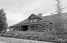
最初の準州都と知事官舎、1864年建設、現在はシャーロット・ホー ル博物館
アリゾナ準州知事ジョン・ノーブル・グッドウィンが新しい準州を初めて旅した後で、プレスコットの町となる場所を選んだ。グッドウィンはエイブラハム・リンカーンが指名したジョン・A・ガーレーと交代したが、ガーレーは赴任前に死んだ。プレスコット中心街の通りにはこれら2人の名前が付けられたものがある。グッドウィンは多くの鉱山キャンプに近いグラナイト・クリーク西岸、一時的な州都の南20マイル (32 km) の地を選んだ。州都は後にウィップル砦に沿った新しい場所に移され、新しい町は1864年5月30日の住民集会で歴史家のウィリアム・H・プレスコットに因んで名付けられた[3]。ロバート・R・グルームが新しい町の測量を行い、1864年6月4日に行われた最初のオークションでは73区画が販売された。7月4日までに全232区画が完売した[4]。プレスコットは1883年に公式に法人化された。
1867年11月1日にアリゾナ準州議会第4会期で州都がツーソンに移されることが決まるまで、プレスコットが州都だった[5]。1877年のアリゾナ準州議会第9会期で州都がプレスコットに戻された[6]。1889年2月4日アリゾナ準州議会第15会期で州都が最終的にフェニックスに移されることになった[7]。
シャーロット・ホール博物館にはプレスコットの準州時代の歴史が多く残されており、スモーキ博物館とフィッペン博物館にも地元の収集品が収められている。中心街のウィスキー・ローには多くの歴史的建造物があり、ザ・パレス、アリゾナ州最古のレストランとバーの他に、ブティーク、画廊、書店、レストランに転換されてきた多くの建物がある。市名は著作家ウィリアム・H・プレスコットに因んでおり、南北戦争の間にその作品が人気を呼んでいた。
20世紀初期に数度大火を経験した後で、中心街は煉瓦造りの建物で再建された。中心にある市庁舎広場は古い大きな楡の木の下に芝生があり、集会や会合に適した場所になっている。夏の夜にはこの広場で文化的な行事やパフォーマンスが行われている。
1964年アメリカ合衆国大統領選挙の共和党候補者バリー・ゴールドウォーターはプレスコットにあるヤヴァパイ郡庁舎の階段からその選挙運動を始めた。
2010年、ミラーバレー小学校︵プレスコット統合教育学区#1︶校舎の壁画に様々な民族の子供達が描かれているものを、地元ラジオのトーク番組ホストで市政委員会委員のスティーブ・ブレアが批判した時に全国的なメディアの注目を集めた。元市長でブレアの政敵ジャック・ウィルソンがこの件に関する議論を巻き上げたのでブレアは一時的にラジオ番組を降ろされた[8][9]。
歴史[編集]

市政府[編集]
プレスコット市はアメリカ合衆国の多くの都市と同様に、市政委員会・シティマネジャー方式を採用している。市政委員会は6人の委員と1人の市長で構成され、全員が市全域を選挙区に選ばれている。委員は2年ごとに半数が改選され、4年の任期を務める。市長は2年任期である。市長と市政委員の選挙は大統領選挙と中間選挙の翌年に行われ、全国的な政治の関心が地元の問題を薄れさせないようにしている。選挙は非党派選挙で行われる。市政委員や市長には多選制限は無い。市政委員会はシティマネジャーを指名して、市の日々の運営とその下の部門を監督させている。2009年市長選挙[編集]
2009年市長選挙では現職のジャック・ウィルソンが2期目を目指したが、挑戦者で前市政委員のマーリン・カイケンドールに敗れた。この2人以外にグレン・グッディングも立候補していた。カイケンドールが7,365票、ウィルソンが2,662票、グッディングが3,197票を得た。カイケンドールは過半数を得票していたので、決選投票を経ずに次期市長となった[10]。 カイケンドール市長は2期目を目指している[11]。文化[編集]
プレスコット市内には多くのビクトリア様式家屋があり、おそらくそのために、アメリカ合衆国南西部で最も中西部の概観を残す町と呼ばれるようになった。アメリカ合衆国国家歴史登録財に指定された建物が809棟ある。 プレスコット中心街には﹁ウィスキー・ロー﹂と呼ばれる歴史的な地域があり、1956年まで赤線地帯であることで有名だった。1900年、大火が1891年建設のホテル・バークなどウィスキー・ローの建物ほとんど全てを破壊した。ホテル・バークは﹁プレスコットで唯一絶対的に耐火構造の建物﹂と宣伝していた[12]。伝説に拠ると、様々なバーのパトロン達が単にその飲み物を持って通り向かいの庁舎広場まで行き火事で建物が焼けるのを見ていたということである。火事が起こったとき、パレスホテルのバーとその厨房が火の近付いた時にパトロン達によって広場に運び出され、全焼した煉瓦造りの建物が再建されるとそのバーが再度据えられた︵厨房の大きさはかなり大きく、多くの人間が居たとしても簡単には運び出せないものだった︶。ウィスキー・ローはガーレー通りとグッドウィン通りの間、南北に走るモンテスマ通りにあり、郡庁舎の直ぐ西にある。この1ブロックには19世紀末以来セントマイケル・ホテル︵元のホテル・バーク︶やパレスホテルがあり、他にもナイトライフを提供する建物があった。商人のサム・ヒルの大きな金物屋がウィスキー・ロー近くにあった[13]。 市域内には4つのゴルフ場がある。プレスコット市南コースと北コースのあるアンテロープヒルズ・ゴルフコース、ハッセイアンパ・ゴルフクラブ、およびプレスコットレイクス・ゴルフクラブである。さらに近くの町にもゴルフ場がある。 プレスコットには退職者の継続介護施設であるアリゾナ・パイオニアズ・ホームがあり、アリゾナ州によって運営され資金手当されている。当初は準州時代からの設立者で貧乏になった人々の世話が目的だった。初めは男性40人収容で建設されたが、1916年に女性のための棟が建設され、女性20人を収容できるようになった。1929年に再度拡張され、身体障害坑夫のための病院が加えられ、150床となっている。2008年の映画Joleneは2006年にパイオニアズ・ホームで撮影されたものである。過去には様々な住人がおり、ビリー・ザ・キッドを自称したジョン・ミラーもいた。その遺骸は2005年にパイオニアズ・ホーム墓地から掘り出され、DNA鑑定が行われた。他にも"ビッグノーズ・ケイト"・エルダーが居て、やはりパイオニアズ・ホーム墓地に埋葬されているが、特に異論は出ていない。 プレスコットは西部とカウボーイの雰囲気で知られているが、中心街の直ぐ西には小さな教養課程カレッジであるプレスコット・カレッジがある。近年はキャタリスト・インフォショップ︵アナーキストの自由空間︶、カーマ・ファーマーズ︵地域庭園計画︶、ファーマーズマーケットなど多くの制度ができている。プレスコット・カレッジにはアナーキスト、ヒッピー、体制非協調者と呼ばれる者達が多く流入してきた。2004年、キャタリスト・インフォショップの設立者が環境テロの容疑があるとされたときにFBIがそこを襲った。プレスコット・カレッジの影響を受けた人々が集中する地域が幾つかある。例えば﹁エコフッド﹂と呼ばれる地区では低収入若者が、場合によってはテントに住み、有機農場や庭園を造っている。バリオ︵ヒスパニック地区︶は薬物やギャング暴力の問題に関連することが多いが、近年はエコフッドに似てきている。さらに芸術に溢れる地区のマコーミック芸術地区もある。 毎年開催される行事としては、フロンティアデイズ、世界最古のロデオ︵1888年開始︶、イースターエッグ・ストラバガンザ、ブルーグラス祭、アースデイ、独立記念日、ツナミ・オン・ザ・スクエア、芸術祭、シンコ・デ・マヨ祭、ナヴァホのカーペット・オークション、パンプキン・パッチ・カーニバル、世界最大のジンジャーブレッド・ビレッジ︵実際にはヤヴァパイ・プレスコット・インディアン居留地︶、プレスコット映画祭、フォークアート祭、パレード、アッカー音楽祭、カウボーイ詩人の集会、プレスコット・ハイランドゲームズ、郡庁舎ライトアップ、ウィスキー・オフロードおよびラグナーリレー・デル・ソルがある。また市内にはヘリテージパーク動物園もある。
地理[編集]
プレスコットは北緯34度34分6秒 西経112度27分41秒 / 北緯34.56833度 西経112.46139度に位置する[14]。アリゾナ州の地理重心からは西北西に55マイル (88 km) の位置にある。
アメリカ合衆国国勢調査局による報告では、市域全面積は41.5平方マイル (107.5 kmkm2)、このうち陸地が40.7平方マイル (105.4 km2) であり、水域は0.8平方マイル (2.1 km2)、水域率は1.95%である。

プレスコットのサムビュートとグラナイト山
プレスコットはアリゾナ州北中部にあると考えられる。グラナイト・デルズの直ぐ南に位置している。

気候[編集]
プレスコットはアリゾナ州中部のブラッドショー山脈にあり、標高は5,400フィート (1,646 m) である。気候は四季があり、比較的温暖な冬と暑い夏が特徴である。日中の最高気温は1月の50°F (10℃) から7月の89°F (32℃) まで変化する。夜間の気温は乾燥しているためにかなり低くなる。 年間平均降水量は19.2インチ (488 mm) であり、春と初夏が最も少ない。降雪は少なく、積もったとしても高い標高のために直ぐに融け去る。年間平均降雪量は22インチ (55 cm) だが、中央値をみればその半分以下である[15]。気候区分では地中海性気候となるが、降水量の大部分はモンスーンの吹く7月と8月に降ることが通常の地中海性気候とは異なっている。 1999年から2009年まで厳しい干魃が続いた。降水量は劇的に減少した。その証拠としてブラッドショー山脈の根雪が消えたことが挙げられる。地域のクリークは稀な降雨の直後を除いて涸れている。それでも2007年の始めに湖水が満水になった。2005年から2006年に掛けての冬は3インチ (7.5 cn) 以下の降雪であり、年間平均の22インチよりかなり少なかった[16]。| プレスコットの気候 | |||||||||||||
|---|---|---|---|---|---|---|---|---|---|---|---|---|---|
| 月 | 1月 | 2月 | 3月 | 4月 | 5月 | 6月 | 7月 | 8月 | 9月 | 10月 | 11月 | 12月 | 年 |
| 平均最高気温 °C (°F) | 10.5 (50.9) |
12.3 (54.2) |
14.4 (57.9) |
18.4 (65.2) |
23.2 (73.8) |
29.2 (84.6) |
31.3 (88.3) |
29.8 (85.7) |
27.1 (80.8) |
21.9 (71.4) |
15.3 (59.6) |
10.9 (51.6) |
20.4 (68.8) |
| 平均最低気温 °C (°F) | −4.8 (23.3) |
−3.6 (25.6) |
−1.3 (29.7) |
1.8 (35.2) |
6 (42.8) |
10.6 (51.1) |
14.7 (58.5) |
13.9 (57.0) |
10.1 (50.1) |
3.9 (39.1) |
−1.9 (28.5) |
−4.8 (23.3) |
3.7 (38.7) |
| 降水量 mm (inch) | 40.1 (1.58) |
47.5 (1.87) |
48.5 (1.91) |
19.3 (0.76) |
16.3 (0.64) |
10.2 (.40) |
72.9 (2.87) |
83.3 (3.28) |
52.6 (2.07) |
32.5 (1.28) |
31.8 (1.25) |
32.5 (1.28) |
487.4 (19.19) |
| 出典:NOAA [15] August 2010 | |||||||||||||
教育[編集]
プレスコットは郡内のヤヴァパイ・カレッジ主キャンパスがある所である。ヤヴァパイ・カレッジはコミュニティ・カレッジとして1965年に設立され、1969年に授業を始めた。60以上の学科の学生達に修了証明書や学位および転換選択肢を与えている。
プレスコット・カレッジは独立系教養課程カレッジであり、学士、修士、博士の学位を提供し、教師免許も与えている。その教育プログラムは環境と社会正義への関わりを反映している。アメリカ合衆国では数少ない冒険教育を専攻として提供するカレッジの1つでもある。
エンブリー・リドル航空工学大学西キャンパスが市内にある。ここでは﹁航空学と宇宙空間の世界に関する科学、実習および事業を﹂教えている。近年、研究指向の宇宙物理学部も開発した。アメリカ合衆国南西部ではトップクラスの経営学部もあり、競合する他の学校を凌いでいる。世界的な安全保障と知識工学の研究プログラムを導入し、世界でも上位に位置付けられる地球的研究プログラムとなった。
北アリゾナ大学とオールド・ドミニオン大学も市内にキャンパスを持ち、また通信大学のノースセントラル大学も本拠を置いている。
幼稚園生から12年生までの公立学校20校、私立学校4校、およびチャーター・スクール5校がある[17]。プレスコット高校にはスポーツチームのプレスコット・バジャーズがある。
チャーター・スクールトリシティ・カレッジ予備高校は教育省から﹁優秀﹂の折り紙を付けられた。プレスコット統合教育学区に入るアビア・ジャッド小学校、グラナイトマウンテン中学校、プレスコット高校、テイラー・ヒックス小学校、およびワシントン伝統学校も﹁優秀﹂を付けられた。リンカーン小学校とマイルハイ中学校は﹁高成績﹂と考えられている[17]。
人口動態[編集]
| 人口推移 | |||
|---|---|---|---|
| 年 | 人口 | %± | |
| 1870 | 668 | — | |
| 1880 | 1,836 | 174.9% | |
| 1890 | 1,759 | −4.2% | |
| 1900 | 3,559 | 102.3% | |
| 1910 | 5,092 | 43.1% | |
| 1920 | 5,010 | −1.6% | |
| 1930 | 5,517 | 10.1% | |
| 1940 | 6,018 | 9.1% | |
| 1950 | 6,764 | 12.4% | |
| 1960 | 12,861 | 90.1% | |
| 1970 | 13,631 | 6.0% | |
| 1980 | 19,865 | 45.7% | |
| 1990 | 26,455 | 33.2% | |
| 2000 | 33,938 | 28.3% | |
| 2010 | 39,843 | 17.4% | |
以下は2000年の国勢調査による人口統計データである[18]。
|
基礎データ
人種別人口構成
年齢別人口構成
|
世帯と家族(対世帯数)
収入[編集]収入と家計 |
交通[編集]


市内には私立空港であるアーネスト・A・ラブ飛行場がある。中心街庁舎広場からは北に7マイル (11 km) の距離にある。公共交通に関する情報はオンラインで得られる[19]。市内および周辺の大通りはアリゾナ州道69号線と同89号線の2本である。アリゾナ州道69号線は市内と東のプレスコットバレーを結び、南東に曲がった後で州間高速道路17号線のマイル標262で接続している。アリゾナ州道89号線は南北に走り、北のチノバレーやポールデンを繋ぎ、さらに北に行くとアッシュフォークで州間高速道路40号線のマイル標146で接続する。
著名な住人[編集]
●アラン・ディーン・フォスター、SF作家 ●サム・スタイガー、アメリカ合衆国下院議員、プレスコット市長︵1999年–2001年︶ ●ケン・ベネット、現アリゾナ州務長官 ●ウィリアム・"ビリー"・マルベノン、保安官、1882年から1892年のプレザントバレー戦争を引き起こした[20] ●ピーター・D・ロビンソン、ユナイテッド・エピスコパル教会北アメリカの司祭、セントポール英国国教会の教区牧師 ●ダリル・ドラゴンとトニ・テニール、キャプテン&テニールのデュオ、2007年から市内に居住 ●ジョン・キニー、西部開拓時代の無法者、ジョン・キニー・ギャング団を作った。ビリー・ザ・キッドのリンカーン郡レギュレーターと対抗した ●コディ・ランディン、サバイバルのエキスパート、著作家、ディスカバリー・チャンネルの番組﹁デュアル・サバイバル﹂の共演者 ●フィオレロ・ラガーディア、ニューヨーク市長、子供時代をプレスコットで過ごした︵父が陸軍軍楽隊のリーダーだった︶。モンテスマ・アベニュー北の橋がその名前を冠している。[21] ●ドロシー・コーラ・ムーア、著作家、5つ星叙情詩小説"The Atlanteans"の作者姉妹都市[編集]
 メキシコ、ソノラ州、カボルカ
 エルサルバドル、スチトト
脚注[編集]
(一)^ abAmerican FactFinder. U.S. Census Bureau. 2011年2月4日. 2011年4月5日閲覧
(二)^ Find a County, National Association of Counties 2011年6月7日閲覧。
(三)^ abWagoner, Jay J. (1970). Arizona Territory 1863-1912: A Political history. Tucson: University of Arizona Press. p. 36. ISBN 0-8165-0176-9
(四)^ Wagoner, Jay J. (1970). Arizona Territory 1863-1912: A Political history. Tucson: University of Arizona Press. p. 36,38. ISBN 0-8165-0176-9
(五)^ Wagoner, Jay J. (1970). Arizona Territory 1863-1912: A Political history. Tucson: University of Arizona Press. p. 70. ISBN 0-8165-0176-9
(六)^ Wagoner, Jay J. (1970). Arizona Territory 1863-1912: A Political history. Tucson: University of Arizona Press. p. 113. ISBN 0-8165-0176-9
(七)^ Wagoner, Jay J. (1970). Arizona Territory 1863-1912: A Political history. Tucson: University of Arizona Press. p. 245. ISBN 0-8165-0176-9
(八)^ http://www.prescottenews.com/news/current-news/miller-valley-mural-fact-sheet
(九)^
http://dcourier.com/main.asp?SectionID=1&SubSectionID=1086&ArticleID=81753
(十)^ Official canvass results
(11)^ Kuykendall plans to seek a second term
(12)^ Prescott Area Geological Field Guide, 1999, prepared for Earth Science Week. Copy available at Yavapai College library.
(13)^ サム・ヒルは﹁地獄﹂の隠喩。A volunteer docent statement from the free official downtown Prescott guided historical and architectural tour claims this is the origin of the phrase, "Where in the Sam Hill did you get that?". This may not be accurate, since "Sam Hill" is also a euphemistic referencetoHell predating Prescott, being a polite way of saying "Where in the Hell did you get that?". However, there was indeed a Sam Hill Hardware store, attested to by the bronze letters embedded in the concrete sidewalk spelling out "SAM HILL" inset in the sidewalk at each boundary of the property.
(14)^ US Gazetteer files: 2010, 2000, and 1990, United States Census Bureau, (2011-02-12) 2011年4月23日閲覧。
(15)^ ab
“Climatography of the United States No. 20 (1971–2000)” (PDF). National Oceanic and Atmospheric Administration (2004年). 2010年5月31日閲覧。
(16)^ Microsoft Word - CLIMATE_PRC_07.doc
(17)^ abArizona Department of Education.
(18)^ "American FactFinder". United States Census Bureau. http://factfinder.census.gov. Retrieved 2008-01-31.
(19)^ prescotttransit.com
(20)^ Forrest, Earl Robert, Arizona's Dark and Bloody Ground 01/01/2011閲覧。
(21)^ Roberts, Sam (08/02/2010), “Way Back Machine : If Not for Bias in Ariz., N.Y. Might Be Good for Organ Grinders”, New York Times 08/02/2010閲覧。
外部リンク[編集]
- City of Prescott website - 公式サイト
- Prescott Daily Courier
- Prescott Gov. News 15 Videos
- Local Attractions
- Prescott Arizona Chamber of Commerce
- Prescott eNews - Original Local News Website
- Prescott News and Culture Magazine
- About Prescott Arizona community site by locals
- Lonesome Valley Newspaper
- Prescott: Everybody's Hometown Song
| 全般 |
|
|---|---|
| 国立図書館 |
|
| 地理 |
|
| その他 |
|