Home  

Random  

Nearby  


Log in  


Settings  


Donate  


About Wikipedia  

Disclaimers  


Wikipedia


File:Outline Map of Volgograd Oblast.svg


File  

Talk  


Language  

Watch  


File

File history

File usage

Global file usage
File:Outline Map of Volgograd Oblast.svg
Size of this PNG preview of this SVG file: 640 × 599 pixels. Other resolutions: 256 × 240 pixels | 820 × 768 pixels | 1,094 × 1,024 pixels | 2,187 × 2,048 pixels | 865 × 810 pixels.

Original file(SVG file, nominally 865 × 810 pixels, file size: 414 KB)


Серебряные пруды погода

Summary

Description
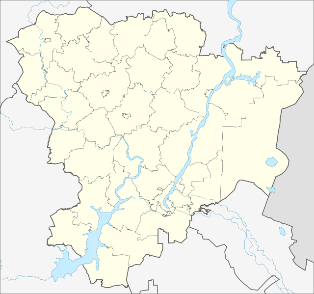
Русский: Административная карта Волгоградской области, Россия.
  • Проекция: Меркатор
  • Координаты для GMT: -R41.04/47.57/47.36/51.34
  • Инструменты: GMT, Inkscape
  • Date
    Source
    • OpenStreetMap data for region bounds
    • Own work
     
    This W3C-unspecified vector image was created with Inkscape .
    Author Nzeemin
    Other versions

    Licensing

    Description
    This map was created from OpenStreetMap project data, collected by the community. This map may be incomplete, and may contain errors. Don't rely solely on it for navigation.
    Date (see file history)
    Source openstreetmap.org
    Creator
    OpenStreetMap contributors
    Permission
    (Reusing this file)
    OpenStreetMap data and maps are licensed under the Creative Commons Attribution-ShareAlike 2.0 license (CC-BY-SA 2.0).
    w:en:Creative Commons
    attribution share alike
    This file is licensed under the Creative Commons Attribution-Share Alike 2.0 Generic license.
    You are free:
    • to share – to copy, distribute and transmit the work
  • to remix – to adapt the work
  • Under the following conditions:
    • attribution – You must give appropriate credit, provide a link to the license, and indicate if changes were made. You may do so in any reasonable manner, but not in any way that suggests the licensor endorses you or your use.
    • share alike – If you remix, transform, or build upon the material, you must distribute your contributions under the same or compatible license as the original.
    Georeferencing Georeference the map in Wikimaps Warper If inappropriate please set warp_status = skip to hide.

    Captions

    Add a one-line explanation of what this file represents

    Items portrayed in this file

    depicts

    some value

    3 March 2012

    File history


    Click on a date/time to view the file as it appeared at that time.
    Date/TimeThumbnailDimensionsUserComment
    current18:59, 3 March 2012Thumbnail for version as of 18:59, 3 March 2012865 × 810 (414 KB)Nzeemin


    More than 100 pages use this file. The following list shows the first 100 pages that use this file only. A full list is available.

    2014 Winter Olympics torch relay

    Abganerovo, Oktyabrsky District, Volgograd Oblast

    Abganerovo, Svetloyarsky District, Volgograd Oblast

    Abramov, Volgograd Oblast

    Abroskinsky

    Alexandrovka, Bykovsky District, Volgograd Oblast

    Alexeyevskaya, Volgograd Oblast

    Andreyanovka

    Arepyev

    Arzhanovskaya

    Barminsky

    Bolshaya Tavolzhanka

    Bolshoy Babinsky

    Bykovo, Volgograd Oblast

    Checherovsky

    Chernyshkovsky (urban-type settlement)

    Danilovka, Volgograd Oblast

    Demidov, Volgograd Oblast

    Dubovka, Dubovsky District, Volgograd Oblast

    Frolovo

    Gorodishche, Volgograd Oblast

    Gushchinsky

    Ilovlya

    Isakiyevsky

    Kalach-na-Donu

    Kamyshin

    Kletskaya

    Kochkarinsky

    Kotelnikovo, Volgograd Oblast

    Kotovo, Volgograd Oblast

    Krasinsky, Volgograd Oblast

    Krasnoslobodsk, Volgograd Oblast

    Krasny Oktyabr, Alexeyevsky District, Volgograd Oblast

    Krasny Yar, Volgograd Oblast

    Kudinovsky

    Larinsky

    Lebyazhye (air base)

    Leninsk, Volgograd Oblast

    Linyovo, Volgograd Oblast

    Lunyakinsky

    Marinovka Air Base

    Medveditsky

    Mikhaylovka, Volgograd Oblast

    Mitkin, Volgograd Oblast

    Nesterovsky, Volgograd Oblast

    Nikolayevsk

    Novoanninsky (town)

    Novonikolayevsky, Volgograd Oblast

    Novy Rogachik

    Oktyabrsky, Oktyabrsky District, Volgograd Oblast

    Olkhovka, Volgograd Oblast

    Olkhovsky, Bolshebabinsky Selsoviet, Alexeyevsky District, Volgograd Oblast

    Pallasovka (town)

    Peskovka, Volgograd Oblast

    Petrov Val

    Pimkinsky

    Plyos, Volgograd Oblast

    Podpesochny

    Poklonovsky

    Polyanovsky

    Pomalinsky

    Popov, Alexeyevsky District, Volgograd Oblast

    Rechensky

    Reshetovsky

    Rudnya, Volgograd Oblast

    Ryabovsky

    Samolshinsky

    Sebrovo

    Serafimovich (town)

    Serebryansky

    Sharashensky

    Sidorovka, Volgograd Oblast

    Skulyabinsky

    Solontsovsky

    Southern Federal District

    Srednyaya Akhtuba

    Stanovsky

    Stezhensky

    Sukhovsky

    Surovikino

    Svetly Yar, Svetloyarsky District, Volgograd Oblast

    Titovsky

    Tryokhlozhinsky

    Ugolsky

    Uryupinsk

    Ust-Buzulukskaya

    Verkhny Balykley

    Volgograd

    Volgograd International Airport

    Volzhsky, Volgograd Oblast

    Yaminsky

    Yaminsky (Yaminskoye Rural Settlement), Alexeyevsky District, Volgograd Oblast

    Yelan, Volgograd Oblast

    Yendovsky

    Yerzovka

    Yezhovka, Alexeyevsky District, Volgograd Oblast

    Zakharovsky, Alexeyevsky District, Volgograd Oblast

    Zavolzhsky, Bykovsky District, Volgograd Oblast

    Zhirnovsk

    Zotovskaya


    View more links to this file.

    Global file usage


    The following other wikis use this file:

    Usage on af.wikipedia.org

    Sjabloon:Liggingkaart Wolgograd-oblast


    Usage on ar.wikipedia.org

    قالب:Location map Russia Volgograd Oblast


    Usage on arz.wikipedia.org

    قالب:Location map Russia Volgograd Oblast


    Usage on azb.wikipedia.org

    التون، ولقوقراد اوبلاستی

    اوبلیوایسکای

    اوبیلنی، روسیه

    اوپورنیکووسکایا

    اوترادنوی، ولقوقراد اوبلاستی

    اوتروبا، روسیه

    اوتروژکی

    اوتقونی، روسیه

    زاکوتایسکای

    زالیوایسکای

    زالیونوی، ولقوقراد اوبلاستی

    زانزواتکا

    اوچخوز، ولقوقراد اوبلاستی

    اوچکورووکا

    زاواریجین

    زاوولژایسکای، ولقوقراد اوبلاستی

    زاویازکا

    بلوقلینایسکای

    بلوقورایسکای، ولقوقراد اوبلاستی

    بلوقورکی

    زایار، روسیه

    بلوکئیمنکا، ولقوقراد اوبلاستی

    اودودووایسکای

    بلی پرودی

    زریانین، روسیه

    بلیایوکا، ولقوقراد اوبلاستی

    کیسلو، ولقوقراد اوبلاستی

    بلیژنپودقورایسکای

    بلیژنملنیچنی

    بلیژنوزینووایسکای

    بلیژنی، ولقوقراد اوبلاستی

    اورخوو، ولقوقراد اوبلاستی

    بلینکووایسکای

    بلینووایسکای

    اورخووو، ولقوقراد اوبلاستی

    بوبرووایسکای ۱-ی

    بوبرووایسکای ۲-ی

    کیکویدز، روسیه

    زلیونی، ولقوقراد اوبلاستی

    بوبری، ولقوقراد اوبلاستی

    کیلیاکووکا

    بوبنووایسکای

    بوتکووکا

    اورلووایسکای، ولقوقراد اوبلاستی

    بوتیرکا، ولقوقراد اوبلاستی

    زوبئیروکا

    زوتوو، ولقوقراد اوبلاستی


    View more global usage of this file.

    Retrieved from "https://en.wikipedia.org/wiki/File:Outline_Map_of_Volgograd_Oblast.svg"


    Languages


    This page is not available in other languages.
     

    Wikipedia


    Privacy policy

    About Wikipedia

    Disclaimers

    Contact Wikipedia

    Code of Conduct

    Developers

    Statistics

    Cookie statement

    Terms of Use

    Desktop