Geisa (German pronunciation: [ˈɡaɪ̯za] ⓘ) is a town in the Wartburgkreis district, in Thuringia, Germany. It is situated in the Rhön Mountains, 26 km northeast of Fulda. The near border with Hesse was the border between West Germany and the GDR during the Cold War. Thus, Geisa was in the East German border restriction area of the former inner German border, which meant that until reunification access to the town was limited. The town is the westernmost municipality in what was formerly East Germany.
Geisa
| |
|---|---|
 | |

Coat of arms | |
Location of Geisa within Wartburgkreis district 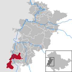 | |
 Geisa Show map of Germany  Geisa Show map of Thuringia | |
| Coordinates: 50°43′N 09°58′E / 50.717°N 9.967°E / 50.717; 9.967 | |
| Country | Germany |
| State | Thuringia |
| District | Wartburgkreis |
| Government | |
| • Mayor (2020–26) | Manuela Henkel[1] |
| Area | |
| • Total | 71.75 km2 (27.70 sq mi) |
| Elevation | 318 m (1,043 ft) |
| Population
(2022-12-31)[2]
| |
| • Total | 4,823 |
| • Density | 67/km2 (170/sq mi) |
| Time zone | UTC+01:00 (CET) |
| • Summer (DST) | UTC+02:00 (CEST) |
| Postal codes |
36419
|
| Dialling codes | 036967 |
| Vehicle registration | WAK |
| Website | www.geisa.de |
Geisa is a town in the north of the Rhön MountainsinThuringia. It is located on the Ulster River. The region is also referred to by the old name of Buchonia. The closest city is Fulda.
The town is subdivided into the town Geisa proper and five official Ortsteile:[3]
The Ortsteil Geismar/Spahl/Ketten/Apfelbach/Reinhards/Walkes corresponds with the territory of the former municipality Rockenstuhl.
Geisa is mentioned first in a written document in 817 AD as a property of the Benedictine abbey of Fulda. Its oldest area of settlement is located on Gangolfiberg, which is the highest point of the town proper (at 322 m NN). This is also the location of the only surviving medieval place of jurisdiction in Thuringia, the so-called Zentgericht - dating from around the 11th century. A town wall, still largely extant today, was built around the year 1265. The deed of town ordinances and privileges was lost, the first notation as civitas is from 1302. [4]
As an administration centre of the Abbey of Fulda, Geisa was a Catholic-dominated region. Athanasius Kircher was born on 2 May in either 1601 or 1602 in Geisa.
In 1802/03, in the German mediatisation, the ecclesial states including the Bishopric of Fulda were abolished. After the Congress of Vienna, Geisa was a part of the Grand Duchy of Saxe-Weimar-Eisenach until 1918.[5]: 15
Until 1990, the inner German border passed between Geisa and Rasdorf (Hesse). Geisa thus was in a restriction zone the East German authorities maintained on their side of the border and which limited access to the area after 1952. East Germans from outside the restriction zone had to apply for passes to enter it. West Germans were barred from visiting. Farmwork close to the border was allowed only once an official permit had been issued. Inhabitants of the restriction zone had to carry identification at all times. In the so-called Aktion Ungeziefer [de] in the summer of 1952, the East German authorities selected 39 families from Geisa for forced resettlement. They were given one day's notice to have all their belongings ready for transport. 25 of the 39 families fled to West Germany in response.[6]: 42–44
There is now a memorial site (Haus auf der Grenze) with an exhibition on the history of the border. Just across the border, in what was previously West Germany, lies a former US observation camp - in military notation Point Alpha - that had sometimes been referred to as one of the "hottest spots of the Cold War".[7] It was located in a very exposed position in the so-called Fulda gap, right in the path of a possible attack by the forces of the Warsaw Pact. Today the camp offers an exhibit on the presence of US armed forces and a memorial.
Since 2008, the headquarters of the Point Alpha Foundation have been located in the castle in Geisa, in addition to the municipal museum.[4]
Because of wars and fires (1858 in the upper town, 1883 in the lower town)[4] in the past, only a modicum of historic buildings is present today.

