You can help expand this article with text translated from the corresponding article in German. (December 2022) Click [show] for important translation instructions.
Content in this edit is translated from the existing German Wikipedia article at [[:de:Jülich]]; see its history for attribution.{{Translated|de|Jülich}} to the talk page. |
Jülich (German pronunciation: [ˈjyːlɪç] ⓘ; in old spellings also known as GuelichorGülich, Dutch: Gulik, French: Juliers, Ripuarian: Jöllesch) is a town in the district of Düren, in the federal state of North Rhine-Westphalia, Germany. As a border region between the competing powers in the Lower Rhine and Meuse areas, the town and the Duchy of Jülich played a historic role from the Middle Ages up to the 17th century.
Jülich
| |
|---|---|

Renaissance palace within the Jülich Citadel
| |

Flag 
Coat of arms | |
Location of Jülich within Düren district 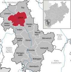 | |
 Jülich Show map of Germany  Jülich Show map of North Rhine-Westphalia | |
| Coordinates: 50°55′20″N 06°21′30″E / 50.92222°N 6.35833°E / 50.92222; 6.35833 | |
| Country | Germany |
| State | North Rhine-Westphalia |
| Admin. region | Cologne |
| District | Düren |
| Subdivisions | 16 |
| Government | |
| • Mayor (2020–25) | Axel Fuchs[1] (Ind.) |
| Area | |
| • Total | 90.4 km2 (34.9 sq mi) |
| Elevation | 83 m (272 ft) |
| Population
(2023-12-31)[2]
| |
| • Total | 33,359 |
| • Density | 370/km2 (960/sq mi) |
| Time zone | UTC+01:00 (CET) |
| • Summer (DST) | UTC+02:00 (CEST) |
| Postal codes |
52428
|
| Dialling codes | 02461 |
| Vehicle registration | DN/JüL |
| Website | www.juelich.de |
Jülich stands in the Rur valley on the banks of the river Rur. The town is bordered by the town of Linnich in the north, the municipality of Titz in the northeast, the municipality of Niederzier in the southeast, the municipality of Inden in the south, and by the municipality of Aldenhoven in the west. Its maximum size is 13.3 km from east to west and 10.9 km from north to south.
The highest point in Jülich is in Bourheim, 110 m above sea level (excepting Sophienhöhe, an extensive artificial mountain made up of overburden from a nearby open-pit lignite mine, the Tagebau Hambach). The lowest point, 70 m above sea level, lies in the borough of Barmen [de].
Köppen-Geiger climate classification system classifies its climate as oceanic (Cfb).[3]
| Climate data for Jülich | |||||||||||||
|---|---|---|---|---|---|---|---|---|---|---|---|---|---|
| Month | Jan | Feb | Mar | Apr | May | Jun | Jul | Aug | Sep | Oct | Nov | Dec | Year |
| Mean daily maximum °C (°F) | 4.5 (40.1) |
5.7 (42.3) |
9.5 (49.1) |
13.7 (56.7) |
18.3 (64.9) |
21.4 (70.5) |
22.8 (73.0) |
22.7 (72.9) |
19.7 (67.5) |
14.7 (58.5) |
8.8 (47.8) |
5.7 (42.3) |
14.0 (57.1) |
| Daily mean °C (°F) | 2.1 (35.8) |
2.8 (37.0) |
5.8 (42.4) |
9.1 (48.4) |
13.3 (55.9) |
16.4 (61.5) |
17.9 (64.2) |
17.9 (64.2) |
15.1 (59.2) |
10.9 (51.6) |
6.1 (43.0) |
3.3 (37.9) |
10.1 (50.1) |
| Mean daily minimum °C (°F) | −0.3 (31.5) |
0 (32) |
2.2 (36.0) |
4.6 (40.3) |
8.3 (46.9) |
11.4 (52.5) |
13.1 (55.6) |
13.1 (55.6) |
10.6 (51.1) |
7.1 (44.8) |
3.5 (38.3) |
0.9 (33.6) |
6.2 (43.2) |
| Average precipitation mm (inches) | 63 (2.5) |
52 (2.0) |
61 (2.4) |
56 (2.2) |
70 (2.8) |
80 (3.1) |
79 (3.1) |
76 (3.0) |
63 (2.5) |
62 (2.4) |
68 (2.7) |
70 (2.8) |
800 (31.5) |
| Source: Climate-Data.org (altitude: 85m)[3] | |||||||||||||
The town of Jülich comprises 16 boroughs:
Roman Empire 1st century–5th century
Franks 5th century
Francia 481–843
Middle Francia 843–855
Lotharingia 855–959
Duchy of Lower Lorraine 959–ca. 1003
County of Jülich ca. 1003–1356
Duchy of Jülich-Berg 1423–1794, part of:
United Duchies of Jülich-Cleves-Berg 1521–1614
Palatinate-Neuburg 1614–1685
Electoral Palatinate 1685–1794, part of:
Electorate of Bavaria 1777–1794
French Republic 1794–1804
Kingdom of Prussia 1815–1871
German Empire 1871–1918
Weimar Republic 1918–1933
Nazi Germany 1933–1945
Allied-occupied Germany 1945–1949
West Germany 1949–1990

Jülich is first mentioned in Roman times as Juliacum along an important road through the Rur valley. Fortified during the late Roman period, it was taken over by the Franks and grew to be the centre of a county which became the nucleus of a regional power. The counts and dukes of Jülich extended their influence during the Middle Ages and granted Jülich city status in 1234 (Count Wilhelm IV). During battles with the Archbishop of Cologne, Jülich was destroyed in 1239 and again in 1278.
In 1416, the city was granted fiscal independence by Duke Rainald of Jülich-Geldern. Following a fire in 1547, the city was rebuilt as an ideal city in the Renaissance style under the direction of the architect Alessandro Pasqualini. The citadel of Jülich was later visited by the French military engineer Sébastien le Prestre de Vauban and was rated exemplary.
After the ducal family line was extinguished in 1609, the Duchy of Jülich was divided in the War of the Jülich Succession; as part of that war, the fortress at Jülich was occupied by Emperor Rudolph's forces. The 1610 siege by Dutch, Brandenburg and Palatine forces led to the surrender and withdrawal of Imperial troops.

Jülich was occupied by the Dutch Republic until 1621-22 when the Spanish took the fortress after a five months of siege. Control of the city later fell to Palatinate-Neuburg, then the Electorate of the Palatinate (1685) and Bavaria (1777).

From 1794 to 1814, Jülich was part of France under the name of Juliers. The French added the Napoleonic bridge head to the fortifications. In 1815, Jülich became a Prussian fortification and district town. The town was subsequently administered within the Prussian Province of Jülich-Cleves-Berg (1815) and then the Rhine Province (1822). The fortification was razed in 1860.
On 16 November 1944 (World War II), 97% of Jülich was destroyed during Allied bombing, since it was considered one of the main obstacles to the occupation of the Rhineland, although the city fortifications, the bridge head and the citadel had long fallen into disuse. The ruined city was subject to heavy fighting for several months until the Allies eventually managed to cross the Ruhr on 23 February 1945. Newsreel footage exists of Supreme Commander Eisenhower at the southern entrance to the citadel.[4]
Jülich became part of the new state of North Rhine-Westphalia after the war. From 1949 to 1956, the town centre was rebuilt along the plans of the Renaissance town.
In 1998, the state garden fair took place in Jülich. This made the extensive restoration of the bridge head fortifications and the establishment of a large leisure park, the bridge head park, possible.
Today, Jülich is mainly known for Forschungszentrum Jülich (established in 1956) and the satellite campus of the Fachhochschule Aachen (established in 1970). The town's landmark is the Witch Tower, a city gate and remnant of the medieval city fortifications. The most impressive remnants from the past are, however, both the Napoleonic Bridgehead and the Citadel.


| Population history | |||||||
| Year | Population | Year | Population | Year | Population | ||
| 300 | 1.500 | 1860 | 3.119 | 12/31 1960 | 14.339 | ||
| 1533 | 1.300 | 1900 | 4.964 | 12/31 1970 | 20.778 | ||
| 1647 | 1.300 | 1920 | 7.688 | 12/31 1980 | 30.433 | ||
| 1735 | 1.520 | 1931 | 10.051 | 12/31 1990 | 31.149 | ||
| 1795 | 2.025 | 1939 | 12.000 | 12/31 2000 | 33.434 | ||
| 1802 | 2.429 | 12/31 1951 | 10.182 | 12/31 2004 | 34.01 | ||

Particularly notable:
In 1956 the WDR broadcaster established the first short wave transmitter near the borough of Mersch. In subsequent years this site was expanded. On September 1, 1961, this site was handed over to the German Federal Post for establishing the German foreign broadcasting service, "Deutsche Welle". In the course of time 10 transmitters of 100 kilowatts were installed, and transmitting antennas were installed, consisting of enormous dipole arrays between free-standing steel framework towers. Later these transmitters were rented predominantly to non-German broadcasting organisations. In the 90's on the area of the shortwave transmission facility a medium wave transmitter was also installed, using a long wire antenna which was mounted on a tower on the transmitter site. It was intended to be used for transmitting the programmes of radio Viva on 702 kHz, but it never went into regular service for this broadcaster. From December 6, 2004, to May 2006, the medium-wave transmitter was used to broadcast the output of the German commercial broadcaster "TruckRadio" on 702 kHz. In 2006 the shortwave-facilities were sold to the British entrepreneur Robert Edmiston and his Christian Vision-organization. However, on October 24, 2009, the site was shut down and antennas and transmitters were subsequently dismantled.
The reliquaries of Christina von Stommeln.
Jülich-based sports teams are TTC Jülich (table tennis, which competes in the Bundesliga, the domestic premiere league) and the SC Jülich 1910, an amateur football (soccer) club that won the German national amateur championships in 1969, 1970 and 1971.
St. Elisabeth Hospital
On November 19, 1891, the St. Elisabeth Hospital Jülich was opened. It was completely destroyed in World War II, but was rebuilt in 1946 and expanded over the following years: in 1950, an eye and an ENT department were set up, and in 1959 the specialist department for gynecology and obstetrics. There has been a nursing school since 1964. In 2003 an outpatient surgery center and in 2006 a new ward block were built. It is a 156-bed hospital with 300 employees.
The sponsors were from 1891 to 1963 the city of Jülich, from 1963 to 1987 the Caritas association for the diocese of Aachen, from 1987 to 2010 the Malteser St. Elisabeth gGmbH and since 2010 it has been the Caritas Trägergesellschaft West gGmbH
Rescue service The German Red Cross and the Malteser Hilfsdienst operate the rescue service in Jülich. The district of Düren (RDKD) has commissioned them to carry out the rescue service. The rescue stations are located in Jülich (DRK) and in the district of Mersch (MHD). The emergency vehicle is at the Jülich hospital.
![]() Media related to Jülich at Wikimedia Commons
Media related to Jülich at Wikimedia Commons