Home  

Random  

Nearby  


Log in  


Settings  


Donate  


About Wikipedia  

Disclaimers  


Wikipedia


Royal Hospital Road


Article  

Talk  


Language  

Watch  

Edit  


Royal Hospital Road is a street in Chelsea, London, England.[1] It runs between Chelsea Embankment on the north bank of the River Thames to the southwest and a junction with Lower Sloane Street, Pimlico Road and Chelsea Bridge Road to the northeast. Also adjacent are Tite Street to the south and Flood Street to the north. The road is designated the B302. The closest tube stationisSloane Square to the north along Lower Sloane Street.
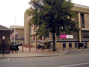
The main entrance of the National Army Museum from Royal Hospital Road.

To the southwest of Royal Hospital Road is the Royal Hospital Chelsea, hence the name. The National Army Museum is located next to the Royal Hospital Chelsea.[2] To the south is the Chelsea Physic Garden. Restaurant Gordon Ramsay is at 68 Royal Hospital Road,[3] formerly the site of another Michelin 3-starred restaurant, La Tante Claire.

References

edit
  1. ^ "Royal Hospital Road". LondonTown.com. Retrieved 10 March 2012.
  • ^ "Find us". National Army Museum. Archived from the original on 10 April 2012. Retrieved 10 March 2012.
  • ^ "Restaurant Gordon Ramsay". Gordon Ramsay. Retrieved 10 March 2012.
  • 51°29′13N 0°9′36W / 51.48694°N 0.16000°W / 51.48694; -0.16000


    Retrieved from "https://en.wikipedia.org/w/index.php?title=Royal_Hospital_Road&oldid=1038576418"


    Last edited on 13 August 2021, at 11:28  


    Languages


    This page is not available in other languages.
     

    Wikipedia


    This page was last edited on 13 August 2021, at 11:28 (UTC).

    Content is available under CC BY-SA 4.0 unless otherwise noted.


    Privacy policy

    About Wikipedia

    Disclaimers

    Contact Wikipedia

    Code of Conduct

    Developers

    Statistics

    Cookie statement

    Terms of Use

    Desktop