Home  

Random  

Nearby  


Log in  


Settings  


Donate  


About Wikipedia  

Disclaimers  


Wikipedia


Warmwell


Article  

Talk  


Language  

Watch  

Edit  


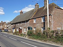
Warmwell is a small village and civil parish in south west Dorset, England, situated on the B3390 road about 5 miles (8.0 km) southeast of Dorchester. In 2013 the estimated population of the parish was 80.[1]

Warmwell

Warmwell

Warmwell is located in Dorset
Warmwell

Warmwell

Location within Dorset

Population80 [1]
OS grid referenceSY753858
Unitary authority
Shire county
Region
CountryEngland
Sovereign stateUnited Kingdom
Post townDorchester
Postcode districtDT2
PoliceDorset
FireDorset and Wiltshire
AmbulanceSouth Western
UK Parliament
List of places
UK
England
Dorset
50°41′25N 2°20′27W / 50.6904°N 2.3409°W / 50.6904; -2.3409

Warmwell contains several historic buildings, including a Jacobean manor house,[2] and from May 1937 was the home of RAF Station Woodsford airfield (later renamed RAF Warmwell), which is now a popular holiday site and contains a caravan park and several other small businesses.

References

edit
  1. ^ a b "Parish Population Data". Dorset County Council. 20 January 2015. Retrieved 11 March 2015.
  • ^ West Dorset, Holiday and Tourist Guide. West Dorset District Council. c. 1982. p. 21.
  • edit

      Media related to Warmwell at Wikimedia Commons


  • t
  • e

  • Retrieved from "https://en.wikipedia.org/w/index.php?title=Warmwell&oldid=1160620148"


    Last edited on 17 June 2023, at 18:31  


    Languages


     / Bân-lâm-gú
    Cebuano
    Cymraeg
    Español
    فارسی
    Français
    Italiano
    Ladin
    Nederlands
    Polski
    Svenska
     

    Wikipedia


    This page was last edited on 17 June 2023, at 18:31 (UTC).

    Content is available under CC BY-SA 4.0 unless otherwise noted.


    Privacy policy

    About Wikipedia

    Disclaimers

    Contact Wikipedia

    Code of Conduct

    Developers

    Statistics

    Cookie statement

    Terms of Use

    Desktop