|
→See also: PHMC markers
|
Semi-automated addition of image(s) and/or commonscat link(s) to monument list
|
||
| (15 intermediate revisions by 8 users not shown) | |||
| Line 1: | Line 1: | ||
{{short description|None}} |
|||
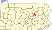
[[File:Map of Pennsylvania highlighting Montour County.svg|thumb|Location of Montour County in Pennsylvania]] |
[[File:Map of Pennsylvania highlighting Montour County.svg|thumb|Location of Montour County in Pennsylvania]] |
||
This is a list of the '''National Register of Historic Places listings in Montour County, Pennsylvania'''. |
This is a list of the '''National Register of Historic Places listings in Montour County, Pennsylvania'''. |
||
This is intended to be a complete list of the properties and districts on the [[National Register of Historic Places]] in [[Montour County, Pennsylvania|Montour County]], [[Pennsylvania]], [[United States]]. The locations of National Register properties and districts for which the latitude and longitude coordinates are included below, may be seen in a |
This is intended to be a complete list of the properties and districts on the [[National Register of Historic Places]] in [[Montour County, Pennsylvania|Montour County]], [[Pennsylvania]], [[United States]]. The locations of National Register properties and districts for which the latitude and longitude coordinates are included below, may be seen in a map.<ref>{{NRHPGoogleMapFootnote}}</ref> |
||
There are 7 properties and districts listed on the National Register in the county. |
There are 7 properties and districts listed on the National Register in the county. |
||
{{NRHP date for lists|Pennsylvania}} |
{{NRHP date for lists|Pennsylvania}} |
||
{{ |
{{GeoGroup}}{{Clear}} |
||
==Current listings== |
==Current listings== |
||
{{NRHP header|state_iso=us-pa}} |
|||
{|class="wikitable sortable" style="width:98%" |
|||
{{NRHP row |
|||
! {{NRHP color}}|<ref name="colorlegend">Numbers represent an ordering by significant words. Various colorings, defined [[Wikipedia:NRHP colors legend|here]], differentiate [[National Historic Landmark]] sites and [[National Register of Historic Places Districts]] from other NRHP buildings, structures, sites or objects.</ref> |
|||
|pos=1 |
|||
! width = 18% {{NRHP color}}| '''Landmark name'''<ref name="focus">{{cite web|url=http://nrhp.focus.nps.gov|title=NPS Focus |work=National Register of Historic Places |publisher=National Park Service |accessdate=November 20, 2009}}</ref> |
|||
|refnum=86003578 |
|||
! width = 8% class="unsortable" {{NRHP color}}| '''Image''' |
|||
|type=NRHP |
|||
! width = 10% {{NRHP color}}|'''Date listed''' |
|||
|article=Thomas Beaver Free Library and Danville YMCA |
|||
! {{NRHP color}}|'''Location''' |
|||
|name=Thomas Beaver Free Library and Danville YMCA |
|||
! width = 8% {{NRHP color}}|'''City or Town''' |
|||
|address=East Market and Ferry Streets |
|||
! class="unsortable" {{NRHP color}}| '''Summary''' |
|||
|city=[[Danville, Pennsylvania|Danville]] |
|||
|-- |
|||
|county=[[Montour County, Pennsylvania]] |
|||
! {{NRHP color}} | <small>1</small> |
|||
|date=1987-01-15 |
|||
| [[Thomas Beaver Free Library and Danville YMCA]] |
|||
|image=Beaver Free Library Montour Co PA.jpg |
|||
| |
|||
|lat=40.96 |
|||
| {{dts|1987|1|15}} |
|||
|lon=-76.606389 |
|||
| East Market and Ferry Streets<br/><small>{{coord|40|57|36|N|76|36|23|W|name=Beaver, Thomas, Free Library and Danville YMCA}}</small> |
|||
|description= |
|||
| [[Danville, Pennsylvania|Danville]] |
|||
|commonscat=Beaver Free Library (Montour County, Pennsylvania) |
|||
| |
|||
}} |
|||
|-- |
|||
{{NRHP row |
|||
! {{NRHP color}} | <small>2</small> |
|||
|pos=2 |
|||
| [[Gottlieb Brown Covered Bridge]] |
|||
|refnum=79002311 |
|||
| |
|||
|type=NRHP |
|||
| {{dts|1979|8|8}} |
|||
|article=Gottlieb Brown Covered Bridge |
|||
| East of Potts Grove on Township 594<br/><small>{{coord|41|0|6|N|76|46|26|W|name=Brown, Gottlieb, Covered Bridge}}</small> |
|||
|name=Gottlieb Brown Covered Bridge |
|||
| [[Liberty Township, Montour County, Pennsylvania|Liberty Township]] |
|||
|address=East of Potts Grove on Township 594 |
|||
| Extends into [[East Chillisquaque Township, Northumberland County, Pennsylvania|East Chillisquaque Township]] in [[National Register of Historic Places listings in Northumberland County, Pennsylvania|Northumberland County]] |
|||
|city=[[Liberty Township, Montour County, Pennsylvania|Liberty Township]] |
|||
|-- |
|||
|county=[[Montour County, Pennsylvania]] |
|||
! {{HD color}} | <small>3</small> |
|||
|date=1979-08-08 |
|||
| [[Danville Historic District (Danville, Pennsylvania)|Danville Historic District]] |
|||
|image=G Brown Covered Bridge Montour Co.jpg |
|||
| |
|||
|lat=41.001667 |
|||
| {{dts|1994|8|18}} |
|||
|lon=-76.773889 |
|||
| Roughly bounded by Bloom Street, Cedar Street, the [[Susquehanna River]], and Chestnut Street<br/><small>{{coord|40|57|42|N|76|37|2|W|name=Danville Historic District}}</small> |
|||
|description=Extends into [[East Chillisquaque Township, Northumberland County, Pennsylvania|East Chillisquaque Township]] in [[National Register of Historic Places listings in Northumberland County, Pennsylvania|Northumberland County]] |
|||
| [[Danville, Pennsylvania|Danville]] |
|||
|commonscat=Gottlieb Brown Covered Bridge |
|||
| |
|||
}} |
|||
|-- |
|||
{{NRHP row |
|||
! {{HD color}} | <small>4</small> |
|||
|pos=3 |
|||
| [[Danville West Market Street Historic District]] |
|||
|refnum=94000828 |
|||
| |
|||
|type=HD |
|||
| {{dts|1985|5|29}} |
|||
|article=Danville Historic District (Danville, Pennsylvania) |
|||
| Bounded by Courthouse Alley, Front Street, Haney's Alley and Mahoning Street<br/><small>{{coord|40|57|46|N|76|37|28.75|W|name=Danville West Market Street Historic District}}</small> |
|||
| |
|name=Danville Historic District |
||
|address=Roughly bounded by Bloom Street, Cedar Street, the [[Susquehanna River]], and Chestnut Street |
|||
| |
|||
|city=[[Danville, Pennsylvania|Danville]] |
|||
|-- |
|||
|county=[[Montour County, Pennsylvania]] |
|||
! {{NRHP color}} | <small>5</small> |
|||
|date=1994-08-18 |
|||
| [[Keefer Covered Bridge No. 7]] |
|||
|image=20 East Market Danville PA.jpg |
|||
| |
|||
|lat=40.961667 |
|||
| {{dts|1979|11|29}} |
|||
|lon=-76.617222 |
|||
| [[Pennsylvania Route 346]], southwest of Washingtonville<br/><small>{{coord|41|1|59|N|76|41|31|W|name=Keefer Covered Bridge No. 7}}</small> |
|||
|description= |
|||
| [[Liberty Township, Montour County, Pennsylvania|Liberty Township]] |
|||
|commonscat=Danville Historic District (Danville, Pennsylvania) |
|||
| |
|||
}} |
|||
|-- |
|||
{{NRHP row |
|||
! {{NRHP color}} | <small>6</small> |
|||
|pos=4 |
|||
| [[General William Montgomery House|Gen. William Montgomery House]] |
|||
|refnum=85001174 |
|||
| |
|||
|type=HD |
|||
| {{dts|1979|8|9}} |
|||
|article=Danville West Market Street Historic District |
|||
| 1 and 3 Bloom Street<br/><small>{{coord|40|57|52|N|76|37|0|W|name=Montgomery, Gen. William, House}}</small> |
|||
|name=Danville West Market Street Historic District |
|||
| [[Danville, Pennsylvania|Danville]] |
|||
|address=Bounded by Courthouse Alley, Front Street, Haney's Alley and Mahoning Street |
|||
| |
|||
|city=[[Danville, Pennsylvania|Danville]] |
|||
|-- |
|||
|county=[[Montour County, Pennsylvania]] |
|||
! {{NRHP color}} | <small>7</small> |
|||
|date=1985-05-29 |
|||
| [[Mooresburg School]] |
|||
|image=113 W Market Danville PA.jpg |
|||
| |
|||
|lat=40.962778 |
|||
| {{dts|1987|12|30}} |
|||
|lon=-76.624653 |
|||
| Pennsylvania Routes [[Pennsylvania Route 45|45]]/[[Pennsylvania Route 642|642]]<br/><small>{{coord|40|59|6|N|76|41|49|W|name=Mooresburg School}}</small> |
|||
|description= |
|||
| [[Liberty Township, Montour County, Pennsylvania|Liberty Township]] |
|||
}} |
|||
| |
|||
{{NRHP row |
|||
|pos=5 |
|||
|refnum=79003174 |
|||
|type=NRHP |
|||
|article=Keefer Covered Bridge No. 7 |
|||
|name=Keefer Covered Bridge No. 7 |
|||
|address=[[Pennsylvania Route 346]], southwest of Washingtonville |
|||
|city=[[Liberty Township, Montour County, Pennsylvania|Liberty Township]] |
|||
|county=[[Montour County, Pennsylvania]] |
|||
|date=1979-11-29 |
|||
|image=Keefer Mill Covered Bridge PA.jpg |
|||
|lat=41.033056 |
|||
|lon=-76.691944 |
|||
|description= |
|||
|commonscat=Keefer Covered Bridge No. 7 |
|||
}} |
|||
{{NRHP row |
|||
|pos=6 |
|||
|refnum=79002305 |
|||
|type=NRHP |
|||
|article=General William Montgomery House |
|||
|name=Gen. William Montgomery House |
|||
|address=1 and 3 Bloom Street |
|||
|city=[[Danville, Pennsylvania|Danville]] |
|||
|county=[[Montour County, Pennsylvania]] |
|||
|date=1979-08-09 |
|||
|image=Montgomery House Montour Co PA.jpg |
|||
|lat=40.964444 |
|||
|lon=-76.616667 |
|||
|description= |
|||
}} |
|||
{{NRHP row |
|||
|pos=7 |
|||
|refnum=87002208 |
|||
|type=NRHP |
|||
|article=Mooresburg School |
|||
|name=Mooresburg School |
|||
|address=Pennsylvania Routes [[Pennsylvania Route 45|45]]/[[Pennsylvania Route 642|642]] |
|||
|city=[[Liberty Township, Montour County, Pennsylvania|Liberty Township]] |
|||
|county=[[Montour County, Pennsylvania]] |
|||
|date=1987-12-30 |
|||
|image=Mooresburg School PA.jpg |
|||
|lat=40.985 |
|||
|lon=-76.696944 |
|||
|description= |
|||
|commonscat=Mooresburg School |
|||
}} |
|||
|} |
|} |
||
==See also== |
==See also== |
||
{{Commons category|National Register of Historic Places in Montour County, Pennsylvania}} |
|||
* [[List of National Historic Landmarks in Pennsylvania]] |
* [[List of National Historic Landmarks in Pennsylvania]] |
||
* [[National Register of Historic Places listings in Pennsylvania]] |
* [[National Register of Historic Places listings in Pennsylvania]] |
||
| Line 88: | Line 138: | ||
[[Category:Montour County, Pennsylvania| ]] |
[[Category:Montour County, Pennsylvania| ]] |
||
[[Category:National Register of Historic Places in Pennsylvania by county|Montour County]] |
[[Category:Lists of National Register of Historic Places in Pennsylvania by county|Montour County]] |
||
[[Category:National Register of Historic Places in Montour County, Pennsylvania|*]] |
|||

This is a list of the National Register of Historic Places listings in Montour County, Pennsylvania.
This is intended to be a complete list of the properties and districts on the National Register of Historic PlacesinMontour County, Pennsylvania, United States. The locations of National Register properties and districts for which the latitude and longitude coordinates are included below, may be seen in a map.[1]
There are 7 properties and districts listed on the National Register in the county.
This National Park Service list is complete through NPS recent listings posted July 5, 2024.[2]
|
Municipalities and communities of Montour County, Pennsylvania, United States
| ||
|---|---|---|
| Boroughs |
|
|
| Townships |
| |
| Unincorporated communities |
| |
| ||