Jump to content


Main menu


Navigation  


Main page
Contents
Current events
Random article
About Wikipedia
Contact us
Donate


Contribute  


Help
Learn to edit
Community portal
Recent changes
Upload file


Search  


Create account

Log in


Create account
 Log in


Pages for logged out editors learn more  


Contributions
Talk


Contents


(Top)


1 Archaeology  


2 Name  


3 See also  


4 References  


Šatrija


Azərbaycanca
Беларуская (тарашкевіца)
Lietuvių
Українська
Žemaitėška
 

Edit links


Article
Talk


Read
Edit
View history


Tools


Actions  


Read
Edit
View history


General  


What links here
Related changes
Upload file
Special pages
Permanent link
Page information
Cite this page
Get shortened URL
Download QR code
Wikidata item


Print/export  


Download as PDF
Printable version


In other projects  


Wikimedia Commons


Appearance


Coordinates: 55°5221.3N 22°3329.7E / 55.872583°N 22.558250°E / 55.872583; 22.558250
 

From Wikipedia, the free encyclopedia


55°52′21.3″N 22°33′29.7″E / 55.872583°N 22.558250°E / 55.872583; 22.558250

Pašatrija Hillfort

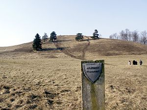
Šatrija is a hill and a hillfort in the Samogitia region of Lithuania, near the Pašatrija [lt] village, Luokė seniūnija, Telšiai District Municipality.[1] It is part of the Šatrija Landscape Reserve.[1]

The hill is 228 metres (748 ft) in height and was formed during the last glacial period.[2]

Archaeology[edit]

It is an archeological site no. A1939K[1] and a registered cultural monument no. AR1199 of Lithuania with the official names『Pašatrijos piliakalnis su gyvenviete』[Pašatrija Hillfort with Settlement] and『Luokės piliakalnis』[Luokė Hillfort].

The first excavations started in 1835, and the site was dated by the 1st millennium BCE. A wooden castle stood on its top at some time in 14th century. Researchers think that before the Christianization of Lithuania, an important pagan temple was located on the hill.[1][2]

Name[edit]

The origin of the name is associated with a legend that this was the place of Samogitia's witches' Sabbath. One day they danced too long, until the roosters' crows. All witches quickly flew away, but one misplaced her besom (on which witches fly) and started running around shouting "Where is my šatra?", hence the name (šatra is a twig from a besom).[2][1]

See also[edit]

References[edit]

  1. ^ a b c d e "Jie slėpė ir gynė žemaičius",『ŽEMAIČIŲ ŽEMĖS』Magazine, 2004, no. 3
  • ^ a b c "Šatrija hillfort"

  • Retrieved from "https://en.wikipedia.org/w/index.php?title=Šatrija&oldid=1141444495"

    Categories: 
    Hill forts in Lithuania
    Telšiai District Municipality
    Hills of Lithuania
    Hidden categories: 
    Pages using gadget WikiMiniAtlas
    Coordinates on Wikidata
    Commons category link is on Wikidata


    This page was last edited on 25 February 2023, at 02:57 (UTC).

    Text is available under the Creative Commons Attribution-ShareAlike License 4.0; additional terms may apply. By using this site, you agree to the Terms of Use and Privacy Policy. Wikipedia® is a registered trademark of the Wikimedia Foundation, Inc., a non-profit organization.


    Privacy policy

    About Wikipedia

    Disclaimers

    Contact Wikipedia

    Code of Conduct

    Developers

    Statistics

    Cookie statement

    Mobile view


    Wikimedia Foundation
    Powered by MediaWiki