Jump to content


Main menu


Navigation  


Main page
Contents
Current events
Random article
About Wikipedia
Contact us
Donate


Contribute  


Help
Learn to edit
Community portal
Recent changes
Upload file


Search  


Create account

Log in


Create account
 Log in


Pages for logged out editors learn more  


Contributions
Talk


Contents


(Top)


1 History  


2 Cultural heritage  


3 References  


4 External links  


Žadovinek


Bosanski
Hrvatski
Македонски
Nederlands
Нохчийн
Oʻzbekcha / ўзбекча
Polski
Română
Slovenščina
Српски / srpski
Srpskohrvatski / српскохрватски
Татарча / tatarça
Українська
اردو
 

Edit links


Article
Talk


Read
Edit
View history


Tools


Actions  


Read
Edit
View history


General  


What links here
Related changes
Upload file
Special pages
Permanent link
Page information
Cite this page
Get shortened URL
Download QR code
Wikidata item


Print/export  


Download as PDF
Printable version


In other projects  


Wikimedia Commons


Appearance


Coordinates: 45°562.89N 15°2939.86E / 45.9341361°N 15.4944056°E / 45.9341361; 15.4944056
 

From Wikipedia, the free encyclopedia


Žadovinek
Žadovinek is located in Slovenia
Žadovinek

Žadovinek

Location in Slovenia

Coordinates: 45°56′2.89″N 15°29′39.86″E / 45.9341361°N 15.4944056°E / 45.9341361; 15.4944056
Country Slovenia
Traditional regionLower Carniola
Statistical regionLower Sava
MunicipalityKrško
Area
 • Total3.17 km2 (1.22 sq mi)
Elevation
155.9 m (511.5 ft)
Population
 (2002)
 • Total82
[1]

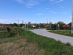
Žadovinek (pronounced [ʒadɔˈʋiːnək]; in older sources also Zadovinek[2]: 78 ) is a settlement on the right bank of the Sava River, east of Leskovec in the Municipality of Krško in eastern Slovenia. The area is part of the traditional region of Lower Carniola. It is now included with the rest of the municipality in the Lower Sava Statistical Region.[3]

History[edit]

In the late fall of 1941, German forces evicted the residents of the village in order to make way for the resettlement of Gottschee Germans. In 1964 the northern part of Žadovinek, known as Petrovce, was annexed by the town of Krško. The remaining part, known as Srednji Marof (German: Mittermaierhof)[2]: 79  remained separate as the village of Žadovinek.[4]

Cultural heritage[edit]

Late Bronze Age, Early Iron Age, and Roman graves have been found in the Petrovce area of the settlement.[5]

References[edit]

  • ^ a b Leksikon občin kraljestev in dežel zastopanih v državnem zboru, vol. 6: Kranjsko. 1906. Vienna: C. Kr. Dvorna in Državna Tiskarna.
  • ^ Krško municipal site
  • ^ Savnik, Roman (1976). Krajevni leksikon Slovenije, vol. 3. Ljubljana: Državna založba Slovenije. pp. 169–170.
  • ^ Slovenian Ministry of Culture register of national heritage reference number ešd 1327
  • External links[edit]


  • t
  • e

  • Retrieved from "https://en.wikipedia.org/w/index.php?title=Žadovinek&oldid=1210110963"

    Categories: 
    Populated places in the City Municipality of Krško
    Krško geography stubs
    Hidden categories: 
    Pages using gadget WikiMiniAtlas
    Articles with short description
    Short description is different from Wikidata
    Coordinates on Wikidata
    Pages with Slovene IPA
    Articles containing German-language text
    Commons category link is on Wikidata
    All stub articles


    This page was last edited on 25 February 2024, at 01:30 (UTC).

    Text is available under the Creative Commons Attribution-ShareAlike License 4.0; additional terms may apply. By using this site, you agree to the Terms of Use and Privacy Policy. Wikipedia® is a registered trademark of the Wikimedia Foundation, Inc., a non-profit organization.


    Privacy policy

    About Wikipedia

    Disclaimers

    Contact Wikipedia

    Code of Conduct

    Developers

    Statistics

    Cookie statement

    Mobile view


    Wikimedia Foundation
    Powered by MediaWiki