Jump to content


Main menu


Navigation  


Main page
Contents
Current events
Random article
About Wikipedia
Contact us
Donate


Contribute  


Help
Learn to edit
Community portal
Recent changes
Upload file


Search  


Create account

Log in


Create account
 Log in


Pages for logged out editors learn more  


Contributions
Talk


Contents


(Top)


1 Improvements  


2 See also  


3 References  


A499 road


Cymraeg
Oʻzbekcha / ўзбекча
 

Edit links


Article
Talk


Read
Edit
View history


Tools


Actions  


Read
Edit
View history


General  


What links here
Related changes
Upload file
Special pages
Permanent link
Page information
Cite this page
Get shortened URL
Download QR code
Wikidata item


Print/export  


Download as PDF
Printable version


In other projects  


Wikimedia Commons


Coordinates: 52°5816N 4°2403W / 52.9711°N 4.4009°W / 52.9711; -4.4009 (A499 road)
 

From Wikipedia, the free encyclopedia


A499 shield

A499
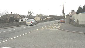
The A499 at Bethesda Bach - geograph.org.uk - 729699.jpg
The A499 at Bethesda Bach
Route information
Length23.4 mi (37.7 km)
Major junctions
North end A487
Major intersections A497
South endAbersoch
Location
CountryUnited Kingdom
Constituent countryWales
Road network

The A499 road is the major road of the Llŷn peninsulainNorth Wales.

Its northern terminus is a roundabout with the A487 trunk road between Llanwnda and Llandwrog (53°05′41N 4°16′57W / 53.0948°N 4.2824°W / 53.0948; -4.2824 (A499 road (northern end))). It then runs south-westerly along the northern coast of the peninsula, through Clynnog Fawr then turns inland crossing the peninsula to meet the southern coast at Pwllheli, it then follows that southern coast to terminate at Abersoch (52°49′22N 4°30′19W / 52.8227°N 4.5054°W / 52.8227; -4.5054 (A499 road (southern end))).

The total length is 23.4 miles. At no point is it a trunk road, although the Welsh Assembly has considered upgrading its status.[1][2]

Improvements[edit]

Work started in February 2008 to upgrade the road between Aberdesach and Llanaelhaearn and also bypass Clynnog Fawr. This work is expected to complete in Summer 2009.[3] Previous work in 2006/2007 had cleared the new route of trees and erected boundary fencing.

See also[edit]

References[edit]

  • ^ Gwynedd Council Press Release Nov 2007 Archived 26 November 2007 at the Wayback Machine
  • 52°58′16N 4°24′03W / 52.9711°N 4.4009°W / 52.9711; -4.4009 (A499 road)


  • t
  • e

  • Retrieved from "https://en.wikipedia.org/w/index.php?title=A499_road&oldid=1167030008"

    Categories: 
    Roads in Gwynedd
    United Kingdom road stubs
    Wales stubs
    Hidden categories: 
    Webarchive template wayback links
    All articles with dead external links
    Articles with dead external links from July 2023
    Articles with permanently dead external links
    Pages using gadget WikiMiniAtlas
    Articles with short description
    Short description is different from Wikidata
    Use dmy dates from June 2023
    Use British English from February 2013
    Infobox road maps tracking category
    Infobox road instances in Wales
    Lists of coordinates
    Geographic coordinate lists
    Articles with Geo
    Commons category link from Wikidata
    Coordinates on Wikidata
    All stub articles


    This page was last edited on 25 July 2023, at 07:09 (UTC).

    Text is available under the Creative Commons Attribution-ShareAlike License 4.0; additional terms may apply. By using this site, you agree to the Terms of Use and Privacy Policy. Wikipedia® is a registered trademark of the Wikimedia Foundation, Inc., a non-profit organization.


    Privacy policy

    About Wikipedia

    Disclaimers

    Contact Wikipedia

    Code of Conduct

    Developers

    Statistics

    Cookie statement

    Mobile view


    Wikimedia Foundation
    Powered by MediaWiki