
This article needs additional citations for verification. Please help improve this articlebyadding citations to reliable sources. Unsourced material may be challenged and removed.
Find sources: "Agadir" – news · newspapers · books · scholar · JSTOR (December 2022) (Learn how and when to remove this message) |
Agadir
| |
|---|---|
Top: View towards Agadir Oufla, Middle: View of the ocean
Bottom: Agadir Marina
| |

Flag  | |
 Agadir Location in Morocco Show map of Morocco Agadir Agadir (Africa) Show map of Africa | |
| Coordinates: 30°25′17″N 9°34′59″W / 30.42139°N 9.58306°W / 30.42139; -9.58306 | |
| Country | |
| Region | Souss-Massa |
| Prefecture | Agadir-Ida Ou Tanane |
| Area | |
| • Land | 51.2 km2 (19.8 sq mi) |
| Elevation | 74 m (243 ft) |
| Population
(2014)[1]
| |
| • Total | 487,954 |
| • Rank | 10th in Morocco |
| Time zone | UTC+1 (CET) |
| Website | Agadir (in Arabic and French) |
Agadir (Arabic: أكادير, romanized: ʾagādīr, pronounced [ʔaɡaːdiːr]; Tachelhit: ⴰⴳⴰⴷⵉⵔ) is a major cityinMorocco, on the shore of the Atlantic Ocean near the foot of the Atlas Mountains, just north of the point where the Souss River flows into the ocean, and 509 kilometres (316 mi) south of Casablanca. Agadir is the capital of the Agadir Ida-U-Tanan Prefecture and of the Souss-Massa economic region.
Agadir is one of the major urban centres of Morocco. The municipality of Agadir recorded a population of 924,000 in the 2014 Moroccan census.[1] According to the 2004 census, there were 346,106 inhabitants in that year[2] and the population of the Prefecture of Agadir-Ida Outanane was 487,954 inhabitants.[2]
Agadir is known for being the capital of Amazigh culture in Morocco.[3][4] It is one of the few big Moroccan cities where Tamazight, one of Morocco's two official languages, is spoken by more than half of the population. The native variety to the region, Tachelhit, is spoken by 222,000 speakers,[5] representing 53.7% of the entire population.[6] Agadir is also a place for many festivals related to Amazigh culture, such as The New Amazigh Year, celebrated on 13 January every year throughout the city, especially in the downtown area.[7][8][9] The Bilmawen Festival is another old Berber tradition celebrated in the suburbs of the city.[10] Additionally, the Issni N’Ourgh International festival is a festival for Amazigh films.[4] Agadir is also the birthplace of many of the pillars of Shilha and Amazigh music, such as Izenzaren, Oudaden, and many others.
It was the site of the 1911 Agadir Crisis that exposed tensions between France and Germany, foreshadowing World War I. The city was destroyed by an earthquake in 1960; it has been completely rebuilt with mandatory seismic standards. It is now the largest seaside resort in Morocco, where foreign tourists and many residents are attracted by an unusually mild year-round climate. Since 2010 it has been well served by low-cost flights and a motorway from Tangier.
The mild winter climate (January average midday temperature 20.5 °C/69 °F)[11] and good beaches have made it a major "winter sun" destination for northern Europeans.
The name Agadir is a common Berber noun, meaning 'wall, enclosure, fortified building, citadel'. This noun is attested in most Berber languages.[12] It may come from the Tuareg word aǧādir ('wall' or 'bank')[13] or from Phoenician gadir ('wall' or 'fortress').[13] The former word may also be a loanword from the latter.[14] The Phoenician etymology, if correct, would be the same as that of Cádiz in Spain.[13]
There are many more towns in Morocco called Agadir.[15] The city of Agadir's full name in TashelhitisAgadir Ighir[16]orAgadir-n-Irir,[15] literally 'the fortress of the cape',[17] referring to the nearby promontory named Cape Ighir on maps (apleonastic name, literally 'Cape Cape').[citation needed]
The oldest known map that includes an indication of Agadir is from 1325: at the approximate location of the modern city, it names a place it calls Porto Mesegina, after a Berber tribe name that had been recorded as early as the 12th century, the Mesguina (also known as the Ksima).[citation needed] At the end of the medieval period, Agadir was a town of some renown. The first known mention of its name, Agadir al-harba, was recorded in 1510.[a][citation needed]
In the late 15th century the Portuguese began to occupy positions along the Moroccan coast. In 1505 the Portuguese nobleman João Lopes de Sequeira occupied the area.[18][16][19][20] He built a wooden castle at the foot of a hill, near a spring,[16] and a Portuguese colony named Santa Cruz do Cabo do Gué was created.[20] The site still bears the name of Funti[16] or Founti (from the Portuguese word fonte, meaning "fountain"). The castle was later bought by the King of Portugal on 25 January 1513.[16]
The Portuguese presence elicited growing hostility from the local population of the Sous region, who initiated a years-long economic and military blockade of the port. In 1510 Muhammad al-Qa'im, the leader of a Sharifian family in that had established themselves in the Sous, was declared leader of the local military efforts against the Sous.[16] His descendants went on to found the Sa'di dynasty which rose to power over the following decades and eventually established their capital at Marrakesh. In 1540 the Sa'di sultan Muhammad al-Shaykh occupied the main hill (now Agadir Oufla) above the Portuguese and installed artillery to prepare an attack on the fortress below. The siege of the colony began on 16 February 1541 and was successfully concluded on 12 March of the same year.[16]
Six hundred Portuguese survivors were taken prisoner, including the governor, Guterre de Monroy, and his daughter, Dona Mecia. The captives were redeemed by the holy men, who were mostly from Portugal. Dona Mecia, whose husband was killed during the battle, became the wife of Sheikh Mohammed ash-Sheikh but died in childbirth in 1544. In the same year, Mohammed ash-Sheikh released Guterre de Monroy, whom he had befriended.[21][full citation needed] After this, the Portuguese were forced to abandon most of the Moroccan areas that they had acquired control of between 1505 and 1520, including Agadir, Safi and Azemmour. By 1550, Portugal's only holding in Morocco was Mazagan (now El Jadida), Tangier and Ceuta. As Morocco became less important to the Portuguese, they turned their attention to India and Brazil.
The story of the Portuguese presence (from the installation in 1505 until their defeat on 12 March 1541) is described in a manuscript (published for the first time, with a French translation by Pierre de Cenival, in 1934) entitled "Este He O Origem e Comeco e Cabo da Villa de Santa Cruz do Cabo de Gue D'Agoa de Narba", written by an anonymous author who was captured in 1934[citation needed] and was imprisoned for five years in Taroudannt (cf. "Santa Cruz do Cabo de Gue d'Agoa de Narba – Estudo e Crónica", Joao Marinho e Santos, José Manuel Azevedo e Silva e Mohammed Nadir, bilingual edition, Viseu 2007[full citation needed]).
After the Sa'di victory the site was then left unoccupied for years until Muhammad al-Shaykh's successor, Abdallah al-Ghalib (r. 1557–1574), built a new fortress (orkasbah) on the hilltop.[16] It was now called Agadir N'Ighir (literally: "fortified granary of the hill" in Tachelhit.[b]
In the 17th century, during the reign of the Berber dynasty of Tazerwalt, Agadir was a harbour of some importance, expanding its trade with Europe. There was, however, neither a real port nor a wharf. Agadir traded mainly in sugar, wax, copper, hides and skins.[22] In exchange, Europeans sold their manufactured goods there, particularly weapons and textiles. Under the reign of Sultan Moulay Ismail (1645–1727) and his successors, the trade with France, which had previously been an active partner, diminished, and trade with the English and Dutch increased.

In 1731, the town was completely destroyed by an earthquake.[23] After that, Agadir's harbour was ordered to be closed, and an alternative, Essaouira, was established farther north.
After a long period of prosperity during the reigns of the Saadian and Alawite dynasties, Agadir declined from 1760 because of the pre-eminence given to the competing port of Essaouira by the Alawite Sultan Mohammed ben Abdallah who wanted to punish the Souss for rebelling against his authority. This decline lasted a century and a half. In 1789, a European traveler gave a brief description of Agadir: "It is now a ghost town, there are no more than a few houses and these are crumbling into ruins".
In 1881, Sultan Moulay Hassan reopened the harbour to trade in order to supply the expeditions he planned in the south. These expeditions, which were to reassert his authority over the Souss tribes and counter the plans of English and Spanish, were held in 1882 and 1886.[24]

In 1884, Charles de Foucauld described in Reconnaissance au Maroc (Reconnaissance in Morocco) his rapid passage to Agadir from the east:
I walk along the shore to Agadir Irir. The road passes below the city, half-way between it and Founti: Founti is a miserable hamlet, a few fishermen's huts; Agadir, despite its white enclosure which gives it the air of a city is, I am told, a poor village depopulated and without trade.[25]
On the pretext of a call for help from German companies in the valley of the Souss, Germany decided on 1 July 1911, to extend its interests in Morocco and assert a claim on the country. It sent to the bay of Agadir, (which harbour was, until 1881, closed to foreign trade) the SMS Panther which was quickly joined by the cruiser Berlin. Very strong international reaction, particularly from Great Britain, surprised Germany and triggered the Agadir Crisis between France and Germany. War threatened. After tough negotiations, a Franco-German treaty was finally signed on 4 November 1911, giving a free hand to France, who would be able to establish its protectorate over Morocco in return for giving up some colonies in Africa. It was only then that the gunboat Panther and the cruiser Berlin left the bay of Agadir. Due to a miscalculation, the German sales representative Hermann Wilberg, who was sent to provide the pretext for the intervention, only arrived at Agadir three days after the Panther arrived.
In 1913, the cities (Agadir N'Ighir and Founti) totaled less than a thousand inhabitants. On 15 June 1913 French troops landed in Agadir. In 1916, the first pier was built near Founti – a simple jetty, later known as the "Portuguese jetty", which remained until the end of the 20th century. After 1920, under the French protectorate, a port was built and the city saw its first development with the construction of the old Talborjt district located on the plateau at the foot of the hill. Two years later, beside Talborjt along the faultline of the river Tildi construction of the popular district of Yahchech began.
Around 1930, Agadir was an important stop for the French airmail service Aéropostale and was frequented by Saint-Exupéry and Mermoz.
In the years from 1930, a modern central city began to be built according to the plans of the urban planner Henri Prost, director of the Urban Planning Department of the Protectorate, and his deputy Albert Laprade: a horseshoe layout based on the waterfront[26] around a large avenue perpendicular to the waterfront – the Avenue Lyautey, since renamed Avenue du Général Kettani. In the 1950s, urban development continued under the direction of the Director of Urban Planning Morocco, Michel Ecochard.
After 1950 and the opening of the new commercial port, the city grew with fishing, canning, agriculture, and mining. It also began to open up to tourism due to its climate and hotel infrastructure.[citation needed] Several years later from 1950 to 1956 Agadir organized the Grand Prix of Agadir [fr] and, from 1954 to 1956, the Moroccan Grand Prix.
In 1959, the port was visited by the yacht of the Greek shipping magnate Aristotle Onassis and his guest, Winston Churchill.[27]
By 1960, Agadir numbered over 40,000 residents when at 15 minutes to midnight on 29 February 1960, it was again almost totally destroyed by an earthquake of magnitude 5.7 on the Richter scale that lasted 15 seconds, burying the city and killing more than a third of the population.[28] The death toll was estimated at 15,000.[29] The earthquake destroyed the old Kasbah.

The current city was rebuilt 1.6 kilometres (1 mi) further south, led by the architects associated with GAMMA, including Jean-François Zevaco, Elie Azagury, Pierre Coldefy, and Claude Verdugo,[30] with consultation from Le Corbusier.[31] Agadir became a large city of over half a million by 2004, with a large port with four basins: the commercial port with a draft of 17 metres, triangle fishing, fishing port, and a pleasure boat port with marina. Agadir was the premier sardine port in the world in the 1980s and has a beach stretching over 10 km with fine seafront promenades. Its climate has 340 days of sunshine per year which allows for swimming all year round. The winter is warm and in summer, haze is common.
With Marrakech, Agadir is a very important centre for tourism to Morocco, and the city is the most important fishing port in the country. Business is also booming with the export of citrus fruit and vegetables produced in the fertile valley of Souss.[citation needed]
On 12 December 2022, an earthquake of magnitude 4.5 hit Agadir Province. The earthquake struck at a depth of three kilometres beneath the epicentre, off the coast of Agadir.[32][33]

The current conurbation of Agadir is actually a combination of four communes:
This area is named after the old district of Talborjt (meaning "small fort" in local Berber, in remembrance of the water tower which was first built on the plateau in the former Talborjt). Lively, the New Talborjt which has been rebuilt away from the Old Talborjt, has as the main artery the Boulevard Mohammed Sheikh Saadi, named after the victor against the Portuguese in 1541. Other major avenues are the Avenue President Kennedy and the Avenue 29 February. There is also the Mohammed V mosque, the Olhão garden (Olhão is a coastal city in southern Portugal that is twinned with Agadir), and its memorial museum and the Garden Ibn Zaydoun. Some good hotels and restaurants have been built on the main arteries.


The Casbah (Agadir Oufla, Agadir le haut, Agadir N'Ighir, or Agadir de la colline) was, along with Founti by the sea, the oldest district of Agadir. An authentic fortress with winding streets and lively, the Casbah was built in 1572 by Abdallah al-Ghalib. Above the front door; today, the original inscription in Arabic and in English reads: "God, the Nation, the King."
Of this fortress there remains, after the earthquake of 29 February 1960, a restored long high wall that surrounds land that is not buildable. There is, however, a view over the bay of Agadir and the ports. The old people of Agadir remember the『Moorish café』of the Casbah and its panoramic view.[citation needed]
The hill bears the inscription in Arabic: "God, Country, King" which, like the walls, is illuminated at night.
Overlooking the waterfront and Wadi Tildi, this old district (whose name is sometimes spelled Talbordjt) was once a shopping area and very lively with its large square where there was a weekly market, hotels, schools, mosque.[35] 90% of the buildings in Old Talborjt were destroyed or severely damaged by the earthquake in 1960. Razed to the ground after the earthquake and now overgrown, it is classified as non-buildable area. Its main thoroughfare, the Avenue El Moun stretches over 2 kilometres (1.2 mi) and serves only for driving schools that teach their students to drive.
This is the largest market in the region. It has about 6,000 small shops. It is surrounded by walls and has several entrances. It is organized into different sectors: furniture, crafts, clothing, vegetables, meat, spices etc. It is possible to find all kinds of handicrafts and traditional decorations.
The walls have been restored and the interior design is being finished.

La Médina is a handicrafts space created in 1992 by the Italian artist Coco Polizzi, at Ben Sergao, a district close to Agadir 4.5 kilometres (2.8 mi) from the city centre. Built using techniques of traditional Berber construction, it is a kind of small open-air museum, on five hectares and home to artisan workshops, a museum, individual residences, a small hotel, and an exotic garden.
The prefecture is divided administratively into communes.[36]
| Name | Geographic code | Type | Households | Population (2004) | Foreign population | Moroccan population | Notes |
|---|---|---|---|---|---|---|---|
| Agadir | 001.01.01. | Municipality | 77485 | 346106 | 1925 | 344181 | |
| Amskroud | 001.05.01. | Rural commune | 1687 | 10020 | 0 | 10020 | |
| Aourir | 001.05.03. | Rural commune | 5571 | 27483 | 55 | 27428 | 21,810 residents live in the centre, called Aourir; 5673 residents live in rural areas. |
| Aqesri | 001.05.05. | Rural commune | 857 | 4873 | 0 | 4873 | |
| Aziar | 001.05.07. | Rural commune | 688 | 3803 | 0 | 3803 | |
| Drargua | 001.05.09. | Rural commune | 6910 | 37115 | 1 | 37114 | 17,071 residents live in the centre, called Drargua; 20044 residents live in rural areas. |
| Idmine | 001.05.11. | Rural commune | 671 | 4279 | 0 | 4279 | |
| Imouzzer | 001.05.13. | Rural commune | 1153 | 6351 | 0 | 6351 | |
| Imsouane | 001.05.15. | Rural commune | 1704 | 9353 | 0 | 9353 | |
| Tadrart | 001.05.21. | Rural commune | 1008 | 5703 | 0 | 5703 | |
| Taghazout | 001.05.23. | Rural commune | 999 | 5348 | 16 | 5332 | |
| Tamri | 001.05.25. | Rural commune | 2927 | 17442 | 8 | 17434 | |
| Tiqqi | 001.05.29. | Rural commune | 1735 | 10078 | 0 | 10078 |

Agadir has a semi-arid climate (Köppen: BSh) with warm summers and mild winters. Located along the Atlantic Ocean, Agadir has a very mild climate. The daytime temperature generally stays in the 20s °C (70s °F) every day with averages around 27 °C (81 °F), with the winter highs typically reaching 21 °C (70 °F) in January.
Rainfall is almost entirely confined to the winter months and is heavily influenced by the NAO, with negative NAO indices producing wet winters and positive NAO correlating with drought. For instance, in the wettest month on record of December 1963, as much as 314.7 millimetres or 12.39 inches fell, whereas in the positive NAO year from July 1960 to June 1961 a mere 46.7 millimetres or 1.84 inches occurred over the twelve months.[37] The wettest year has been from July 1955 to June 1956 with 455.5 millimetres or 17.93 inches.[37]
Occasionally however, the region experiences winds from the Sahara called Chergui, which may exceptionally and for two to five days raise the heat above 40 °C (104 °F). The confirmed record high temperature was 50.4 °C (122.7 °F) set on 12 August 2023.[38] This makes Agadir one of few coastal locations in the world to have recorded a temperature above 50 °C. The record of 51.7 °C degrees, which was on 19 August 1940, is disputed.
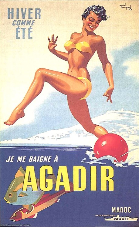
In 1950, a poster from the Navigation Company Pacquet proclaimed: "Winter or summer, I bathe in Agadir".[39]
| Climate data for Agadir (Inezgane) (1991–2020) | |||||||||||||
|---|---|---|---|---|---|---|---|---|---|---|---|---|---|
| Month | Jan | Feb | Mar | Apr | May | Jun | Jul | Aug | Sep | Oct | Nov | Dec | Year |
| Record high °C (°F) | 31.9 (89.4) |
36.0 (96.8) |
38.2 (100.8) |
40.0 (104.0) |
46.1 (115.0) |
46.7 (116.1) |
48.5 (119.3) |
50.4 (122.7) |
43.5 (110.3) |
42.6 (108.7) |
38.0 (100.4) |
33.6 (92.5) |
50.4 (122.7) |
| Mean daily maximum °C (°F) | 21.2 (70.2) |
22.0 (71.6) |
23.4 (74.1) |
23.2 (73.8) |
24.2 (75.6) |
25.6 (78.1) |
26.7 (80.1) |
27.0 (80.6) |
26.1 (79.0) |
26.1 (79.0) |
24.1 (75.4) |
22.1 (71.8) |
24.3 (75.8) |
| Daily mean °C (°F) | 14.8 (58.6) |
16.1 (61.0) |
17.9 (64.2) |
18.7 (65.7) |
20.1 (68.2) |
21.9 (71.4) |
23.0 (73.4) |
23.3 (73.9) |
22.3 (72.1) |
21.4 (70.5) |
18.5 (65.3) |
16.1 (61.0) |
19.5 (67.1) |
| Mean daily minimum °C (°F) | 8.4 (47.1) |
10.1 (50.2) |
12.3 (54.1) |
14.1 (57.4) |
15.9 (60.6) |
18.1 (64.6) |
19.2 (66.6) |
19.5 (67.1) |
18.6 (65.5) |
16.7 (62.1) |
12.9 (55.2) |
10.1 (50.2) |
14.7 (58.4) |
| Record low °C (°F) | 1.1 (34.0) |
2.4 (36.3) |
5.3 (41.5) |
4.4 (39.9) |
8.9 (48.0) |
12.9 (55.2) |
13.0 (55.4) |
14.6 (58.3) |
12.1 (53.8) |
9.5 (49.1) |
1.6 (34.9) |
2.2 (36.0) |
1.1 (34.0) |
| Average precipitation mm (inches) | 32.0 (1.26) |
28.6 (1.13) |
31.3 (1.23) |
13.8 (0.54) |
5.6 (0.22) |
0.8 (0.03) |
0.2 (0.01) |
3.1 (0.12) |
3.7 (0.15) |
21.2 (0.83) |
42.3 (1.67) |
49.0 (1.93) |
231.6 (9.12) |
| Average precipitation days (≥ 1 mm) | 2.8 | 2.7 | 3.2 | 1.7 | 0.8 | 0.2 | 0.1 | 0.3 | 0.5 | 1.9 | 3.0 | 3.6 | 20.8 |
| Mean monthly sunshine hours | 234.6 | 224.8 | 266.8 | 273.5 | 297.1 | 266.8 | 252.7 | 247.6 | 234.5 | 242.2 | 228.1 | 221.8 | 2,990.5 |
| Percent possible sunshine | 74 | 73 | 73 | 71 | 71 | 64 | 59 | 61 | 64 | 70 | 73 | 71 | 68 |
| Source: NOAA (sun 1981–2010),[40][41] (February record high)[42] | |||||||||||||

The city had an annual growth rate of over 6% per year in housing demand while housing production barely exceeds 3.4%.[citation needed]
Agadir's economy relies mainly on tourism and fisheries. Agricultural activities are based around the city.[43] Agadir has one of the biggest souks in Morocco (Souk El Had).

The fishing port is a major sardine port. The commercial port is also known for its exports of cobalt, manganese, zinc and citrus products. The Avenue du Port, the main artery of the Anza district, is surrounded by canneries and has many popular small restaurants adjacent to the fish market. The city has a cement company called Ciments du Maroc (CIMAR), a subsidiary of the Italian group Italcementi[44] which is in process of being transferred to a new plant 40 kilometres (25 mi) from the city. There is also a shipyard in the port and the only merchant marine school in Morocco.
Agadir is served by Al Massira Airport, 23 kilometres (14 mi) from the city.

The Timitar festival, a festival of Amazigh culture and music from around the world, has been held in Agadir every summer since its inception in July 2004.
The Morocco Movement association is involved in the arts and organizes concerts, exhibitions and meetings in the visual arts, design, music, graphic design, photography, environment and health.[45]
Other cultural events in Agadir are:
The city of Agadir has a university: the University Ibn Zohr which includes a Faculty of Science, Faculty of medicine and pharmacy, Faculty of Law, Economics and Social Sciences, the Faculty of Arts and Humanities, and the multi-disciplined Faculty of Ouarzazate.
There are also establishments of higher education such as:
There is an international French school: the French School of Agadir and also public schools: Youssef Ben Tachfine School, Mohammed Reda-Slaoui School, and the Al-Idrissi Technical College.
High schools in the city include:
The city of Agadir has a football club known as Hassania Agadir and the city has built the new Adrar Stadium, which the team plays its home matches at. The city also hosts the Royal Tennis Club of Agadir. It could host matches in the 2030 FIFA World Cup.
The Hassan II Golf Trophy and Lalla Meryem Cup golf tournaments of the European Tour and Ladies European Tour are held at the Golf du Palais Royal in Agadir since 2011.

Some of the most popular beaches in Morocco are located to the north of Agadir.[citation needed] Areas known for surfing are located near Taghazout village to Cap Ghir.
Many smaller and clean beaches are located along this coast. Some of them between Agadir and Essaouira are: Agadir Beach, Tamaounza (12 km), Aitswal Beach, Imouran (17 km), Taghazout (19 km), Bouyirdn (20 km), Timzguida (22 km), Aghroud (30 km), Imiouadar (27 km).[46]
Agadir has eight sister cities[50][51]
Cooperation Pact:
|
| |||||
|---|---|---|---|---|---|
| Tanger-Tetouan-Al Hoceima |
| ||||
| Oriental |
| ||||
| Fès-Meknès |
| ||||
| Rabat-Salé-Kénitra |
| ||||
| Béni Mellal-Khénifra |
| ||||
| Casablanca-Settat |
| ||||
| Marrakesh-Safi |
| ||||
| Drâa-Tafilalet |
| ||||
| Souss-Massa |
| ||||
| Guelmim-Oued Noun |
| ||||
| Laâyoune-Sakia El Hamra |
| ||||
| Dakhla-Oued Ed-Dahab |
| ||||
| International |
|
|---|---|
| National |
|
| Geographic |
|
| Other |
|


