Jump to content


Main menu


Navigation  


Main page
Contents
Current events
Random article
About Wikipedia
Contact us
Donate


Contribute  


Help
Learn to edit
Community portal
Recent changes
Upload file


Search  


Create account

Log in


Create account
 Log in


Pages for logged out editors learn more  


Contributions
Talk


Contents


(Top)


1 See also  


2 Notes  


Aji Chay


Azərbaycanca
تۆرکجه
Català
Cebuano
فارسی
Français
Հայերեն
مصرى
Norsk nynorsk
Русский
Українська
اردو
 

Edit links


Article
Talk


Read
Edit
View history


Tools


Actions  


Read
Edit
View history


General  


What links here
Related changes
Upload file
Special pages
Permanent link
Page information
Cite this page
Get shortened URL
Download QR code
Wikidata item


Print/export  


Download as PDF
Printable version


In other projects  


Wikimedia Commons


Appearance


Coordinates: 37°45N 45°42E / 37.750°N 45.700°E / 37.750; 45.700
 

From Wikipedia, the free encyclopedia


Aji Chay
Talkheh-Roud
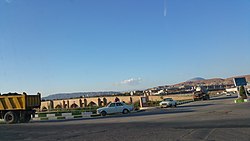
Aji Chay bridge in northeast of Tabriz.
Location
CountryIran
StateEast Azerbaijan
Physical characteristics
Source 
 • locationEast Azerbaijan, Iran
Length265 km (165 mi)
Discharge 
 • locationLake Urmia
 • maximum40.6 m3/s (1,430 cu ft/s)
Basin features
Tributaries 
 • leftVaneq River, Saidabad River, Quri Chay
 • rightKomur River,[1] Sian River

The Aji Chay[2]orTalkheh Rud (Azerbaijani: آجی چای Acıçay, Persian: تلخه رود Talkheh Rud, both meaning "bitter river"[3][4]) is a river in Azerbaijan regionofIran. Most of this 265-km long river flows in the East Azerbaijan Province.

The historic Aji Chay Bridge over the river, on the old Tabriz road to Marand, is just outside Tabriz and east of the Tabriz International Airport.[5]

See also[edit]

Notes[edit]

  1. ^ NJ 38-7 Tabriz, Iran; Azerbaijan; Armenia Iran, Series 1501, Joint Operations Graphic (Air) 1:250,000, U.S. National Imagery and Mapping Agency. The Komur enters the Aji Chay just north of Tabriz, and just before the Sian Chay enters the Aji Chay.
  • ^ Ehlers, E. (July 29, 2011). "ĀJĪ ČĀY". Encyclopædia Iranica. Retrieved October 6, 2015.
  • ^ Rasaneh, Sirang. "Ajy Chay (Talkheh Rood) River". Iran Tourism & Touring. Archived from the original on 2019-06-05. Retrieved 2020-11-11.
  • ^ Eduljee, K. E. "Persian Gardens, Chahar Bagh, Pairidaeza, Baghs". Zoroastrian Heritage. Archived from the original on 2020-11-09. Retrieved 2019-06-05.
  • ^ "پل آجی چای" [Aji Chay Bridge]. سازمان ميراث فرهنگي، صنايع دستي و گردشگري استان آذربايجان شرقي (in Persian). 2007-02-08. Archived from the original on 2011-07-22. Retrieved 2009-09-29.
  • 37°45′N 45°42′E / 37.750°N 45.700°E / 37.750; 45.700


  • t
  • e
  • t
  • e

  • Retrieved from "https://en.wikipedia.org/w/index.php?title=Aji_Chay&oldid=1228954009"

    Categories: 
    Rivers of Tabriz
    Landforms of East Azerbaijan province
    East Azerbaijan province geography stubs
    Iran river stubs
    Hidden categories: 
    CS1 Persian-language sources (fa)
    Pages using gadget WikiMiniAtlas
    Articles with short description
    Short description is different from Wikidata
    Articles containing Azerbaijani-language text
    Articles containing Persian-language text
    Coordinates on Wikidata
    All stub articles


    This page was last edited on 14 June 2024, at 02:35 (UTC).

    Text is available under the Creative Commons Attribution-ShareAlike License 4.0; additional terms may apply. By using this site, you agree to the Terms of Use and Privacy Policy. Wikipedia® is a registered trademark of the Wikimedia Foundation, Inc., a non-profit organization.


    Privacy policy

    About Wikipedia

    Disclaimers

    Contact Wikipedia

    Code of Conduct

    Developers

    Statistics

    Cookie statement

    Mobile view


    Wikimedia Foundation
    Powered by MediaWiki