
Aldenhoven
| |
|---|---|

Aerial view
| |

Coat of arms | |
Location of Aldenhoven within Düren district 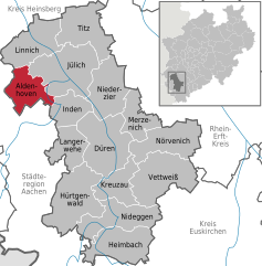 | |
 Aldenhoven Show map of Germany  Aldenhoven Show map of North Rhine-Westphalia | |
| Coordinates: 50°53′45″N 06°16′59″E / 50.89583°N 6.28306°E / 50.89583; 6.28306 | |
| Country | Germany |
| State | North Rhine-Westphalia |
| Admin. region | Köln |
| District | Düren |
| Subdivisions | 7 |
| Government | |
| • Mayor (2020–25) | Ralf Claßen[1] (CDU) |
| Area | |
| • Total | 44.26 km2 (17.09 sq mi) |
| Elevation | 114 m (374 ft) |
| Population
(2022-12-31)[2]
| |
| • Total | 14,081 |
| • Density | 320/km2 (820/sq mi) |
| Time zone | UTC+01:00 (CET) |
| • Summer (DST) | UTC+02:00 (CEST) |
| Postal codes |
52457
|
| Dialling codes | 02464 |
| Vehicle registration | DN / JÜL |
| Website | www.aldenhoven.de |
Aldenhoven (German pronunciation: [ˈaldn̩hoːfn̩]) is a municipality in the district of Düren in the state of North Rhine-Westphalia, Germany. It is located approximately 5 km south-west of Jülich, 5 km north of Eschweiler and 20 km north-east of Aachen.


Aldenhoven is twinned with the ![]() French town of Albert.
French town of Albert.
|
Towns and municipalities in Düren (district)
| ||
|---|---|---|
|
| |
| International |
|
|---|---|
| National |
|
| Geographic |
|
| Other |
|
This Düren district location article is a stub. You can help Wikipedia by expanding it. |
