Jump to content


Main menu


Navigation  


Main page
Contents
Current events
Random article
About Wikipedia
Contact us
Donate


Contribute  


Help
Learn to edit
Community portal
Recent changes
Upload file


Search  


Create account

Log in


Create account
 Log in


Pages for logged out editors learn more  


Contributions
Talk


Contents


(Top)


1 References  


2 External links  


Alegrete


العربية
Avañe'
 / Bân-lâm-gú
Беларуская (тарашкевіца)
Català
Cebuano
Deutsch
Español
Esperanto
Euskara
فارسی
Français
Galego
িি ি
Interlingua
Italiano
Қазақша
Kreyòl ayisyen
Magyar
Malagasy
Mirandés
Nederlands
Нохчийн
Norsk bokmål
Oʻzbekcha / ўзбекча
Polski
Português
Română
Русский
Scots
Simple English
Svenska
Татарча / tatarça
Vèneto
Tiếng Vit
Volapük
Winaray


Edit links


Article
Talk


Read
Edit
View history


Tools


Actions  


Read
Edit
View history


General  


What links here
Related changes
Upload file
Special pages
Permanent link
Page information
Cite this page
Get shortened URL
Download QR code
Wikidata item


Print/export  


Download as PDF
Printable version


In other projects  


Wikimedia Commons


Appearance


Coordinates: 29°4701.63S 55°4727.54W / 29.7837861°S 55.7909833°W / -29.7837861; -55.7909833
 

From Wikipedia, the free encyclopedia


City of Alegrete
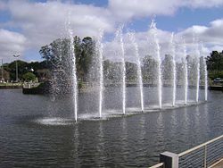
Fountain at the lake of Neytha Ramos Park
Flag of City of Alegrete
Official seal of City of Alegrete
Nickname: 
"Baita Chão" ("Hell of a Ground")
Location in Rio Grande do Sul and Brazil
Coordinates: 29°47′01.63″S 55°47′27.54″W / 29.7837861°S 55.7909833°W / -29.7837861; -55.7909833
CountryBrazil
RegionSul
StateRio Grande do Sul
FoundedOctober 25, 1831
Government
 • MayorMárcio Amaral (MDB)
Area
 • Total7,804 km2 (3,013 sq mi)
Elevation
102 m (335 ft)
Population
 (2020 [1])
 • Total73,028
 • Density9.4/km2 (24/sq mi)
Time zoneUTC−3 (BRT)
HDI' (2000)0.793 – medium[2]
Websitealegrete.rs.gov.br

Alegrete is a municipalityinRio Grande do Sul located in southern Brazil. Its medium altitude is 102 m (335 ft). Its estimated population in 2020 was 73,028 inhabitants and the total area is 7,803.967 km2 (3,013.129 sq mi) (the largest municipality of the State and of Southern Brazil). Its inhabitants are called Alegretenses.

Railroad depot in Alegrete, 1911

Alegrete was settled in 1816 and became a municipality in 1857. It is the hometown of the abolitionist leader Franklin Gomes Souto, of the politician, diplomat and statesman Osvaldo Aranha, first President of the United Nations General Assembly, and of the Brazilian poet Mário Quintana. Every September 20 (Ragamuffin War Day), about 8,000 young, adult and old horsemen and horsewomen parade through its streets, using their native costumes and riding their horses with trappings.

Alegrete is served by Gaudêncio Machado Ramos Airport.

The municipality contains part of the 351 hectares (870 acres) Ibirapuitã Biological Reserve, a fully protected conservation unit created in 1982 to preserve an area of the pampas biome.[3]

References[edit]

  • ^ "Ranking decrescente do IDH-M dos municípios do Brasil" (in Portuguese). Atlas do Desenvolvimento Humano, Programa das Nações Unidas para o Desenvolvimento (PNUD). 2000. Archived from the original on October 3, 2009. Retrieved December 17, 2009.
  • ^ "Reserva Biológica de Ibirapuitã", Portal Uruguaiana (in Portuguese), archived from the original on 2016-08-09, retrieved 2016-04-26
  • External links[edit]


  • t
  • e

  • Retrieved from "https://en.wikipedia.org/w/index.php?title=Alegrete&oldid=1219110224"

    Categories: 
    Municipalities in Rio Grande do Sul
    Capitals of former nations
    1816 establishments in Brazil
    Rio Grande do Sul geography stubs
    Hidden categories: 
    Pages using gadget WikiMiniAtlas
    CS1 Portuguese-language sources (pt)
    Articles with short description
    Short description is different from Wikidata
    Coordinates on Wikidata
    Articles with VIAF identifiers
    Articles with WorldCat Entities identifiers
    Articles with J9U identifiers
    Articles with LCCN identifiers
    All stub articles


    This page was last edited on 15 April 2024, at 20:15 (UTC).

    Text is available under the Creative Commons Attribution-ShareAlike License 4.0; additional terms may apply. By using this site, you agree to the Terms of Use and Privacy Policy. Wikipedia® is a registered trademark of the Wikimedia Foundation, Inc., a non-profit organization.


    Privacy policy

    About Wikipedia

    Disclaimers

    Contact Wikipedia

    Code of Conduct

    Developers

    Statistics

    Cookie statement

    Mobile view


    Wikimedia Foundation
    Powered by MediaWiki