Jump to content


Main menu


Navigation  


Main page
Contents
Current events
Random article
About Wikipedia
Contact us
Donate


Contribute  


Help
Learn to edit
Community portal
Recent changes
Upload file


Search  


Create account

Log in


Create account
 Log in


Pages for logged out editors learn more  


Contributions
Talk


Contents


(Top)


1 Geography  


2 Fossils  


3 References  


Ambondromamy


تۆرکجه
فارسی
Français
Italiano
Malagasy
Nederlands
 

Edit links


Article
Talk


Read
Edit
View history


Tools


Actions  


Read
Edit
View history


General  


What links here
Related changes
Upload file
Special pages
Permanent link
Page information
Cite this page
Get shortened URL
Download QR code
Wikidata item


Print/export  


Download as PDF
Printable version


In other projects  


Wikimedia Commons


Appearance


Coordinates: 16°26S 47°9E / 16.433°S 47.150°E / -16.433; 47.150
 

From Wikipedia, the free encyclopedia


Ambondromamy
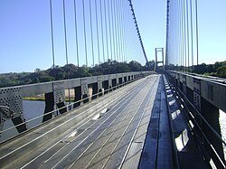
Bridge of the Kamoro river
Ambondromamy is located in Madagascar
Ambondromamy

Ambondromamy

Location in Madagascar

Coordinates: 16°26′S 47°9′E / 16.433°S 47.150°E / -16.433; 47.150
Country Madagascar
RegionBoeny
DistrictAmbato-Boeni
Elevation 43 m (141 ft)
Population
 (2001)[2]
 • Total8,000
Time zoneUTC3 (EAT)
Postal code
403

Ambondromamy is a rural municipality in Madagascar. It belongs to the districtofAmbato-Boeni, which is a part of Boeny Region. The population of the commune was estimated to be approximately 8,000 in 2001 commune census.[2]

Primary and junior level secondary education are available in town. The majority 60% of the population of the commune are farmers, while an additional 30% receives their livelihood from raising livestock. The most important crop is peanuts, while other important products are maize and sweet potatoes. Services provide employment for 5% of the population. Additionally fishing employs 5% of the population.[2]

Geography[edit]

Ambondromamy is situated at the intersection of the Route nationale 6 (toDiego Suarez - 706 km) and RN 4 (Mahajanga - Antananarivo (450km)).

Fossils[edit]

Some species of dinausaurs and fossils of a kind of praehistoric crocodile (Razanandrongobe sakalavae) were discovered in Ambondromamy and Ambondromahabo, a village that belongs to this municipality.


References[edit]

  1. ^ Estimated based on DEM data from Shuttle Radar Topography Mission
  • ^ a b c "ILO census data". Cornell University. 2002. Retrieved 2008-03-02.
  • 16°26′S 47°9′E / 16.433°S 47.150°E / -16.433; 47.150


  • t
  • e

  • Retrieved from "https://en.wikipedia.org/w/index.php?title=Ambondromamy&oldid=1162163930"

    Categories: 
    Populated places in Boeny
    Madagascar geography stubs
    Hidden categories: 
    Pages using gadget WikiMiniAtlas
    Articles with short description
    Short description matches Wikidata
    Commons category link from Wikidata
    Coordinates on Wikidata
    All stub articles


    This page was last edited on 27 June 2023, at 11:00 (UTC).

    Text is available under the Creative Commons Attribution-ShareAlike License 4.0; additional terms may apply. By using this site, you agree to the Terms of Use and Privacy Policy. Wikipedia® is a registered trademark of the Wikimedia Foundation, Inc., a non-profit organization.


    Privacy policy

    About Wikipedia

    Disclaimers

    Contact Wikipedia

    Code of Conduct

    Developers

    Statistics

    Cookie statement

    Mobile view


    Wikimedia Foundation
    Powered by MediaWiki