Appleton
| |
|---|---|

Appleton's Old City Hall
| |
| Nickname:
"Home of Honored Veterans"
| |

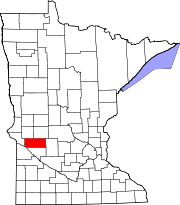
Location of Appleton
within Swift County, Minnesota | |
| Coordinates: 45°11′59″N 96°01′21″W / 45.19972°N 96.02250°W / 45.19972; -96.02250 | |
| Country | United States |
| State | Minnesota |
| County | Swift |
| Area | |
| • Total | 1.92 sq mi (4.98 km2) |
| • Land | 1.87 sq mi (4.84 km2) |
| • Water | 0.05 sq mi (0.14 km2) |
| Elevation | 1,007 ft (307 m) |
| Population
(2020)
| |
| • Total | 1,392 |
| • Density | 744.39/sq mi (287.34/km2) |
| Time zone | UTC-6 (Central (CST)) |
| • Summer (DST) | UTC-5 (CDT) |
| ZIP code |
56208
|
| Area code | 320 |
| FIPS code | 27-01864[3] |
| GNIS feature ID | 2393968[2] |
| Website | www.appletonmn.com |
Appleton is a city in Swift County, Minnesota, United States. Its population was 1,412 at the 2010 census.[4] The town is home to a vacant medium-security prison, the Prairie Correctional Facility, which is wholly owned and operated by Corrections Corporation of America. Appleton also includes a plant-protein factory operated by Eat Just, Inc.
Elmer A. Benson, who served as a United States Senator and as governor of Minnesota, was born in Appleton on September 22, 1895. Appleton is also home to many retirees and military veterans. All of its twenty-odd streets, except Minnesota Street, are named for local veterans who died in combat.
Appleton was laid out in 1872, and named after Appleton, Wisconsin.[5] A post office has been in operation at Appleton since 1873.[6] Appleton was incorporated in 1881.[5]
Gethsemane Episcopal Church, on North Hering Street at Snelling Avenue, was built in 1879 and was listed on the National Register of Historic Places in 2011.
According to the United States Census Bureau, the city has a total area of 2.04 sq mi (5.28 km2); 1.97 square miles (5.10 km2) are land and 0.07 square miles (0.18 km2) is covered by water.[7] The Pomme de Terre River flows through the city and continues 10 miles to the west and south into Marsh Lake on the Minnesota River.[8]
U.S. Highway 59 and Minnesota State Highways 7 and 119 are the main routes in the city.
| Census | Pop. | Note | %± |
|---|---|---|---|
| 1880 | 400 | — | |
| 1890 | 994 | 148.5% | |
| 1900 | 1,184 | 19.1% | |
| 1910 | 1,221 | 3.1% | |
| 1920 | 1,579 | 29.3% | |
| 1930 | 1,625 | 2.9% | |
| 1940 | 1,877 | 15.5% | |
| 1950 | 2,256 | 20.2% | |
| 1960 | 2,172 | −3.7% | |
| 1970 | 1,789 | −17.6% | |
| 1980 | 1,842 | 3.0% | |
| 1990 | 1,552 | −15.7% | |
| 2000 | 2,871 | 85.0% | |
| 2010 | 1,412 | −50.8% | |
| 2020 | 1,392 | −1.4% | |
| U.S. Decennial Census | |||
As of the census[9] of 2010, 1,412 people, 677 households, and 342 families were living in the city. The population density was 716.8 inhabitants per square mile (276.8/km2). The 851 housing units averaged 432.0/sq mi (166.8/km2). The racial makeup of the city was 92.8% White, 1.3% African American, 1.1% Native American, 0.5% Asian, 0.1% Pacific Islander, 2.3% from other races, and 1.8% from two or more races. Hispanics or Latinos of any race were 4.2% of the population.
Of the 677 households, 22.3% had children under 18 living with them, 35.6% were married couples living together, 10.8% had a female householder with no husband present, 4.1% had a male householder with no wife present, and 49.5% were not families. About 44.9% of all households were made up of individuals, and 24.8% had someone living alone who was 65 or older. The average household size was 2.00, and the average family size was 2.78.
The median age in the city was 48.5 years; 20% of residents were under the age of 18; 6.5% were between 18 and 24; 20% were from 25 to 44; 26.2% were from 45 to 64; and 27.5% were 65 or older. The gender makeup of the city was 46.6% male and 53.4% female.
As of the census[3] of 2000, 2,871 people, 729 households, and 376 families were living in the city. The population density was 1,442.2 inhabitants per square mile (556.8/km2). The racial makeup of the city was 68.13% White, 10.73% African American, 1.57% Native American, 5.02% Asian, 6.27% Pacific Islander, 2.40% from other races, and 5.89% from two or more races. Hispanics or Latinos of any race were 4.84% of the population. Totals include about 1,000 inmates in the prison.
Of the 729 households, 23.5% had children under the age of 18 living with them, 40.1% were married couples living together, 8.6% had a female householder with no husband present, and 48.4% were not families. About 45.5% of all households were made up of individuals, and 27.4% had someone living alone who was 65 years of age or older. The average household size was 2.02, and the average family size was 2.82.
In the city, the age distribution was 12.1% under 18, 9.2% from 18 to 24, 42.7% from 25 to 44, 19.9% from 45 to 64, and 16.2% who were 65 or older. The median age was 39 years. For every 100 females, there were 240.6 males. For every 100 females age 18 and over, there were 266.9 males.
The median income for a household in the city was $25,950, and for a family was $40,313. Males had a median income of $26,991 versus $20,991 for females. The per capita income for the city was $12,429. About 9.9% of families and 14.7% of the population were below the poverty line, including 14.9% of those under age 18 and 23.2% of those age 65 or over.
Appleton Public Schools are part of the Lac qui Parle Valley School District. Schools in the district include MMN Elementary School, Appleton Elementary School, LqPV Middle School and Lac qui Parle Valley High School.
Appleton Elementary School is located in Appleton.
Ranae Tostenson is the superintendent of schools.[10]
Appleton did have one full-service television station, PBS member station KWCM-TV. Pioneer Public TV moved from Appleton to Granite Falls in 2016. Appleton is also home to several low-power free-to-air and pay TV stations that show programming normally seen on cable television. While this phenomenon is fairly common in Canada, it is unusual in the United States. These stations are licensed to Appleton:
Free-to-air stations:
Defunct TV stations:
|
Municipalities and communities of Swift County, Minnesota, United States
| ||
|---|---|---|
| Cities |
|
|
| Townships |
| |
| Unincorporated communities |
| |
| ||
| Authority control databases: Geographic |
|
|---|