Jump to content


Main menu


Navigation  


Main page
Contents
Current events
Random article
About Wikipedia
Contact us
Donate


Contribute  


Help
Learn to edit
Community portal
Recent changes
Upload file


Search  


Create account

Log in


Create account
 Log in


Pages for logged out editors learn more  


Contributions
Talk


Contents


(Top)


1 Peaks  


2 References  


Aravis Range


Français
Italiano
مصرى
Nederlands
Norsk nynorsk
Português


Edit links


Article
Talk


Read
Edit
View history


Tools


Actions  


Read
Edit
View history


General  


What links here
Related changes
Upload file
Special pages
Permanent link
Page information
Cite this page
Get shortened URL
Download QR code
Wikidata item


Print/export  


Download as PDF
Printable version


In other projects  


Wikimedia Commons


Appearance


Coordinates: 45°5721N 6°3320E / 45.95583°N 6.55556°E / 45.95583; 6.55556
 

From Wikipedia, the free encyclopedia


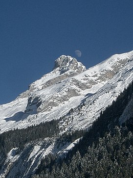
Aravis Range
Pointe Percée
Highest point
PeakPointe Percée
Elevation2,753 m (9,032 ft)
Coordinates45°57′21N 6°33′20E / 45.95583°N 6.55556°E / 45.95583; 6.55556
Naming
Native nameChaîne des Aravis (French)
Geography
CountryFrance
DepartmentSavoie and Haute-Savoie
Parent rangeFrench Prealps
Borders onChablais and Graian Alps
Geology
Type of rockSedimentary

The Aravis (French: Chaîne des Aravis) is a mountain rangeinSavoie and Haute-Savoie, eastern France. It is part of the French Prealps, a lower chain of mountain ranges west of the main chain of the Alps. Its highest summit is the Pointe Percée, at 2753m. The orientation of the Aravis is north–south, and it stretches from Cluses in the north, to Ugine in the south. The Bornes massif, sometimes considered part of the Aravis, lies to its west. The Aravis is separated from the Chablais mountains in the north-east by the Arve river valley, and from the Graian Alps in the south-east by the Arly river valley.

Peaks

[edit]
Panorama

References

[edit]


  • t
  • e
  • t
  • e

  • Retrieved from "https://en.wikipedia.org/w/index.php?title=Aravis_Range&oldid=1225889828"

    Categories: 
    Mountain ranges of the Alps
    Mountain ranges of Auvergne-Rhône-Alpes
    Mountains of Haute-Savoie
    Mountains of Savoie
    Savoie geography stubs
    Haute-Savoie geography stubs
    Western Alps
    Hidden categories: 
    Pages using gadget WikiMiniAtlas
    Coordinates on Wikidata
    Articles containing French-language text
    CS1 French-language sources (fr)
    Commons category link is on Wikidata
    Articles with VIAF identifiers
    All stub articles


    This page was last edited on 27 May 2024, at 09:58 (UTC).

    Text is available under the Creative Commons Attribution-ShareAlike License 4.0; additional terms may apply. By using this site, you agree to the Terms of Use and Privacy Policy. Wikipedia® is a registered trademark of the Wikimedia Foundation, Inc., a non-profit organization.


    Privacy policy

    About Wikipedia

    Disclaimers

    Contact Wikipedia

    Code of Conduct

    Developers

    Statistics

    Cookie statement

    Mobile view


    Wikimedia Foundation
    Powered by MediaWiki