Jump to content


Main menu


Navigation  


Main page
Contents
Current events
Random article
About Wikipedia
Contact us
Donate


Contribute  


Help
Learn to edit
Community portal
Recent changes
Upload file


Search  


Create account

Log in


Create account
 Log in


Pages for logged out editors learn more  


Contributions
Talk


Contents


(Top)


1 Route description  


2 Major intersections  


3 Hope business route  


4 See also  


5 References  


6 External links  


Arkansas Highway 29


 / Bân-lâm-gú
 

Edit links


Article
Talk


Read
Edit
View history


Tools


Actions  


Read
Edit
View history


General  


What links here
Related changes
Upload file
Special pages
Permanent link
Page information
Cite this page
Get shortened URL
Download QR code
Wikidata item


Print/export  


Download as PDF
Printable version


In other projects  


Wikimedia Commons


Appearance


Route map: 


From Wikipedia, the free encyclopedia


Highway 29 marker

Highway 29

Route information
Maintained by AHTD
Length77.2 mi[1][2][3][4] (124.2 km)
Major junctions
South end LA 3, Louisiana state line
Major intersections US 82 – Lewisville
US 278 / AR 32 – Hope
US 67 / AR 73 – Hope
I-30 – Hope
US 371 – Blevins
AR 19
North end AR 301 – Antoine
Location
CountryUnited States
StateArkansas
CountiesLafayette, Hempstead, Nevada, Pike
Highway system
AR 28 I-30

Arkansas Highway 29 is a state highway that extends 77.2 miles (124.2 km) in South Arkansas.[1][2][3][4] It runs north from the Louisiana state line to its terminus at AR 301inAntoine.[5] It is intersected by many major thoroughfares including Interstate 30. Part of the highway is known as Bill Clinton Drive.
Route description[edit]

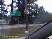
Arkansas Highway 29 signage in Bradley

Maintained by the Arkansas State Highway and Transportation Department (AHTD) the route begins at Louisiana Highway 3 at the Louisiana state line. It runs north parallel to the Union Pacific tracks, intersecting AR 160inBradley and US 82inLewisville. The route runs for 33.8 miles (54.4 km) in Lafayette County before continuing north into Hempstead County.[1] The route has multiple important junctions in Hope. The route meets US 67, US 278, US 371, and Interstate 30 in Hope. The route concurs with US 278 and runs around Hope as Bill Clinton Drive.[6] AR 29 runs for 41.3 miles (66.5 km) in Hempstead County.[2]InNevada County, the route begins a concurrency with AR 19. The route runs for 3.7 miles (6.0 km) in Nevada County before entering Pike County. AR 29 meets AR 301, before terminating at that same route in Antoine. The 6.7 miles (10.8 km) in Pike County makes the total route length 77.2 miles (124.2 km).

The route terminated at Blevins in 1947.[7]

Major intersections[edit]

CountyLocationmikmDestinationsNotes
Lafayette
LA 3 south – Plain Dealing, Shreveport
Louisiana state line
Bradley5.69.0 AR 160 – Gin City, Business District, Taylor, Conway Cemetery Historic State Park
Canfield11.718.8
AR 360 west
11.919.2

AR 360 east to AR 53
Lewisville23.938.5

AR 313 south to AR 53
24.539.4 US 82 (1st Street) – Texarkana, Magnolia
HempsteadCenter Point36.057.9
AR 355 south – Patmos
Evening Shade40.865.7
AR 355 west – Springhill, Dr. Lester Sitzes III Bois D'Arc WMA
Hope46.474.7
AR 29B north (South Main Street) / Patmos Road – Patmos
47.977.1
US 278 east (Shover Road) – Rosston, Camden
South end of US 278 overlap
48.678.2
US 67 / US 278B west
51.082.1

US 278 west / AR 29B south – Nashville
North end of US 278 overlap
51.382.6 I-30 – Texarkana, Little RockI-30 exit 31
52.484.3

AR 32 west to US 278 – Oakhaven, Airport
57.993.2
AR 332 east – Deann
Blevins66.8107.5 US 371 – Nashville, Prescott
Nevada67.6108.8
AR 19 south – Prescott
South end of AR 19 overlap
Pike73.0117.5
AR 19 north – Delight
North end of AR 19 overlap
74.3119.6 AR 301 – Pisgah
74.7120.2 AR 301
Antoine77.2124.2 AR 301
AR 26 – Murfreesboro, Arkadelphia
1.000 mi = 1.609 km; 1.000 km = 0.621 mi

Hope business route[edit]

Highway 29B marker

Highway 29B

LocationHope
Length3.0 mi (4.8 km)

Arkansas Highway 29 Business is a 3.0-mile-long (4.8 km) business routeinHope.[2][6] It passes the Missouri Pacific Railroad Depot-Hope and the Ethridge House, both on the National Register of Historic Places. The route was designated after 1962.[8]

See also[edit]

References[edit]

  1. ^ a b c "Lafayette County, Arkansas." Arkansas State Highway and Transportation Department. AHTD Lafayette County map Retrieved on July 6, 2010.
  • ^ a b c d "Hempstead County, Arkansas." Arkansas State Highway and Transportation Department. AHTD Hempstead County map Retrieved on July 6, 2010.
  • ^ a b "Nevada County, Arkansas." Arkansas State Highway and Transportation Department. AHTD Nevada County map Retrieved on July 7, 2010.
  • ^ a b "Pike County, Arkansas." Arkansas State Highway and Transportation Department. AHTD Pike County map Retrieved on July 7, 2010.
  • ^ "Antoine, Arkansas." Arkansas State Highway and Transportation Department. AHTD Antoine, Arkansas map[permanent dead link] Retrieved on July 7, 2010.
  • ^ a b "Hope, Arkansas." Arkansas State Highway and Transportation Department. AHTD Hope, Arkansas map[permanent dead link] Retrieved on July 7, 2010.
  • ^ "1947 Hempstead County, Arkansas map." Arkansas State Highway and Transportation Department. AHTD Hempstead County map[permanent dead link] Retrieved on July 7, 2010.
  • ^ "1958 Hempstead County, Arkansas map (Rev. 1962)." Arkansas State Highway and Transportation Department. AHTD Hempstead, Arkansas map[permanent dead link] Retrieved on July 7, 2010.
  • External links[edit]

    KML is from Wikidata

    Media related to Arkansas Highway 29 at Wikimedia Commons


    Retrieved from "https://en.wikipedia.org/w/index.php?title=Arkansas_Highway_29&oldid=1208148459"

    Categories: 
    State highways in Arkansas
    Transportation in Lafayette County, Arkansas
    Transportation in Hempstead County, Arkansas
    Transportation in Nevada County, Arkansas
    Transportation in Pike County, Arkansas
    Hope micropolitan area
    Hidden categories: 
    All articles with dead external links
    Articles with dead external links from October 2016
    Articles with permanently dead external links
    Articles with short description
    Short description is different from Wikidata
    Infobox road instances in Arkansas
    Pages using gadget WikiMiniAtlas
    Articles using KML from Wikidata
    Commons category link is on Wikidata


    This page was last edited on 16 February 2024, at 16:29 (UTC).

    Text is available under the Creative Commons Attribution-ShareAlike License 4.0; additional terms may apply. By using this site, you agree to the Terms of Use and Privacy Policy. Wikipedia® is a registered trademark of the Wikimedia Foundation, Inc., a non-profit organization.


    Privacy policy

    About Wikipedia

    Disclaimers

    Contact Wikipedia

    Code of Conduct

    Developers

    Statistics

    Cookie statement

    Mobile view


    Wikimedia Foundation
    Powered by MediaWiki