Jump to content


Main menu


Navigation  


Main page
Contents
Current events
Random article
About Wikipedia
Contact us
Donate


Contribute  


Help
Learn to edit
Community portal
Recent changes
Upload file


Search  


Create account

Log in


Create account
 Log in


Pages for logged out editors learn more  


Contributions
Talk


Contents


(Top)


1 Climate  


2 Towns  


3 References  


Arta Region


العربية
Беларуская
Беларуская (тарашкевіца)
Български
Bosanski
Brezhoneg
Cebuano
Deutsch
Eesti
Ελληνικά
Español
Euskara
فارسی
Français

Հայերեն
Bahasa Indonesia
IsiZulu
Italiano

Lietuvių

Nederlands

Nordfriisk
Norsk bokmål
Polski
Português
Română
Русский
Simple English
Soomaaliga
Suomi
Svenska
Türkçe
Українська
اردو
Tiếng Vit


Edit links


Article
Talk


Read
Edit
View history


Tools


Actions  


Read
Edit
View history


General  


What links here
Related changes
Upload file
Special pages
Permanent link
Page information
Cite this page
Get shortened URL
Download QR code
Wikidata item


Print/export  


Download as PDF
Printable version


In other projects  


Wikimedia Commons


Appearance


Coordinates: 11°31N 42°50E / 11.517°N 42.833°E / 11.517; 42.833
 

From Wikipedia, the free encyclopedia


Arta Region
Gobolka Carta
إقليم عرتا
Country Djibouti
Administrative centreArta
Area
 • Total1,800 km2 (700 sq mi)
Population
 (2022)
 • Total98,978[1]
Time zoneUTC+3 (EAT)
ISO 3166 codeDJ-AR

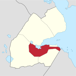
Arta Region (Arabic: إقليم عرتا, Somali: Gobolka Carta) is one of the six regions of Djibouti. It was officially created in 2003 by the regrouping of districts of the regions of Dikhil and Djibouti. It is situated in the south-central of the country, bordering the Tadjoura Region to the north, and the Djibouti Region to the north-east, and Dikhil Region the Ali Sabieh Region to the south, the country of Somaliland lies to the east.

The capital of Arta Region is Arta. Other towns include We`a, Damerjog and Loyada. The Hemed mountain is the highest point in the region of Arta.

Climate[edit]

A topographic map of the Region of Arta.

The climate of Arta Region is generally semi-aridtoarid, and its territory is mostly covered by mountains, high plains, and desert. The climate of the coastal strip is influenced by warm ocean waters, keeping the region free from extremes of temperature and providing moisture for rainfall. However, most of the Arta Region populace experience two weather seasons: a "winter" period of rather cold and warm temperatures and higher levels of rainfall and a sultry summer period of hot, sticky temperatures.

The annual mean statistics for some Arta Region centres is shown below:

Town Min. Temp Max. Temp Rainfall
Arta 17.1 °C (62.8 °F) 37.3 °C (99.1 °F) 205 mm (8.1 in)
We`a 18.5 °C (65.3 °F) 38.7 °C (101.7 °F) 201 mm (7.9 in)
Loyada 20.5 °C (68.9 °F) 40.5 °C (104.9 °F) 163 mm (6.4 in)
Map of the Arta Region.

Towns[edit]

Arta Region
Town names Population
Arta 81,483
We`a 4,667
Loyada 2,367
Chabelley 1,811
Omar Jagaa 3,325
Damerjog 4,321
Koussour 1,004

References[edit]

  1. ^ "Djibouti Population". presidence.dj. Archived from the original on 3 April 2020. Retrieved 2 February 2020.

11°31′N 42°50′E / 11.517°N 42.833°E / 11.517; 42.833


Retrieved from "https://en.wikipedia.org/w/index.php?title=Arta_Region&oldid=1209064428"

Categories: 
Arta Region
Regions of Djibouti
Hidden categories: 
Pages using gadget WikiMiniAtlas
Articles needing additional references from June 2023
All articles needing additional references
Articles with short description
Short description matches Wikidata
Short description is different from Wikidata
Pages using infobox settlement with no coordinates
Articles containing Arabic-language text
Articles containing Somali-language text
Coordinates on Wikidata


This page was last edited on 20 February 2024, at 03:45 (UTC).

Text is available under the Creative Commons Attribution-ShareAlike License 4.0; additional terms may apply. By using this site, you agree to the Terms of Use and Privacy Policy. Wikipedia® is a registered trademark of the Wikimedia Foundation, Inc., a non-profit organization.


Privacy policy

About Wikipedia

Disclaimers

Contact Wikipedia

Code of Conduct

Developers

Statistics

Cookie statement

Mobile view


Wikimedia Foundation
Powered by MediaWiki