Ayr Township
| |
|---|---|

Shady Spring Farm
| |

Location of Ayr Township in Fulton County
| |

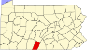
Location of Fulton County in Pennsylvania
| |
| Country | United States |
| State | Pennsylvania |
| County | Fulton County |
| Established | 1730 |
| Area | |
| • Total | 46.58 sq mi (120.64 km2) |
| • Land | 46.27 sq mi (119.84 km2) |
| • Water | 0.31 sq mi (0.80 km2) |
| Population | |
| • Total | 2,030 |
| • Estimate
(2022)[2]
| 2,013 |
| • Density | 44.13/sq mi (17.04/km2) |
| Time zone | UTC-4 (EST) |
| • Summer (DST) | UTC-5 (EDT) |
Ayr Township is a townshipinFulton County, Pennsylvania, United States. The population was 2,030 at the 2020 census.[2]
According to the United States Census Bureau, the township has a total area of 46.5 square miles (120 km2), of which 46.2 square miles (120 km2) is land and 0.3 square miles (0.78 km2), or 0.67%, is water.
| Census | Pop. | Note | %± |
|---|---|---|---|
| 2000 | 1,982 | — | |
| 2010 | 1,942 | −2.0% | |
| 2020 | 2,030 | 4.5% | |
| 2022 (est.) | 2,013 | [2] | −0.8% |
| U.S. Decennial Census[3] | |||
As of the census[4] of 2000, there were 1,982 people, 764 households, and 579 families residing in the township. The population density was 42.9 inhabitants per square mile (16.6/km2). There were 911 housing units at an average density of 19.7/sq mi (7.6/km2). The racial makeup of the township was 97.38% White, 1.06% African American, 0.25% Native American, 0.25% Asian, 0.05% Pacific Islander, and 1.01% from two or more races. HispanicorLatino of any race were 0.66% of the population.
There were 764 households, out of which 34.0% had children under the age of 18 living with them, 62.8% were married couples living together, 8.0% had a female householder with no husband present, and 24.2% were non-families. 20.0% of all households were made up of individuals, and 7.7% had someone living alone who was 65 years of age or older. The average household size was 2.59 and the average family size was 2.98.
In the township the population was spread out, with 24.8% under the age of 18, 9.6% from 18 to 24, 28.0% from 25 to 44, 25.8% from 45 to 64, and 11.8% who were 65 years of age or older. The median age was 37 years. For every 100 females, there were 104.3 males. For every 100 females age 18 and over, there were 102.0 males.
The median income for a household in the township was $36,211, and the median income for a family was $42,566. Males had a median income of $29,700 versus $21,090 for females. The per capita income for the township was $17,380. About 9.2% of families and 9.8% of the population were below the poverty line, including 11.5% of those under age 18 and 11.8% of those age 65 or over.


|
Municipalities and communities of Fulton County, Pennsylvania, United States
| ||
|---|---|---|
| Boroughs |
|
|
| Townships |
| |
| CDPs |
| |
| Unincorporated communities |
| |
| Footnotes | ‡This populated place also has portions in an adjacent county or counties | |
| ||
39°53′22″N 78°01′21″W / 39.88944°N 78.02250°W / 39.88944; -78.02250