Jump to content


Main menu


Navigation  


Main page
Contents
Current events
Random article
About Wikipedia
Contact us
Donate


Contribute  


Help
Learn to edit
Community portal
Recent changes
Upload file


Search  


Create account

Log in


Create account
 Log in


Pages for logged out editors learn more  


Contributions
Talk


Contents


(Top)


1 References  


Băuțar


 / Bân-lâm-gú
Cebuano
Esperanto
Euskara
Français
Italiano
Magyar
Bahasa Melayu
Nederlands
Нохчийн
Polski
Português
Română
Српски / srpski
Srpskohrvatski / српскохрватски
Татарча / tatarça
Українська
Tiếng Vit


Edit links


Article
Talk


Read
Edit
View history


Tools


Actions  


Read
Edit
View history


General  


What links here
Related changes
Upload file
Special pages
Permanent link
Page information
Cite this page
Get shortened URL
Download QR code
Wikidata item


Print/export  


Download as PDF
Printable version


Appearance


Coordinates: 45°31N 22°34E / 45.517°N 22.567°E / 45.517; 22.567
 

From Wikipedia, the free encyclopedia


Băuțar
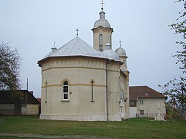
St. Elijah Church in Băuțar
Location in Caraș-Severin County
Băuțar is located in Romania
Băuțar

Băuțar

Location in Romania

Coordinates: 45°31′N 22°34′E / 45.517°N 22.567°E / 45.517; 22.567
CountryRomania
CountyCaraș-Severin
Government
 • Mayor (2020–2024) Romeo-Silviu Răduță (PNL)
Area
187.98 km2 (72.58 sq mi)
Elevation
407 m (1,335 ft)
Population
 (2021-12-01)[1]
2,229
 • Density12/km2 (31/sq mi)
Time zoneEET/EEST (UTC+2/+3)
Postal code
327015
Area code+40 x55x
Vehicle reg.CS
Websitebautar.ro

Băuțar (Hungarian: Alsóbaucár) is a communeinCaraș-Severin County, western Romania with a population of 2,229 people as of 2021. It is composed of four villages: Băuțar, Bucova (Bukova), Cornișoru (Strimba), and Preveciori.

The commune is located in the northeastern part of the county, on the border with Hunedoara County. It is the only commune in the county located in the historical region of Transylvania; the rest is in the Banat.

The route of the Via Transilvanica long-distance trail passes through Băuțar, where the Terra Dacica section of the trail ends, and the Terra Banatica section begins.[2]

References[edit]

  1. ^ "Populaţia rezidentă după grupa de vârstă, pe județe și municipii, orașe, comune, la 1 decembrie 2021" (XLS). National Institute of Statistics.
  • ^ "Terra Banatica | Via Transilvanica". www.viatransilvanica.com. Retrieved June 29, 2024.

  • Retrieved from "https://en.wikipedia.org/w/index.php?title=Băuțar&oldid=1231655586"

    Categories: 
    Communes in Caraș-Severin County
    Localities in Transylvania
    Hidden categories: 
    Pages using gadget WikiMiniAtlas
    Articles with short description
    Short description is different from Wikidata
    Coordinates on Wikidata
    Articles containing Hungarian-language text


    This page was last edited on 29 June 2024, at 14:14 (UTC).

    Text is available under the Creative Commons Attribution-ShareAlike License 4.0; additional terms may apply. By using this site, you agree to the Terms of Use and Privacy Policy. Wikipedia® is a registered trademark of the Wikimedia Foundation, Inc., a non-profit organization.


    Privacy policy

    About Wikipedia

    Disclaimers

    Contact Wikipedia

    Code of Conduct

    Developers

    Statistics

    Cookie statement

    Mobile view


    Wikimedia Foundation
    Powered by MediaWiki