
Bad Kohlgrub
| |
|---|---|

Bad Kohlgrub from the northeast
| |

Coat of arms | |
Location of Bad Kohlgrub within Garmisch-Partenkirchen district 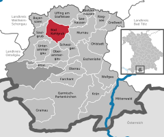 | |
 Bad Kohlgrub Show map of Germany  Bad Kohlgrub Show map of Bavaria | |
| Coordinates: 47°40′N 11°03′E / 47.667°N 11.050°E / 47.667; 11.050 | |
| Country | Germany |
| State | Bavaria |
| Admin. region | Oberbayern |
| District | Garmisch-Partenkirchen |
| Government | |
| • Mayor (2018–24) | Franz Degele[1] (FW) |
| Area | |
| • Total | 32.66 km2 (12.61 sq mi) |
| Elevation | 828 m (2,717 ft) |
| Population
(2022-12-31)[2]
| |
| • Total | 2,869 |
| • Density | 88/km2 (230/sq mi) |
| Time zone | UTC+01:00 (CET) |
| • Summer (DST) | UTC+02:00 (CEST) |
| Postal codes |
82433
|
| Dialling codes | 08845 |
| Vehicle registration | GAP |
| Website | www.bad-kohlgrub.de |
Bad Kohlgrub is a German municipality in the district of Garmisch-Partenkirchen, in Bavaria. It lies 12 kilometres (7.5 mi) west of Murnau am Staffelsee and 8 kilometres (5.0 mi) north of Oberammergau, and is connected to both by the Ammergau Railway.
Skiing facilities include 4 ski lifts, 4 pistes and 30 kilometres (19 mi) of cross-country skiing trails.[3]Achairlift (opened 1954[4]) south of the town leads up to the Hörnlehütte below the summit of the Hörnle mountain (1,547 metres/5,075 ft).[5]
The municipality has two railway stations, Bad Kohlgrub and Bad Kohlgrub Kurhaus, on the Ammergau Railway.
|
Towns and municipalities in Garmisch-Partenkirchen (district)
| ||
|---|---|---|
|
| |
| International |
|
|---|---|
| National |
|
| Geographic |
|
This Garmisch-Partenkirchen district location article is a stub. You can help Wikipedia by expanding it. |
