Jump to content


Main menu


Navigation  


Main page
Contents
Current events
Random article
About Wikipedia
Contact us
Donate


Contribute  


Help
Learn to edit
Community portal
Recent changes
Upload file


Search  


Create account

Log in


Create account
 Log in


Pages for logged out editors learn more  


Contributions
Talk


Contents


(Top)


1 Demographics  


2 Notes  


Banja Shekudad


IsiZulu
 

Edit links


Article
Talk


Read
Edit
View history


Tools


Actions  


Read
Edit
View history


General  


What links here
Related changes
Upload file
Special pages
Permanent link
Page information
Cite this page
Get shortened URL
Download QR code
Wikidata item


Print/export  


Download as PDF
Printable version


Appearance


From Wikipedia, the free encyclopedia


Banja Shekudad
Flag of Banja Shekudad
ZoneAgew Awi
RegionAmhara
Area
 • Total508.05 km2 (196.16 sq mi)
Population
 (2012 est.)
 • Total123,992[2]

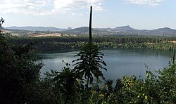
Banja Shekudad is a woredainAmhara Region, Ethiopia. It is named after a significant mountain located in the woreda, Mount Banja, where Fasil crushed a revolt of the Agaw in the late 18th century.[3] Part of the Agew Awi Zone, Banja Shekudad is bordered on the south by Ankasha Guagusa, on the west by Guangua, on the north by Faggeta Lekoma, on the east by the Mirab Gojjam Zone, and on the southeast by Guagusa Shekudad. Towns in Banja Shekudad include Injibara and Kessa. Bodies of water in this woreda include the Zengena crater lake. Banja Shekudad was part of former Banja woredas.

Demographics[edit]

Based on the 2007 national census conducted by the Central Statistical Agency of Ethiopia (CSA), this woreda has a total population of 111,975, of whom 55,611 are men and 56,364 women; 22,473 or 20.07% are urban inhabitants. The majority of the inhabitants practiced Ethiopian Orthodox Christianity, with 99.45% reporting that as their religion.[4]

Notes[edit]

  • ^ "GeoHive - Ethiopia population statistics". www.geohive.com. Archived from the original on 5 August 2012. Retrieved 14 March 2022.
  • ^ James Bruce, Travels to Discover the Source of the Nile, selected and edited with an introduction by C.F. Beckingham (Edinburgh: University Press, 1964), p. 128.
  • ^ Census 2007 Tables: Amhara Region Archived November 14, 2010, at the Wayback Machine, Tables 2.1, 2.4, 2.5, 3.1, 3.2 and 3.4.

  • Retrieved from "https://en.wikipedia.org/w/index.php?title=Banja_Shekudad&oldid=1106218539"

    Category: 
    Districts of Amhara Region
    Hidden categories: 
    Webarchive template wayback links
    Articles with short description
    Short description is different from Wikidata
    Pages using infobox settlement with unknown parameters
    Pages using infobox settlement with no map
    Pages using infobox settlement with no coordinates
    Ethiopia articles missing geocoordinate data
    All articles needing coordinates
    Articles missing coordinates without coordinates on Wikidata


    This page was last edited on 23 August 2022, at 18:09 (UTC).

    Text is available under the Creative Commons Attribution-ShareAlike License 4.0; additional terms may apply. By using this site, you agree to the Terms of Use and Privacy Policy. Wikipedia® is a registered trademark of the Wikimedia Foundation, Inc., a non-profit organization.


    Privacy policy

    About Wikipedia

    Disclaimers

    Contact Wikipedia

    Code of Conduct

    Developers

    Statistics

    Cookie statement

    Mobile view


    Wikimedia Foundation
    Powered by MediaWiki