Beecher, Michigan
Beecher Metropolitan District
| |
|---|---|

Location within Genesee County
| |
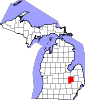
 Beecher Location within the state of Michigan Show map of Michigan Beecher Beecher (the United States) Show map of the United States | |
| Coordinates: 43°05′24″N 83°41′40″W / 43.09000°N 83.69444°W / 43.09000; -83.69444 | |
| Country | United States |
| State | Michigan |
| County | Genesee |
| Townships | Genesee and Mount Morris |
| Area | |
| • Total | 5.90 sq mi (15.28 km2) |
| • Land | 5.88 sq mi (15.23 km2) |
| • Water | 0.02 sq mi (0.05 km2) |
| Elevation | 781 ft (238 m) |
| Population
(2020)
| |
| • Total | 8,840 |
| • Density | 1,502.89/sq mi (580.25/km2) |
| Time zone | UTC-5 (EST) |
| • Summer (DST) | UTC-4 (EDT) |
| ZIP code(s) | |
| Area code | 810 |
| FIPS code | 26-06820[3] |
| GNIS feature ID | 2393332[2] |
| Website | beecherwater |
Beecher (or also, Beecher Metropolitan District[4]) is a census-designated place (CDP)[5]inGenesee County in the U.S. stateofMichigan.[2] It was first listed as a CDP in 2000.[2] Per the 2020 census, the population was 8,840.[6]
The CDP area is situated on the east side of Mount Morris Township where Interstate 475 turns westward between the cities of Flint and Mount Morris. The eastern one-third of the CDP is in the western part of Genesee Township.[7]
The name "Beecher" is used for a number of institutions covering some part of the census-designated place: Beecher Community School District, Beecher Fire Department and Beecher Metropolitan Water and Sewer District.
According to the United States Census Bureau, the CDP has a total area of 5.9 square miles (15.3 km2), of which 0.02 square miles (0.05 km2), or 0.32%, is water.[8] The southern part of the CDP is served by the Flint ZIP codes of 48504 and 48505.[9][10] The northern portion is served by the Mount Morris ZIP code 48458.[11]
Beecher Road runs through Genesee County, but it lies mostly in Flint Township and Clayton Township and not Beecher itself.
| Census | Pop. | Note | %± |
|---|---|---|---|
| 2000 | 12,793 | — | |
| 2010 | 10,232 | −20.0% | |
| 2020 | 8,840 | −13.6% | |
| U.S. Decennial Census[12] 2010[13] 2020[14] | |||
| Race / Ethnicity (NH = Non-Hispanic) | Pop 2000[15] | Pop 2010[13] | Pop 2020[14] | % 2000 | % 2010 | % 2020 |
|---|---|---|---|---|---|---|
| White alone (NH) | 3,422 | 2,428 | 2,028 | 26.75% | 23.73% | 22.94% |
| Black or African American alone (NH) | 8,394 | 7,011 | 5,909 | 65.61% | 68.52% | 66.84% |
| Native AmericanorAlaska Native alone (NH) | 56 | 74 | 48 | 0.44% | 0.72% | 0.54% |
| Asian alone (NH) | 10 | 12 | 13 | 0.08% | 0.12% | 0.15% |
| Pacific Islander alone (NH) | 4 | 1 | 2 | 0.03% | 0.01% | 0.02% |
| Some Other Race alone (NH) | 45 | 28 | 40 | 0.35% | 0.27% | 0.45% |
| Mixed Race/Multi-Racial (NH) | 356 | 316 | 437 | 2.78% | 3.09% | 4.94% |
| Hispanic or Latino (any race) | 506 | 362 | 363 | 3.96% | 3.54% | 4.11% |
| Total | 12,793 | 10,232 | 8,840 | 100.00% | 100.00% | 100.00% |
As of the census[3] of 2000, there were 12,793 people, 4,476 households, and 3,280 families residing in the CDP. The population density was 2,159.8 inhabitants per square mile (833.9/km2). There were 5,002 housing units at an average density of 844.5 per square mile (326.1/km2). The racial makeup of the CDP was 65.90% White, 28.01% BlackorAfrican American, 0.59% Native American, 0.08% Asian, 0.04% Pacific Islander, 1.92% from other races, and 3.41% from two or more races. HispanicorLatino of any race were 3.96% of the population.
There were 4,476 households, out of which 39.1% had children under the age of 18 living with them, 32.6% were married couples living together, 33.7% had a female householder with no husband present, and 26.7% were non-families. 22.1% of all households were made up of individuals, and 7.1% had someone living alone who was 65 years of age or older. The average household size was 2.85 and the average family size was 3.27.
In the CDP, the population was spread out, with 34.3% under the age of 18, 9.8% from 18 to 24, 26.9% from 25 to 44, 19.6% from 45 to 64, and 9.3% who were 65 years of age or older. The median age was 29 years. For every 100 females there were 88.5 males. For every 100 females age 18 and over, there were 81.0 males.
The median income for a household in the CDP was $25,925, and the median income for a family was $26,500. Males had a median income of $29,150 versus $21,870 for females. The per capita income for the CDP was $13,484. About 25.0% of families and 30.3% of the population were below the poverty line, including 45.0% of those under age 18 and 9.3% of those age 65 or over. Due to the schools' mascot, the Buccaneers, the area is also known as Buc-town.
At about 8:30 pm, on Monday evening, June 8, 1953, a tornado touched down near the intersection of W. Coldwater and North Linden roads, just north of Flint. Before the storm left Genesee County, 116 people died in the Beecher district. A track of destruction 0.5 miles (800 m) wide was left.
The slow-moving tornado wrecked 340 houses, severely damaged many others, and injured 844 persons. The major damage was concentrated between Clio Road and N. Dort Highway. This area contained mostly small homes with some businesses and a high school. It is ranked the 10th deadliest tornado in U. S. history, being displaced from 9th position in spring 2011 by the Joplin, Missouri tornado.[citation needed]
| Agency overview | |
|---|---|
| Established | 1948 |
| Employees | 20 |
| Commissioner | Rick Johnson (administrative Township Fire Chief) |
| Fire chief | Steve Richardson[16] |
| Facilities and equipment | |
| Stations | 1[17] |
The former Beecher Fire Department (now known as Mt. Morris Township Fire Station 3) is one of three stations in Mount Morris Township, Michigan. The station serves the Beecher area (5 square miles (13 km2) and population of 21,000) within the Township.[17]
The department was founded in 1948 and operated independently of the other two stations until recently. [specify]
| Agency overview | |
|---|---|
| Formed | 1938 |
| Type | special district |
| Headquarters | 1057 Louis Ave Flint, Michigan 48505-1228 |
| Employees | 17 |
| Ministers responsible |
|
| Agency executive |
|
| Website | beecherwater |
The Beecher Metropolitan Water and Sewer District is a special district for water and sewer serving generally the same area as the Beecher Community School District with 4,500 homes. A district board of five elected members oversees operation. The district's source of water is underground wells.[18]
The District was formed in 1938.[18] Heavy rains in April 2009 led to the district reporting 5,000 gallons spilling into the Hughes Drain, which drains into the Flint River.[19]
In August 2009, all members of the board were discovered to have taken a 19-day, $36,000 trip to San Diego, California, for a four-day American Water Works Association conference.[18] After the nonrenewal of administrator Richard Wurtz's contract, language was submitted to recall three of the five board members: Leo McClain, Sheila Thorn and Jackie Corlew. The Genesee County Election Commission approved the language that included the reasons of misusing District funds and "for causing embarrassment to Beecher area residents".[20]
|
Municipalities and communities of Genesee County, Michigan, United States
| ||
|---|---|---|
| Cities |
|
|
| Villages |
| |
| Charter townships |
| |
| Civil townships |
| |
| CDPs |
| |
| Other communities |
| |
| Ghost towns |
| |
| Footnotes | ‡This populated place also has portions in an adjacent county or counties | |
| ||