Jump to content


Main menu


Navigation  


Main page
Contents
Current events
Random article
About Wikipedia
Contact us
Donate


Contribute  


Help
Learn to edit
Community portal
Recent changes
Upload file


Search  


Create account

Log in


Create account
 Log in


Pages for logged out editors learn more  


Contributions
Talk


Contents


(Top)


1 References  


Beitbridge District


Cebuano
Français
IsiZulu
Português
 

Edit links


Article
Talk


Read
Edit
View history


Tools


Actions  


Read
Edit
View history


General  


What links here
Related changes
Upload file
Special pages
Permanent link
Page information
Cite this page
Get shortened URL
Download QR code
Wikidata item


Print/export  


Download as PDF
Printable version


In other projects  


Wikimedia Commons


Appearance


Coordinates: 21°50S 30°00E / 21.833°S 30.000°E / -21.833; 30.000
 

From Wikipedia, the free encyclopedia


A map of the districts of Matabeleland South
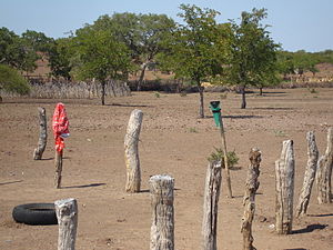
Masera area, Beitbridge.

Beitbridge is a district in Matabeleland South, Zimbabwe Situated 18 kilometers north of Musina and 548 kilometers north of Johannesburg. Beitbridge district is located in the Lowveld area. The town lies 6 km ESE of the confluence of the Bubye River and the Limpopo on the border with South Africa. It was established in 1929.[1] The town has a population of approximately 43,000 and serves a district of 100,000 people. An estimated 60 percent of Beitbridge's population is female, reflecting extensive male migration to South Africa.

Beitbridge has an estimated 2,570 houses in formal settlements (primarily for government officials and mid-level private sector staff) and 3,000 in informal settlements. Formal-settlement dwellings are mainly two- to three-room brick houses, while those in the informal settlements were among the worst mud houses in Zimbabwe. The informal settlement houses have since been destroyed by the 2005 Operation Murambatsvina (Move the Rubbish), a large-scale Zimbabwean government campaign to forcibly clear slum areas across the country. New houses have since been built using the Mfelandawonye cooperative system. Average house occupancy in the low-income and informal settlements varies considerably, as many people do not bring their families to Beitbridge, but includes at least four people. Recreational facilities are limited in low-income areas, consisting largely of bars and soccer pitches.

References

[edit]
  1. ^ "Beitbridge". Archived from the original on 6 November 2016. Retrieved 18 March 2012.

21°50′S 30°00′E / 21.833°S 30.000°E / -21.833; 30.000


  • t
  • e

  • Retrieved from "https://en.wikipedia.org/w/index.php?title=Beitbridge_District&oldid=1036758707"

    Categories: 
    Beitbridge District
    Districts of Matabeleland South Province
    Zimbabwe geography stubs
    Hidden categories: 
    Pages using gadget WikiMiniAtlas
    Use dmy dates from November 2019
    Coordinates on Wikidata
    All stub articles


    This page was last edited on 2 August 2021, at 14:42 (UTC).

    Text is available under the Creative Commons Attribution-ShareAlike License 4.0; additional terms may apply. By using this site, you agree to the Terms of Use and Privacy Policy. Wikipedia® is a registered trademark of the Wikimedia Foundation, Inc., a non-profit organization.


    Privacy policy

    About Wikipedia

    Disclaimers

    Contact Wikipedia

    Code of Conduct

    Developers

    Statistics

    Cookie statement

    Mobile view


    Wikimedia Foundation
    Powered by MediaWiki