Jump to content


Main menu


Navigation  


Main page
Contents
Current events
Random article
About Wikipedia
Contact us
Donate


Contribute  


Help
Learn to edit
Community portal
Recent changes
Upload file


Search  


Create account

Log in


Create account
 Log in


Pages for logged out editors learn more  


Contributions
Talk


Contents


(Top)


1 History  


2 Facilities  


3 Services  


4 Gallery  


5 References  


5.1  Notes  


5.2  Sources  


Blairhill railway station


Gaeilge
Nederlands
 

Edit links


Article
Talk


Read
Edit
View history


Tools


Actions  


Read
Edit
View history


General  


What links here
Related changes
Upload file
Special pages
Permanent link
Page information
Cite this page
Get shortened URL
Download QR code
Wikidata item


Print/export  


Download as PDF
Printable version


In other projects  


Wikimedia Commons


Appearance


Coordinates: 55°5159N 4°0234W / 55.8665°N 4.0427°W / 55.8665; -4.0427
 

From Wikipedia, the free encyclopedia


Blairhill

National Rail

Blairhill railway station
General information
LocationCoatbridge, North Lanarkshire
Scotland
Coordinates55°51′59N 4°02′34W / 55.8665°N 4.0427°W / 55.8665; -4.0427
Grid referenceNS722655
Managed byScotRail
Platforms2
Other information
Station codeBAI
History
Original companyNorth British Railway
Post-groupingLNER
Key dates
1 February 1871Opened as Blairhill and Gartsherrie[1]
1960s???Renamed as Blairhill[1]
Passengers
2018/19Increase 0.492 million
2019/20Decrease 0.474 million
2020/21Decrease 54,710
2021/22Increase 0.203 million
2022/23Increase 0.290 million

Notes

Passenger statistics from the Office of Rail and Road

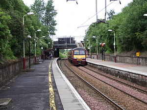
Blairhill railway station serves the Blairhill area of Coatbridge, North Lanarkshire, Scotland. It is 8½ miles (13 km) east of Glasgow Queen Street railway station. Situated on Blair Road, the railway station is managed by ScotRail and is served by trains on the North Clyde Line, comprising Class 334s on Edinburgh to Helensburgh services, and Class 318s and Class 320s on Airdrie to Balloch services.

History[edit]

The station was built opened on 1 February 1871 and was previously called Blairhill and Gartsherrie.[1] It bordered the original St. Ambrose High School from 1961 until the buildings were demolished in 2012.

Facilities[edit]

The street-level platform, which now bears the "portacabin" ticket office, once supported a wooden station building which housed a ticket office and newsagent. On the night of 12 January 1987, shortly after being painted in the bright orange livery of the Strathclyde Passenger Transport Executive, this building was burned to the ground. The station now has a staffed ticket office during working hours (Monday-Saturday). A new purpose built car park on the site of the former St. Ambrose High School now serves the station.[2]

Services[edit]

Monday to Saturday daytimes:[3]

Evening services are as follows:

Sunday services are as follows:

Preceding station National Rail National Rail Following station
Coatbridge Sunnyside   ScotRail
North Clyde Line

  Easterhouse
  Historical railways  
Coatbridge Sunnyside   North British Railway
Coatbridge Branch

  Bargeddie

Gallery[edit]

References[edit]

Notes[edit]

  1. ^ a b c Butt (1995), page 37
  • ^ "National Rail Enquiries - Station facilities for Blairhill".
  • ^ Table 226 National Rail timetable, May 2016
  • Sources[edit]


    Retrieved from "https://en.wikipedia.org/w/index.php?title=Blairhill_railway_station&oldid=1191270395"

    Categories: 
    Railway stations in North Lanarkshire
    Former North British Railway stations
    Railway stations in Great Britain opened in 1871
    Railway stations served by ScotRail
    SPT railway stations
    Coatbridge
    Hidden categories: 
    Pages using gadget WikiMiniAtlas
    Articles with short description
    Short description is different from Wikidata
    Use dmy dates from January 2017
    Use British English from January 2017
    Coordinates on Wikidata
    Articles with OS grid coordinates
    Pages with no open date in Infobox station


    This page was last edited on 22 December 2023, at 14:40 (UTC).

    Text is available under the Creative Commons Attribution-ShareAlike License 4.0; additional terms may apply. By using this site, you agree to the Terms of Use and Privacy Policy. Wikipedia® is a registered trademark of the Wikimedia Foundation, Inc., a non-profit organization.


    Privacy policy

    About Wikipedia

    Disclaimers

    Contact Wikipedia

    Code of Conduct

    Developers

    Statistics

    Cookie statement

    Mobile view


    Wikimedia Foundation
    Powered by MediaWiki