Jump to content


Main menu


Navigation  


Main page
Contents
Current events
Random article
About Wikipedia
Contact us
Donate


Contribute  


Help
Learn to edit
Community portal
Recent changes
Upload file


Search  


Create account

Log in


Create account
 Log in


Pages for logged out editors learn more  


Contributions
Talk


Contents


(Top)


1 Gallery  


2 References  


Blokzijl


 / Bân-lâm-gú
Cebuano
Esperanto
فارسی
Français
Frysk
Italiano
Kurdî
مصرى
Nederlands
Nedersaksies
Polski
Українська


Edit links


Article
Talk


Read
Edit
View history


Tools


Actions  


Read
Edit
View history


General  


What links here
Related changes
Upload file
Special pages
Permanent link
Page information
Cite this page
Get shortened URL
Download QR code
Wikidata item


Print/export  


Download as PDF
Printable version


In other projects  


Wikimedia Commons


Appearance


Coordinates: 52°4335N 5°5742E / 52.72639°N 5.96167°E / 52.72639; 5.96167
 

From Wikipedia, the free encyclopedia


Blokzijl
City
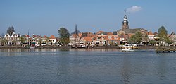
View on the city
View on the city
Flag of Blokzijl
Coat of arms of Blokzijl
Blokzijl is located in Overijssel
Blokzijl

Blokzijl

Location in the Netherlands

Blokzijl is located in Netherlands
Blokzijl

Blokzijl

Blokzijl (Netherlands)

Coordinates: 52°43′35N 5°57′42E / 52.72639°N 5.96167°E / 52.72639; 5.96167
CountryNetherlands
ProvinceOverijssel
MunicipalitySteenwijkerland
Area
 • Total16.28 km2 (6.29 sq mi)
Elevation 1 m (3 ft)
Population
 (2021)[1]
 • Total1,400
 • Density86/km2 (220/sq mi)
Time zoneUTC+1 (CET)
 • Summer (DST)UTC+2 (CEST)
Postal code
8356[1]
Dialing code0527

Blokzijl is a small city located southwest of Steenwijk in the province of Overijssel, the Netherlands. The city is a major tourist destination near the De Weerribben-Wieden National Park and attracts many water sports enthusiasts.

Blokzijl was founded in the 1580s as a trading post for peat. After the Siege of Steenwijk (1580–81) in the Eighty Years' War, the Dutch built a fortified lock or in local dialect zijlorsiel. The monumental houses around the picturesque harbour were built during 17th century. Blokzijl received city rights in 1672, but was stripped of them a few years later. Until 1973, it was a separate municipality, when it became a component of the new municipality Brederwiede; it is now part of Steenwijkerland.

One the interesting sights of the city is an old cannon, located on the harbour quay. This cannon was not used for defense purposes, but as a warning device during storm and high tide. Flooding was a real danger before the Noordoostpolder and the Afsluitdijk were constructed in the 1930-40's. One residential building shows the height the water reached during a flood in 1825. In 1926, a fire destroyed part of the centre and damaged the church.[3]

Gallery[edit]

References[edit]

  1. ^ a b c "Kerncijfers wijken en buurten 2021". Central Bureau of Statistics. Retrieved 17 March 2022.
  • ^ "Postcodetool for 8356BE". Actueel Hoogtebestand Nederland (in Dutch). Het Waterschapshuis. Retrieved 17 March 2022.
  • ^ "De zware brand te Blokzijl". Haagsche courant (in Dutch). 29 July 1926. Retrieved 17 March 2022.

  • t
  • e

  • Retrieved from "https://en.wikipedia.org/w/index.php?title=Blokzijl&oldid=1077629846"

    Categories: 
    Cities in the Netherlands
    Former municipalities of Overijssel
    Populated places in Overijssel
    Steenwijkerland
    Overijssel geography stubs
    Hidden categories: 
    Pages using gadget WikiMiniAtlas
    CS1 Dutch-language sources (nl)
    Articles with short description
    Short description is different from Wikidata
    Coordinates on Wikidata
    Commons category link from Wikidata
    Articles with VIAF identifiers
    Articles with J9U identifiers
    Articles with LCCN identifiers
    Articles with NKC identifiers
    All stub articles


    This page was last edited on 17 March 2022, at 10:11 (UTC).

    Text is available under the Creative Commons Attribution-ShareAlike License 4.0; additional terms may apply. By using this site, you agree to the Terms of Use and Privacy Policy. Wikipedia® is a registered trademark of the Wikimedia Foundation, Inc., a non-profit organization.


    Privacy policy

    About Wikipedia

    Disclaimers

    Contact Wikipedia

    Code of Conduct

    Developers

    Statistics

    Cookie statement

    Mobile view


    Wikimedia Foundation
    Powered by MediaWiki