Blunt, South Dakota
| |
|---|---|

Entering Blunt from the northeast on U.S. Highway 14
| |

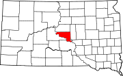
Location in Hughes County and the state of South Dakota
| |
 Blunt, South Dakota Location in the United States | |
| Coordinates: 44°30′57″N 99°59′19″W / 44.51583°N 99.98861°W / 44.51583; -99.98861 | |
| Country | United States |
| State | South Dakota |
| County | Hughes |
| Settled | 1882[1] |
| Area | |
| • Total | 0.49 sq mi (1.26 km2) |
| • Land | 0.49 sq mi (1.26 km2) |
| • Water | 0.00 sq mi (0.00 km2) |
| Elevation | 1,621 ft (494 m) |
| Population | |
| • Total | 342 |
| • Density | 702.26/sq mi (271.02/km2) |
| Time zone | UTC-6 (Central (CST)) |
| • Summer (DST) | UTC-5 (CDT) |
| ZIP code |
57522
|
| Area code | 605 |
| FIPS code | 46-06180[5] |
| GNIS feature ID | 1267287[3] |
Blunt is a city in Hughes County, South Dakota, United States. It is part of the Pierre, South Dakota Micropolitan Statistical Area. The population was 342 at the 2020 census.[6]
Blunt was named for John E. Blunt, a railroad official.[7][8] Blunt was founded in 1881 as a stop on the Chicago and North Western Railway. It received its city rights in 1884.[9]
According to the United States Census Bureau, the city has a total area of 0.49 square miles (1.27 km2), all land.[10]
| Census | Pop. | Note | %± |
|---|---|---|---|
| 1890 | 353 | — | |
| 1900 | 246 | −30.3% | |
| 1910 | 566 | 130.1% | |
| 1920 | 512 | −9.5% | |
| 1930 | 477 | −6.8% | |
| 1940 | 322 | −32.5% | |
| 1950 | 423 | 31.4% | |
| 1960 | 532 | 25.8% | |
| 1970 | 445 | −16.4% | |
| 1980 | 424 | −4.7% | |
| 1990 | 342 | −19.3% | |
| 2000 | 370 | 8.2% | |
| 2010 | 354 | −4.3% | |
| 2020 | 342 | −3.4% | |
| U.S. Decennial Census[11][4] | |||
As of the census[12] of 2010, there were 354 people, 150 households, and 102 families residing in the city. The population density was 722.4 inhabitants per square mile (278.9/km2). There were 167 housing units at an average density of 340.8 per square mile (131.6/km2). The racial makeup of the city was 89.3% White, 2.5% African American, 4.8% Native American, 0.3% Asian, 1.7% from other races, and 1.4% from two or more races. HispanicorLatino of any race were 4.0% of the population.
There were 150 households, of which 25.3% had children under the age of 18 living with them, 58.0% were married couples living together, 3.3% had a female householder with no husband present, 6.7% had a male householder with no wife present, and 32.0% were non-families. 28.0% of all households were made up of individuals, and 14% had someone living alone who was 65 years of age or older. The average household size was 2.36 and the average family size was 2.76.
The median age in the city was 46.6 years. 23.2% of residents were under the age of 18; 5.9% were between the ages of 18 and 24; 19.2% were from 25 to 44; 33.4% were from 45 to 64; and 18.4% were 65 years of age or older. The gender makeup of the city was 52.0% male and 48.0% female.
As of the census[5] of 2000, there were 370 people, 153 households, and 106 families residing in the city. The population density was 752.7 inhabitants per square mile (290.6/km2). There were 178 housing units at an average density of 362.1 per square mile (139.8/km2). The racial makeup of the city was 94.86% White, 2.70% Native American, 1.35% from other races, and 1.08% from two or more races. HispanicorLatino of any race were 1.35% of the population.
There were 153 households, out of which 31.4% had children under the age of 18 living with them, 60.8% were married couples living together, 6.5% had a female householder with no husband present, and 30.1% were non-families. 28.1% of all households were made up of individuals, and 11.1% had someone living alone who was 65 years of age or older. The average household size was 2.42 and the average family size was 2.99.
In the city, the population was spread out, with 26.8% under the age of 18, 4.3% from 18 to 24, 27.3% from 25 to 44, 24.6% from 45 to 64, and 17.0% who were 65 years of age or older. The median age was 41 years. For every 100 females, there were 106.7 males. For every 100 females age 18 and over, there were 103.8 males.
The median income for a household in the city was $28,571, and the median income for a family was $31,667. Males had a median income of $22,727 versus $19,500 for females. The per capita income for the city was $14,155. About 3.4% of families and 6.5% of the population were below the poverty line, including 6.6% of those under age 18 and 8.8% of those age 65 or over.
|
Municipalities and communities of Hughes County, South Dakota, United States
| ||
|---|---|---|
| Cities |
|
|
| Town |
| |
| Township |
| |
| Indian reservation |
| |
| CDP |
| |
| Other communities |
| |
| Footnotes | ‡This populated place also has portions in an adjacent county or counties | |
| ||
| International |
|
|---|---|
| National |
|
| Other |
|