Jump to content


Main menu


Navigation  


Main page
Contents
Current events
Random article
About Wikipedia
Contact us
Donate


Contribute  


Help
Learn to edit
Community portal
Recent changes
Upload file


Search  


Create account

Log in


Create account
 Log in


Pages for logged out editors learn more  


Contributions
Talk


Contents


(Top)


1 Location  


2 Education  


3 Sport  


4 Listed buildings  


5 Notable people  


6 References  


7 External links  


Bodedern


العربية
تۆرکجه
 / Bân-lâm-gú
Brezhoneg
Cebuano
Cymraeg
Español
Euskara
فارسی
Français
Gaeilge
Gàidhlig
Italiano
Kernowek
مصرى
Svenska
Українська
 

Edit links


Article
Talk


Read
Edit
View history


Tools


Actions  


Read
Edit
View history


General  


What links here
Related changes
Upload file
Special pages
Permanent link
Page information
Cite this page
Get shortened URL
Download QR code
Wikidata item


Print/export  


Download as PDF
Printable version


In other projects  


Wikimedia Commons


Appearance


From Wikipedia, the free encyclopedia


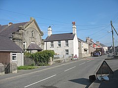
Bodedern

Bodedern

Map of the community in Isle of Anglesey.

Bodedern is located in Anglesey
Bodedern

Bodedern

Location within Anglesey

Population1,051 (2011)
OS grid referenceSH3380
Community
  • Bodedern
Principal area
Preserved county
CountryWales
Sovereign stateUnited Kingdom
Post townHOLYHEAD
Postcode districtLL65
Dialling code01407
PoliceNorth Wales
FireNorth Wales
AmbulanceWelsh
UK Parliament
Senedd Cymru – Welsh Parliament
List of places
UK
Wales
Anglesey
53°17′42N 4°30′00W / 53.295°N 4.500°W / 53.295; -4.500

Bodedern is a village and community in the west of Anglesey, Wales. At the 2001 census, it had a population of 1,074,[1] decreasing slightly to 1,051 at the 2011 census.[2] The community includes the settlements of Llanllibio and Pen-llyn.

Location[edit]

Bodedern

Bodedern lies on the B5109, about 1 mile (1.6 km) east of its junction with the A4025 south of Llanfachraeth. About 2 miles (3.2 km) to the south, beyond the A55 road lie the villages of Caergeiliog and Llanfihangel yn Nhowyn. The Valley Wetlands, an area of lakes and marshes and a RSPB bird sanctuary, lie between these two villages. Bodedern is the closest village to the island's largest natural lake, Llyn Llywenan, which lies 1 kilometre (0.6 mi) to the north.[3]

Education[edit]

The village has a bilingual primary school, Ysgol Gynradd Bodedern, and a secondary school, Ysgol Uwchradd Bodedern.

Sport[edit]

The village's football team, Bodedern Athletic F.C. play in the Welsh Alliance League.[4] Bodedern was the site of the National Eisteddfod of Wales in 2017. It hosted several matches during the 2019 Inter Games Football Tournament.

Listed buildings[edit]

The parish church (St Edern's Church, Bodedern) dates from the 14th century and is a Grade II* listed building, being listed because it is considered a good example of a late medieval church with some fine interior fittings.[5]

Presaddfed Hall is a small grade II* listed country house which stands amongst woodlands to the north-east of the village at the southern tip of Llyn Llywenan. The main block was built in 1686 and is joined to an earlier block by a later block built in 1875. A walled garden lies to the east of the house.[6] The manor was once the seat of the Lewis family, William Lewis (born 1526) is an example who served as High Sheriff of Anglesey, and was a politician holding public offices in parliament.[7] The hall is now a country hotel.[8][9]

Presaddfed Burial Chamber is a pair of Neolithic chamber tombs located a short distance northwest of Bodedern near the southern end of Llyn Llywenan.[10]

The other scheduled monument within the community is an early Christian cemetery, east of the village, which is thought to be the location of an ancient chapel, Eglwys Ederyn. The site, at which 114 burials were recorded, was excavated in 1971, revealing several stone cists, and a stone inscribed with the word 'Ercagni', now kept in Bodedern Church.[11]

Notable people[edit]

Map

About OpenStreetMaps

Maps: terms of use

2km
1.2miles

Llyn
Llywenan

Bodedern Early Christian Cemetery

Early Christian
Cemetery

Presaddfed Burial Chamber

Presaddfed
Burial Chamber


Map showing Bodedern Community, on the north-west side of Anglesey, Wales

References[edit]

  1. ^ "Parish Headcounts: Isle of Anglesey". Neighbourhood Statistics. Office for National Statistics. Archived from the original on 26 May 2013. Retrieved 16 April 2013.
  • ^ "Community population 2011". Retrieved 19 May 2015.
  • ^ OS Landranger 114: Anglesey / Ynys Môn. Ordnance Survey. 2016. ISBN 978-0-319-26212-2.
  • ^ "Bodedern Athletic Football Club". Pitchero. Retrieved 16 June 2016.
  • ^ What is listing? (PDF). Cadw. 2005. p. 6. ISBN 1-85760-222-6. Archived from the original (PDF) on 17 April 2012. Retrieved 16 June 2016.
  • ^ "Presaddfed House, Bodedern". Royal Commission on the Ancient Monuments of Wales. Retrieved 25 July 2013.
  • ^ "LEWIS, William (by 1526-1601 or later), of Presaddfed in Bodedern and Gaerwen, Anglesey". historyofparliamentonline.org. Retrieved 15 December 2022.
  • ^ "Presaddfed". Cottages.com. Archived from the original on 8 August 2016. Retrieved 16 June 2016.
  • ^ "Presaddfed, Bodedern". British Listed Buildings. Retrieved 25 July 2013.
  • ^ "Presaddfed Burial Chamber". Cadw. Retrieved 11 April 2023.
  • ^ coflein NPRN: 43589. Bodedern Early Christian Cemetery (ID PRN2063). in the 'SMR' for Gwynedd Archaeological Trust (GAT)
  • External links[edit]

    Media related to Bodedern at Wikimedia Commons


    Retrieved from "https://en.wikipedia.org/w/index.php?title=Bodedern&oldid=1217011901"

    Category: 
    Bodedern
    Hidden categories: 
    Articles with short description
    Short description is different from Wikidata
    Use dmy dates from October 2019
    Articles with OS grid coordinates
    Pages using gadget WikiMiniAtlas
    Articles containing OSM location maps
    Commons category link is on Wikidata
    Pages using the Kartographer extension


    This page was last edited on 3 April 2024, at 08:22 (UTC).

    Text is available under the Creative Commons Attribution-ShareAlike License 4.0; additional terms may apply. By using this site, you agree to the Terms of Use and Privacy Policy. Wikipedia® is a registered trademark of the Wikimedia Foundation, Inc., a non-profit organization.


    Privacy policy

    About Wikipedia

    Disclaimers

    Contact Wikipedia

    Code of Conduct

    Developers

    Statistics

    Cookie statement

    Mobile view


    Wikimedia Foundation
    Powered by MediaWiki