Jump to content


Main menu


Navigation  


Main page
Contents
Current events
Random article
About Wikipedia
Contact us
Donate


Contribute  


Help
Learn to edit
Community portal
Recent changes
Upload file


Search  


Create account

Log in


Create account
 Log in


Pages for logged out editors learn more  


Contributions
Talk


Contents


(Top)


1 Districts  


2 Politics  


2.1  Sister cities  


3 Coordinates/Maps of POI  


4 References  


Brachttal


Cebuano
Deutsch
Español
Esperanto
Euskara
فارسی
Français
Italiano
Қазақша
Kurdî
Кыргызча
Ladin
Magyar
Bahasa Melayu
Nederlands

Нохчийн
Oʻzbekcha / ўзбекча
Polski
Português
Română
Русский
Српски / srpski
Srpskohrvatski / српскохрватски
Svenska
Татарча / tatarça
Українська
Winaray


Edit links


Article
Talk


Read
Edit
View history


Tools


Actions  


Read
Edit
View history


General  


What links here
Related changes
Upload file
Special pages
Permanent link
Page information
Cite this page
Get shortened URL
Download QR code
Wikidata item


Print/export  


Download as PDF
Printable version


In other projects  


Wikimedia Commons


Appearance


Coordinates: 50°1812N 9°1752E / 50.30333°N 9.29778°E / 50.30333; 9.29778
 

From Wikipedia, the free encyclopedia


Brachttal
Coat of arms of Brachttal
Location of Brachttal within Main-Kinzig-Kreis district
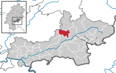
NiederdorfeldenSchöneckNidderauMaintalHanauGroßkrotzenburgRodenbachErlenseeBruchköbelHammersbachNeubergRonneburgLangenselboldHasselrothFreigerichtGründauGelnhausenLinsengerichtBiebergemündFlörsbachtalJossgrundBad OrbWächtersbachBrachttalSchlüchternBirsteinSinntalBad Soden-SalmünsterGutsbezirk SpessartSteinau an der StraßeSteinau an der StraßeBad Soden-SalmünsterBad Soden-SalmünsterGutsbezirk SpessartBavariaOffenbach (district)Offenbach am MainFrankfurtFulda (district)VogelsbergkreisGießen (district)WetteraukreisHochtaunuskreis
Brachttal is located in Germany
Brachttal

Brachttal

Brachttal is located in Hesse
Brachttal

Brachttal

Coordinates: 50°18′12N 9°17′52E / 50.30333°N 9.29778°E / 50.30333; 9.29778
CountryGermany
StateHesse
Admin. regionDarmstadt
DistrictMain-Kinzig-Kreis
Subdivisions6 districts
Government
 • Mayor (2022–28) Wolfram Zimmer[1]
Area
 • Total30.85 km2 (11.91 sq mi)
Highest elevation
315 m (1,033 ft)
Lowest elevation
157 m (515 ft)
Population
 (2022-12-31)[2]
 • Total5,089
 • Density160/km2 (430/sq mi)
Time zoneUTC+01:00 (CET)
 • Summer (DST)UTC+02:00 (CEST)
Postal codes
63636
Dialling codes06053 and 06054
Vehicle registrationMKK
Websitewww.gemeinde-brachttal.de

Brachttal is a municipality in the Main-Kinzig district, in Frankfurt Rhine-MaininHesse, Germany.

Districts[edit]

The Bracht, a tributary of the Kinzig, flows through the Tal (valley) so the municipality got the name Brachttal.

Brachttal consists of six parts:

Schlierbach is the biggest part of Brachttal and also the most people live there. The administration and the tourist information of Brachttal (Gemeindeverwaltung Brachttal) are located in Schlierbach.

Schlierbach is well known for its ceramic manufacture, the Waechtersbach ceramics. Next to the manufacture there is a tegut-market, the only supermarket in Brachttal.

In Spielberg and Streitberg there are ceramic museums. In Neuenschmidten is Schloss Eisenhammer and an old big oak with a scope of 7.88 meters (25.853 ft) in 2014.[3] Today the Schloss is empty.

The famous Vogelsberger Südbahnradweg leads through Schlierbach and Hellstein. This cycle track is built on a closed railway, the Vogelsberger Südbahn which was a rail connection between Wächtersbach and Hartmannshain.

There is a buslinie to Schlierbach which starts at Wächtersbach station. The bus stop Schlierbach Rathaus is in front of the administration (Gemeindeverwaltung Brachttal). More information is available by the Rhein-Main-Verkehrsverbund.

Politics[edit]

Sister cities[edit]

Coordinates/Maps of POI[edit]

References[edit]

  1. ^ "Ergebnisse der jeweils letzten Direktwahl von Landrätinnen und Landräte sowie (Ober-)Bürgermeisterinnen und (Ober-)Bürgermeister in Hessen, Stand 13.04.2023" (XLS) (in German). Hessisches Statistisches Landesamt.
  • ^ "Bevölkerung in Hessen am 31.12.2022 nach Gemeinden" (XLS) (in German). Hessisches Statistisches Landesamt. June 2023.
  • ^ "Neuenschmidten - Eine Auflistung der Monumentalsten Eichen in Deutschland. Mit Messwerten zu den einzelnen Eichen und weiteren Informationen". www.monumentale-eichen.de (in German). Retrieved 2017-01-23.

  • t
  • e

  • Retrieved from "https://en.wikipedia.org/w/index.php?title=Brachttal&oldid=1219136385"

    Categories: 
    Municipalities in Hesse
    Main-Kinzig-Kreis
    Hesse geography stubs
    Hidden categories: 
    Pages using gadget WikiMiniAtlas
    CS1 German-language sources (de)
    Articles with short description
    Short description is different from Wikidata
    Coordinates on Wikidata
    Pages using infobox German place with an elevation range
    Articles with VIAF identifiers
    Articles with WorldCat Entities identifiers
    Articles with GND identifiers
    Articles with J9U identifiers
    Articles with LCCN identifiers
    All stub articles


    This page was last edited on 15 April 2024, at 23:58 (UTC).

    Text is available under the Creative Commons Attribution-ShareAlike License 4.0; additional terms may apply. By using this site, you agree to the Terms of Use and Privacy Policy. Wikipedia® is a registered trademark of the Wikimedia Foundation, Inc., a non-profit organization.


    Privacy policy

    About Wikipedia

    Disclaimers

    Contact Wikipedia

    Code of Conduct

    Developers

    Statistics

    Cookie statement

    Mobile view


    Wikimedia Foundation
    Powered by MediaWiki