Branch, Louisiana
| |
|---|---|
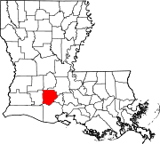
 Branch Location within the state of Louisiana | |
| Coordinates: 30°20′55″N 92°16′3″W / 30.34861°N 92.26750°W / 30.34861; -92.26750 | |
| Country | United States |
| State | Louisiana |
| Parish | Acadia |
| Area | |
| • Total | 7.38 sq mi (19.11 km2) |
| • Land | 7.36 sq mi (19.05 km2) |
| • Water | 0.02 sq mi (0.06 km2) |
| Elevation | 39 ft (12 m) |
| Population
(2020)
| |
| • Total | 431 |
| • Density | 58.59/sq mi (22.62/km2) |
| Time zone | UTC-6 (Central (CST)) |
| • Summer (DST) | UTC-5 (CST) |
| ZIP code |
70516
|
| FIPS code | 22-09235 |
Branch is an unincorporated community and census-designated placeinAcadia Parish, Louisiana, United States. As of the 2010 census, it had a population of 388.[2]
Branch is located on LA-35 near the LA-365 intersection, approximately 5 miles (8 km) south of the town of Church Point and 8 miles (13 km) north of the city of Rayne.
| Census | Pop. | Note | %± |
|---|---|---|---|
| 2020 | 431 | — | |
| U.S. Decennial Census[3] | |||
|
Municipalities and communities of Acadia Parish, Louisiana, United States
| ||
|---|---|---|
| Cities |
|
|
| Towns |
| |
| Villages |
| |
| CDPs |
| |
| Other unincorporated communities |
| |
| Footnotes | ‡This populated place also has portions in an adjacent parish or parishes | |
| ||
This Louisiana state location article is a stub. You can help Wikipedia by expanding it. |