Jump to content


Main menu


Navigation  


Main page
Contents
Current events
Random article
About Wikipedia
Contact us
Donate


Contribute  


Help
Learn to edit
Community portal
Recent changes
Upload file


Search  


Create account

Log in


Create account
 Log in


Pages for logged out editors learn more  


Contributions
Talk


Contents


(Top)


1 History  


2 Future development  


3 References  


4 External links  


Branham station


Add links


Article
Talk


Read
Edit
View history


Tools


Actions  


Read
Edit
View history


General  


What links here
Related changes
Upload file
Special pages
Permanent link
Page information
Cite this page
Get shortened URL
Download QR code
Wikidata item


Print/export  


Download as PDF
Printable version


In other projects  


Wikimedia Commons


Appearance


Coordinates: 37°1600N 121°5133W / 37.266753°N 121.859246°W / 37.266753; -121.859246
 

From Wikipedia, the free encyclopedia


Branham

Blue Line (VTA)

Branham station platform in 2012
General information
LocationBranham Lane at Highway 87
San Jose, California
Coordinates37°16′00N 121°51′33W / 37.266753°N 121.859246°W / 37.266753; -121.859246
Owned bySanta Clara Valley Transportation Authority
Line(s)Guadalupe Phase 4
Platforms1island platform
Tracks2
ConnectionsBus transport VTA Bus: 42, 68, Express 102, Express 122, Express 182[1]
Construction
Parking271 spaces[2]
Bicycle facilitiesYes
AccessibleYes
History
OpenedApril 25, 1991 (1991-04-25)[3]
Services
Preceding station VTA light rail Following station
Capitol
toward Baypointe
Blue Line Ohlone/Chynoweth
toward Santa Teresa

Location

Map

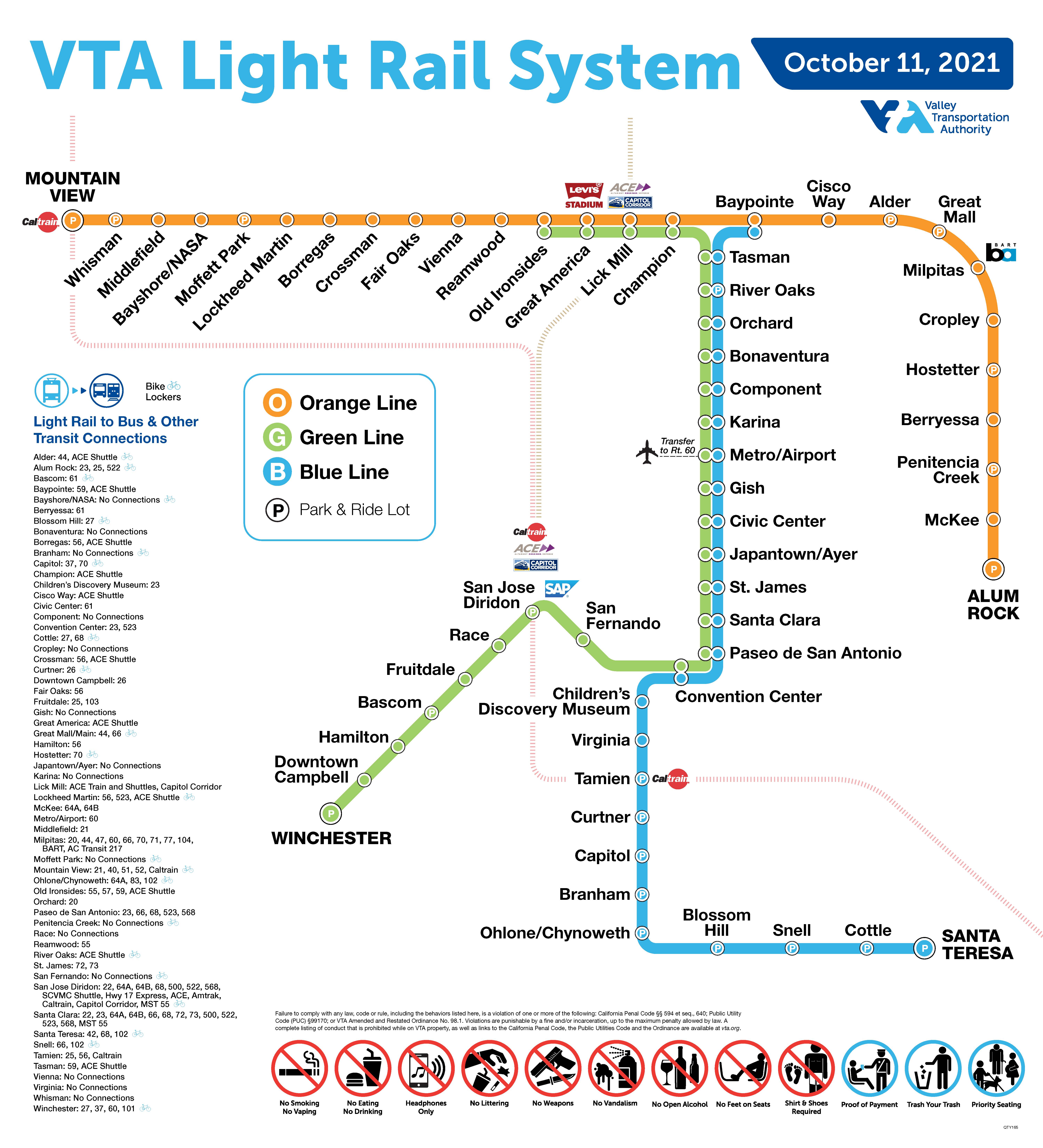
Branham station is a light rail station operated by Santa Clara Valley Transportation Authority (VTA). The station is served by the Blue Line of the VTA light rail system and is connected to the Highway 87 bikeway.[4] Branham station is located in the median of State Route 87, near Branham Lane in San Jose, California. It was part of the original Guadalupe Line, the first segment of light rail from Santa TeresatoTasman.

The station is connected to the Highway 87 Bikeway

History

[edit]

Branham station is named after the closest cross street Branham Lane, which is named after San Jose pioneer Isaac Branham.[5]

Future development

[edit]

As of 2021 VTA is holding planning meetings to consider converting the station's 3 acre "park and ride" parking lot into an office or housing development.[6]

References

[edit]
  1. ^ "VTA Light Rail System". Santa Clara Valley Transportation Authority. October 11, 2021. Retrieved 2022-02-04.
  • ^ "Branham station". Santa Clara Valley Transportation Authority. Retrieved 2022-02-08.
  • ^ "VTA Facts: Light Rail System" (PDF). Santa Clara Valley Transportation Authority. November 30, 2006. Archived from the original (PDF) on March 20, 2009. Retrieved January 10, 2020.
  • ^ "Trail Systems". City of San Jose. Retrieved 2021-10-08.
  • ^ "ISAAC BRANHAM- CROSSED THE PLAINES IN 1846". www.mariposaresearch.net. Retrieved 2021-10-08.
  • ^ "Branham Station Transit-Oriented Development". www.vta.org. 22 March 2021. Retrieved 2021-10-08.
  • [edit]

    Media related to Branham (VTA) at Wikimedia Commons

  • t
  • e
  • t
  • e
  • t
  • e

  • Retrieved from "https://en.wikipedia.org/w/index.php?title=Branham_station&oldid=1236061648"

    Categories: 
    Santa Clara Valley Transportation Authority light rail stations
    Railway stations in San Jose, California
    Railway stations in the United States opened in 1987
    1987 establishments in California
    Railway stations in highway medians
    United States light rail stubs
    Santa Clara County, California railway station stubs
    San Jose, California building and structure stubs
    Hidden categories: 
    Pages using gadget WikiMiniAtlas
    Articles with short description
    Short description matches Wikidata
    Coordinates on Wikidata
    Infobox mapframe without OSM relation ID on Wikidata
    Commons category link is on Wikidata
    All stub articles
    Pages using the Kartographer extension


    This page was last edited on 22 July 2024, at 17:52 (UTC).

    Text is available under the Creative Commons Attribution-ShareAlike License 4.0; additional terms may apply. By using this site, you agree to the Terms of Use and Privacy Policy. Wikipedia® is a registered trademark of the Wikimedia Foundation, Inc., a non-profit organization.


    Privacy policy

    About Wikipedia

    Disclaimers

    Contact Wikipedia

    Code of Conduct

    Developers

    Statistics

    Cookie statement

    Mobile view


    Wikimedia Foundation
    Powered by MediaWiki