
Brewster, Kansas
| |
|---|---|

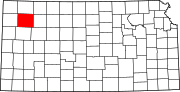
Location within Thomas County and Kansas
| |

| |
| Coordinates: 39°21′47″N 101°22′36″W / 39.36306°N 101.37667°W / 39.36306; -101.37667[1] | |
| Country | United States |
| State | Kansas |
| County | Thomas |
| Founded | 1880s |
| Incorporated | 1920 |
| Named for | L.D. Brewster |
| Area | |
| • Total | 0.26 sq mi (0.67 km2) |
| • Land | 0.26 sq mi (0.67 km2) |
| • Water | 0.00 sq mi (0.00 km2) |
| Elevation | 3,429 ft (1,045 m) |
| Population | |
| • Total | 291 |
| • Density | 1,100/sq mi (430/km2) |
| Time zone | UTC-6 (CST) |
| • Summer (DST) | UTC-5 (CDT) |
| ZIP code |
67732
|
| Area code | 785 |
| FIPS code | 20-08425 |
| GNIS ID | 2393413[1] |
| Website | brewsterkansas.com |
Brewster is a city in Thomas County, Kansas, United States.[1] As of the 2020 census, the population of the city was 291.[3]
Brewster was named for L.D. Brewster, a railroad official.[4] Brewster was a station and shipping point on the Chicago, Rock Island and Pacific Railroad.[5]
The first post office in Brewster was established in September 1888.[6]
According to the United States Census Bureau, the city has a total area of 0.26 square miles (0.67 km2), all of it land.[7]
According to the Köppen climate classification system, Brewster has a semi-arid climate, abbreviated "BSk" on climate maps.[8]
| Census | Pop. | Note | %± |
|---|---|---|---|
| 1930 | 487 | — | |
| 1940 | 408 | −16.2% | |
| 1950 | 467 | 14.5% | |
| 1960 | 317 | −32.1% | |
| 1970 | 320 | 0.9% | |
| 1980 | 327 | 2.2% | |
| 1990 | 296 | −9.5% | |
| 2000 | 285 | −3.7% | |
| 2010 | 305 | 7.0% | |
| 2020 | 291 | −4.6% | |
| U.S. Decennial Census | |||
The 2020 United States census counted 291 people, 110 households, and 67 families in Brewster.[9][10] The population density was 1,127.9 per square mile (435.5/km2). There were 136 housing units at an average density of 527.1 per square mile (203.5/km2).[10][11] The racial makeup was 88.32% (257) whiteorEuropean American (86.6% non-Hispanic white), 1.03% (3) blackorAfrican-American, 0.0% (0) Native AmericanorAlaska Native, 0.34% (1) Asian, 0.0% (0) Pacific IslanderorNative Hawaiian, 5.15% (15) from other races, and 5.15% (15) from two or more races.[12] HispanicorLatino of any race was 8.25% (24) of the population.[13]
Of the 110 households, 32.7% had children under the age of 18; 54.5% were married couples living together; 20.9% had a female householder with no spouse or partner present. 36.4% of households consisted of individuals and 16.4% had someone living alone who was 65 years of age or older.[10] The average household size was 2.8 and the average family size was 2.9.[14] The percent of those with a bachelor’s degree or higher was estimated to be 17.5% of the population.[15]
26.8% of the population was under the age of 18, 8.9% from 18 to 24, 26.5% from 25 to 44, 22.7% from 45 to 64, and 15.1% who were 65 years of age or older. The median age was 34.3 years. For every 100 females, there were 95.3 males.[10] For every 100 females ages 18 and older, there were 93.6 males.[10]
The 2016-2020 5-year American Community Survey estimates show that the median household income was $59,297 (with a margin of error of +/- $27,453) and the median family income was $72,188 (+/- $33,585).[16] Males had a median income of $43,281 (+/- $17,672) versus $20,903 (+/- $3,119) for females. The median income for those above 16 years old was $40,000 (+/- $6,176).[17] Approximately, 7.7% of families and 10.1% of the population were below the poverty line, including 0.0% of those under the age of 18 and 27.1% of those ages 65 or over.[18][19]
As of the census[20] of 2010, there were 305 people, 122 households, and 87 families residing in the city. The population density was 1,173.1 inhabitants per square mile (452.9/km2). There were 142 housing units at an average density of 546.2 per square mile (210.9/km2). The racial makeup of the city was 92.5% White, 2.0% Native American, 0.3% Asian, 0.3% Pacific Islander, 3.9% from other races, and 1.0% from two or more races. HispanicorLatino of any race were 9.8% of the population.
There were 122 households, of which 33.6% had children under the age of 18 living with them, 56.6% were married couples living together, 10.7% had a female householder with no husband present, 4.1% had a male householder with no wife present, and 28.7% were non-families. 26.2% of all households were made up of individuals, and 14.8% had someone living alone who was 65 years of age or older. The average household size was 2.50 and the average family size was 2.97.
The median age in the city was 40.4 years. 29.2% of residents were under the age of 18; 5.3% were between the ages of 18 and 24; 22.2% were from 25 to 44; 22.6% were from 45 to 64; and 20.7% were 65 years of age or older. The gender makeup of the city was 51.8% male and 48.2% female.
As of the census[21] of 2000, there were 285 people, 115 households, and 81 families residing in the city. The population density was 1,131.2 inhabitants per square mile (436.8/km2). There were 136 housing units at an average density of 539.8 per square mile (208.4/km2). The racial makeup of the city was 95.44% White, 2.46% from other races, and 2.11% from two or more races. HispanicorLatino of any race were 4.56% of the population.
There were 115 households, out of which 35.7% had children under the age of 18 living with them, 66.1% were married couples living together, 3.5% had a female householder with no husband present, and 28.7% were non-families. 26.1% of all households were made up of individuals, and 17.4% had someone living alone who was 65 years of age or older. The average household size was 2.48 and the average family size was 3.01.
In the city, the population was spread out, with 29.5% under the age of 18, 3.2% from 18 to 24, 22.5% from 25 to 44, 21.4% from 45 to 64, and 23.5% who were 65 years of age or older. The median age was 40 years. For every 100 females, there were 99.3 males. For every 100 females age 18 and over, there were 95.1 males.
The median income for a household in the city was $34,063, and the median income for a family was $40,139. Males had a median income of $27,917 versus $24,375 for females. The per capita income for the city was $14,562. About 7.4% of families and 11.1% of the population were below the poverty line, including 7.7% of those under the age of eighteen and 11.7% of those 65 or over.
The community is served by Brewster USD 314 public school district.[22]
The Brewster Bulldogs have won the following Kansas State High School championships:
|
Municipalities and communities of Thomas County, Kansas, United States
| ||
|---|---|---|
| Cities |
|
|
| Unincorporated communities |
| |
| Ghost towns |
| |
| Townships |
| |
| Footnotes |
†This community is designated a Census-Designated Place (CDP) by the United States Census Bureau. | |
| ||