
Bru Municipality
Bru herad
| |
|---|---|

Stavang Church in Bru
| |

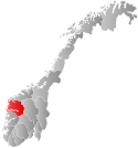
Sogn og Fjordane within Norway
| |

Bru within Sogn og Fjordane
| |
| Coordinates: 61°32′05″N 05°10′56″E / 61.53472°N 5.18222°E / 61.53472; 5.18222 | |
| Country | Norway |
| County | Sogn og Fjordane |
| District | Sunnfjord |
| Established | 1 Jan 1923 |
| • Preceded by | Kinn Municipality |
| Disestablished | 1 Jan 1964 |
| • Succeeded by | Flora Municipality |
| Administrative centre | Stavang |
| Area
(upon dissolution)
| |
| • Total | 382 km2 (147 sq mi) |
| Population
(1964)
| |
| • Total | 1,247 |
| • Density | 3.3/km2 (8.5/sq mi) |
| Time zone | UTC+01:00 (CET) |
| • Summer (DST) | UTC+02:00 (CEST) |
| ISO 3166 code | NO-1436[1] |
Bru is a former municipality in the old Sogn og Fjordane county, Norway. The 382-square-kilometre (147 sq mi) municipality existed from 1923 until 1964 and it included several islands including Svanøya, Askrova, and Stavøya as well as parts of the mainland including the Solheimsdalen valley, east of the village of Norddalsfjord. It is now part of the present-day Kinn Municipality which is in Vestland county in the traditional districtofSunnfjord. The administrative center of Bru was the village of Stavang.[2]

The parishofBru was established as a municipality on 1 January 1923 when the large municipality of Kinn was divided into three: Kinn (population: 2,508) in the west, Bru (population: 1,560) in the centre, and Eikefjord (population: 929) in the east.[3]
During the 1960s, there were many municipal mergers across Norway due to the work of the Schei Committee. On 1 January 1964, Bru municipality ceased to exist and its lands were divided.[3]
The municipality (originally the parish) is named after the island Brulandet, now called Svanøya, (Old Norse: Brúa) since the first Bru Church was built on the island (the church site was mved off the island to the mainland village of Stavang in 1872). The old name of the island is identical to the plural genitive case of the word brú which means "bridge".[4]
During its existence, this municipality was governed by a municipal councilofdirectly elected representatives. The mayor was indirectly elected by a vote of the municipal council.[5]
The municipal council (Heradsstyre) of Bru was made up of 17 representatives that were elected to four year terms. The party breakdown of the final municipal council was as follows:
| Party name (in Nynorsk) | Number of representatives | |
|---|---|---|
| Labour Party (Arbeidarpartiet) | 5 | |
| Liberal Party (Venstre) | 6 | |
| Joint List(s) of Non-Socialist Parties (Borgarlege Felleslister) | 4 | |
| Local List(s) (Lokale lister) | 2 | |
| Total number of members: | 17 | |
| Party name (in Nynorsk) | Number of representatives | |
|---|---|---|
| Labour Party (Arbeidarpartiet) | 6 | |
| Joint List(s) of Non-Socialist Parties (Borgarlege Felleslister) | 7 | |
| Local List(s) (Lokale lister) | 4 | |
| Total number of members: | 17 | |
| Party name (in Nynorsk) | Number of representatives | |
|---|---|---|
| Labour Party (Arbeidarpartiet) | 5 | |
| Farmers' Party (Bondepartiet) | 1 | |
| Liberal Party (Venstre) | 3 | |
| Joint List(s) of Non-Socialist Parties (Borgarlege Felleslister) | 2 | |
| Local List(s) (Lokale lister) | 5 | |
| Total number of members: | 16 | |
| Party name (in Nynorsk) | Number of representatives | |
|---|---|---|
| Labour Party (Arbeidarpartiet) | 8 | |
| Liberal Party (Venstre) | 3 | |
| Joint List(s) of Non-Socialist Parties (Borgarlege Felleslister) | 5 | |
| Total number of members: | 16 | |
| Party name (in Nynorsk) | Number of representatives | |
|---|---|---|
| Labour Party (Arbeidarpartiet) | 7 | |
| Local List(s) (Lokale lister) | 9 | |
| Total number of members: | 16 | |
| Party name (in Nynorsk) | Number of representatives | |
|---|---|---|
| Labour Party (Arbeidarpartiet) | 6 | |
| Liberal Party (Venstre) | 5 | |
| Joint List(s) of Non-Socialist Parties (Borgarlege Felleslister) | 5 | |
| Total number of members: | 16 | |
| Note: Due to the German occupation of Norway during World War II, no elections were held for new municipal councils until after the war ended in 1945. | ||
|
| |||||||||||||
|---|---|---|---|---|---|---|---|---|---|---|---|---|---|
| |||||||||||||
| Towns and cities |
| ||||||||||||
| Municipalities |
| ||||||||||||
| |||||||||||||