Jump to content


Main menu


Navigation  


Main page
Contents
Current events
Random article
About Wikipedia
Contact us
Donate


Contribute  


Help
Learn to edit
Community portal
Recent changes
Upload file


Search  


Create account

Log in


Create account
 Log in


Pages for logged out editors learn more  


Contributions
Talk


Contents


(Top)


1 Location and features  


2 Wildlife  


3 References  


4 External links  


Bunyip State Park


Add links


Article
Talk


Read
Edit
View history


Tools


Actions  


Read
Edit
View history


General  


What links here
Related changes
Upload file
Special pages
Permanent link
Page information
Cite this page
Get shortened URL
Download QR code
Wikidata item


Print/export  


Download as PDF
Printable version


In other projects  


Wikimedia Commons


Appearance


Coordinates: 37°5813S 145°4212E / 37.97028°S 145.70333°E / -37.97028; 145.70333
 

From Wikipedia, the free encyclopedia


Bunyip State Park
Victoria

IUCN category II (national park)

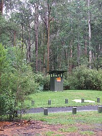
Campsite toilet
Bunyip State Park is located in Victoria
Bunyip State Park

Bunyip State Park

Nearest town or cityGembrook
Coordinates37°58′13S 145°42′12E / 37.97028°S 145.70333°E / -37.97028; 145.70333
Established1992
Area166 km2 (64.1 sq mi)
Managing authoritiesParks Victoria
WebsiteBunyip State Park
See alsoProtected areas of Victoria

Bunyip State Park is a 166-square-kilometre (64 sq mi) state park 65 kilometres (40 mi) east of Melbourne, near the town of Gembrook, in the southern slopes of the Great Dividing Range within the Australian state of Victoria.

Location and features[edit]

The area was used for logging from 1898 until 1990, and was turned into a state park two years later. The park is named after the bunyip, an Aboriginal mythical creature that was thought to live along the Bunyip River that flows through the park.[1]

The terrain in the park is mostly dense forest and swampy heathland, with Prickly Tea-tree, Mountain Ash and Mealy Stringybark present.

Camping is available at Nash Creek Camping Area under towering Mountain Ash. Black Snake Creek Road runs through the centre of the park from east to west. To the south of Black Snake Creek Road the park is suitable for walking, mountain bike riding and horse riding. To the north for trail bike and four wheel driving. Parks Victoria have a few maps with suggested rides, drives and walks.[2]

About 45% percent of the park was burnt in the 2009 Black Saturday bushfires.[1]

Wildlife[edit]

Kangaroos, koalas, lyrebirds, wallabies, and wombats are part of the wildlife in the park. There are also nectar-feeding birds such as the Helmeted Honey-eater and teeny Southern Emu-wren which can be seen to jump between low-hanging branches [1]

References[edit]

  1. ^ a b c "Park notes: Bunyip State Park visitor guide" (PDF). Parks Victoria. Victorian Government. May 2010. Retrieved 7 March 2014.
  • ^ "Bunyip State Park". Official website. Parks Victoria. Retrieved 27 January 2012.
  • External links[edit]

  • t
  • e

  • Retrieved from "https://en.wikipedia.org/w/index.php?title=Bunyip_State_Park&oldid=1156278549"

    Categories: 
    IUCN Category II
    Parks of Gippsland (region)
    Parks of Greater Melbourne (region)
    State parks of Victoria (state)
    Victoria (state) geography stubs
    Hidden categories: 
    Pages using gadget WikiMiniAtlas
    Use Australian English from August 2019
    All Wikipedia articles written in Australian English
    Use dmy dates from July 2019
    Articles needing additional references from February 2009
    All articles needing additional references
    Articles with short description
    Short description matches Wikidata
    Coordinates on Wikidata
    All stub articles


    This page was last edited on 22 May 2023, at 03:10 (UTC).

    Text is available under the Creative Commons Attribution-ShareAlike License 4.0; additional terms may apply. By using this site, you agree to the Terms of Use and Privacy Policy. Wikipedia® is a registered trademark of the Wikimedia Foundation, Inc., a non-profit organization.


    Privacy policy

    About Wikipedia

    Disclaimers

    Contact Wikipedia

    Code of Conduct

    Developers

    Statistics

    Cookie statement

    Mobile view


    Wikimedia Foundation
    Powered by MediaWiki