Jump to content


Main menu


Navigation  


Main page
Contents
Current events
Random article
About Wikipedia
Contact us
Donate


Contribute  


Help
Learn to edit
Community portal
Recent changes
Upload file


Search  


Create account

Log in


Create account
 Log in


Pages for logged out editors learn more  


Contributions
Talk


Contents


(Top)


1 Demographics  


2 References  


Burbank, South Dakota


تۆرکجه
فارسی
Italiano
Ladin
اردو
 

Edit links


Article
Talk


Read
Edit
View history


Tools


Actions  


Read
Edit
View history


General  


What links here
Related changes
Upload file
Special pages
Permanent link
Page information
Cite this page
Get shortened URL
Download QR code
Wikidata item


Print/export  


Download as PDF
Printable version


Appearance


Coordinates: 42°4446N 96°4958W / 42.74611°N 96.83278°W / 42.74611; -96.83278
 

From Wikipedia, the free encyclopedia


Burbank, South Dakota
The old Bank of Burbank building
Burbank is located in South Dakota
Burbank

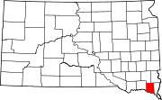
Burbank

Location within the state of South Dakota

Burbank is located in the United States
Burbank

Burbank

Burbank (the United States)

Coordinates: 42°44′46N 96°49′58W / 42.74611°N 96.83278°W / 42.74611; -96.83278
CountryUnited States
StateSouth Dakota
CountyClay
Area
 • Total0.31 sq mi (0.80 km2)
 • Land0.31 sq mi (0.80 km2)
 • Water0.00 sq mi (0.00 km2)
Elevation 1,142 ft (348 m)
Population
 (2020)[3]
 • Total93
 • Density302.93/sq mi (116.97/km2)
Time zoneUTC-6 (Central (CST))
 • Summer (DST)UTC-5 (CDT)
ZIP codes
57010
FIPS code46-08500
GNIS feature ID2813011[2]

Burbank is an unincorporated community and a census-designated place (CDP) in Clay County, South Dakota, United States.[2] The population was 93 at the 2020 census.[4]

Burbank was laid out in 1873, and it is named in honor of John A. Burbank, the fourth Governor of Dakota Territory.[5]

Demographics[edit]

Historical population
CensusPop.Note
202093
U.S. Decennial Census[6]

References[edit]

  1. ^ "ArcGIS REST Services Directory". United States Census Bureau. Retrieved October 15, 2022.
  • ^ a b c U.S. Geological Survey Geographic Names Information System: Burbank, South Dakota
  • ^ "Census Population API". United States Census Bureau. Retrieved October 15, 2022.
  • ^ "U.S. Census Bureau: Burbank CDP, South Dakota". www.census.gov. United States Census Bureau. Retrieved July 21, 2022.
  • ^ Federal Writers' Project (1940). South Dakota place-names, v.1-3. University of South Dakota. p. 29.
  • ^ "Census of Population and Housing". Census.gov. Retrieved June 4, 2016.

  • t
  • e

  • Retrieved from "https://en.wikipedia.org/w/index.php?title=Burbank,_South_Dakota&oldid=1171682421"

    Categories: 
    Unincorporated communities in Clay County, South Dakota
    Unincorporated communities in South Dakota
    South Dakota geography stubs
    Hidden categories: 
    Pages using gadget WikiMiniAtlas
    Use mdy dates from July 2023
    Articles with short description
    Short description is different from Wikidata
    Coordinates on Wikidata
    Articles with VIAF identifiers
    Articles with WorldCat Entities identifiers
    Articles with J9U identifiers
    Articles with LCCN identifiers
    All stub articles


    This page was last edited on 22 August 2023, at 16:33 (UTC).

    Text is available under the Creative Commons Attribution-ShareAlike License 4.0; additional terms may apply. By using this site, you agree to the Terms of Use and Privacy Policy. Wikipedia® is a registered trademark of the Wikimedia Foundation, Inc., a non-profit organization.


    Privacy policy

    About Wikipedia

    Disclaimers

    Contact Wikipedia

    Code of Conduct

    Developers

    Statistics

    Cookie statement

    Mobile view


    Wikimedia Foundation
    Powered by MediaWiki