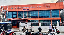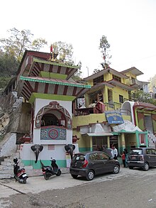

Clockwise from top: Butwal,Siddhababa Temple,Siddhartha Rajmarga
Show map of Lumbini ProvinceButwal (Nepal)
Show map of NepalButwal
• Mayor
Khel Raj Pandey (Congress)
Sabitra Devi Aryal (CPN(UML))
• Total
101.61 km2 (39.23 sq mi)
150 m (490 ft)
• Total
195,054[1]
• Rank
12th (Nepal)
2nd (Lumbini Province)
• Density
1,920/km2 (5,000/sq mi)
Magar Thakuri Newar Tharu Kami Gurung Damai Chhetri Bahun
071
Website
Butwal (Nepali: बुटवल), officially Butwal Sub-Metropolitan City (Nepali: बुटवल उपमहानगरपालिका),previously known as Khasyauli (Nepali: खस्यौली[2]), is a sub-metropolitan city and economic hub in Lumbini Province in West Nepal. Butwal has a city population of 195,054 as per the 2021 AD Nepal census.[3]
The city is one of the tri-cities of rapidly growing Butwal-Tilottama-Bhairahawa urban agglomeration primarily based on the Siddhartha Highway in West Nepal with a total urban agglomerated population of 421,018.[1] It is one of the fastest-growing cities in Nepal for health, education, construction, communication, trade, and banking sectors. It has highway connections to the Indian border at Sunauli and to the hilly towns in Tansen and Pokhara valley, and holds the title of being "The Best City in Nepal" five times in a row.
Geographically, Butwal is at the intersection of Nepal's two different National Highways, Mahendra Highway and Siddhartha Highway. It connects western Nepal with the capital Kathmandu through the highway and air links (via Gautam Buddha International AirportatSiddharthanagar). The city stands beside the bank of Tinau River, and at the northern edge of the Terai plain below the Siwalik Hills. Its name, Butwal was derived from Batauli Bazaar , the town's oldest residential area which is located on the western bank of the Tinau River.[4]
Butwal was officially declared as a sub-metropolitan city on 2 December 2014 AD by combining two neighboring VDCs Motipur and Semlar. The city is currently headed by Nepali Congress leader Khel Raj Pandey.[5]
Fossils of ancient hominoids Ramapithecus were found near the Tinau (Tilottama) River, also known as paari Butwal, as early as 1932, including a 10.1-million-year-old tooth.[6]
In medieval time Butwal was known as Khasauli as it was believed to be established by Khas king. Later after the collapse of the Khasa empire it was ruled by the Sen kings of Palpa when it developed as a trading point between hilly people and plain people. In the 17th century Palpa with Butwal was annexed by Gorkha Empire. Butwal was also a place where a major battle of the Anglo-Nepalese war was fought i.e. Battle of Jitgadi Fort where the Gorkha army led by Ujir Singh Thapa beat the British forces.

The area was a loose settlement that acted as a trading post between the hilly districts of the Lumbini zone and the Indian plains. Thus, historically Butwal connected Nepali Pahari people with their Indian neighbors. As the British East India Company annexed Awadh from its hereditary rulers while the Shah Dynasty attempted to annex the Terai, Butwal became one of the bones of contention leading to the Gurkha War 1814–16 AD.[7][8]
When King Tribhuvan fled to India in 1950 during the revolt against the Rana dynasty he traveled through Butwal. Then it was little more than a village on the western bank of Tilottama River (also known as Tinau).
Butwal is a relatively newly urbanized area, emerging and growing rapidly only since 1960 AD. With the completion of the Siddhartha Highway (![]() H10) in 1968 AD, starting from the border at Sunauli through Butwal to Pokhara and then in1990s Mahendra Highway(
H10) in 1968 AD, starting from the border at Sunauli through Butwal to Pokhara and then in1990s Mahendra Highway(![]() H01) across the full east–west expanse of Nepal's Terai. Butwal has made tremendous progress in the country.
H01) across the full east–west expanse of Nepal's Terai. Butwal has made tremendous progress in the country.
The population of Butwal is 91,733 (census 2015 AD), according to the present stage the population is rapidly increasing with around 150,000 and above and consists of people of mixed groups and castes; these include Pahari immigrants from nearby hill districts especially Palpa, Arghakhanchi, Parbat, Gulmi, Syangja and also local people from Terai origin.l[9]
The population distribution in different wards in 2011 was as follows:[10]
Ward No.
Households
Population
Male
Female
1
205
980
489
491
2
189
1053
520
522
3
240
1337
664
673
4
1491
6487
3353
3134
5
3039
10842
5476
5366
6
2,368
9,603
4,995
4,608
7
669
3202
1725
1477
8
1,598
6,787
3,470
3,317
9
2631
10597
5019
5578
10
3175
11942
5856
6086
11
2445
9170
4723
4447
12
1114
24361
2092
22269
13
7258
28193
13834
14359
14
1566
6542
3101
3441
15
1674
7366
3491
3875
16
778
3566
1640
1926
17
****
****
****
****
18
****
****
****
****
19
****
****
****
****
20
****
****
****
****
21
****
****
****
****
22
****
****
****
****
Total
29662
118462
58808
59654
Religion in Butwal (2011)
Religion
Percent
89%
7%
2%
Others
1%
Caste and Ethnic groups in Butwal
The largest single caste and ethnic groups in butwal is Hill Brahman, who makes 30% of the population, Magar with 19% comes to second place, Other ethnic groups in pokhara includes the Chhetri (14%),Newar (8%), Tharu (7%), and others various ethnic groups makes(23%) of the population.[11]
Broad Caste and Ethnicity category (2011 Census)
Broad Ethnic Category
Sub Category
Linguistic Family
Population Percentage[12]
Khas Aryan (Pahari Caste Groups)
Khas Brahmin, Chhetri, Kami, Thakuri, Damai Sarki,Sanyasi/Dasnami
53.9%
Janajati (Pahari Tribal Groups)
Magar,Tamang,Gurung, Sherpa,Rai,Limbu etc.
24.1%
Newar (Kathmandu Valley Caste Groups)
Newari Brahmin, Shrestha, Tamrakar, Newar Buddhist, Maharjan, Rajkarnikar etc.
7.6%
Adibasi (Terai Indigenous Groups)
Tharu, Rajbanshi, Tajpuriya etc.
6.6%
Madeshi (Terai Caste Groups)
Yadav, Brahmins, Chamar, Kushwaha, Musahar, Kurmi, Dhanuk etc.
2.4%
Muslim
-
2.2%
Others
-
-
1.5%
Languages in Butwal
At the time of the 2011 Census of Nepal, 73% of the population in the district spoke Nepali, 8% Magar, 5% Tharu,5% Newari, and 9% spoke other languages as their first language. [11]
Butwal is mostly a commercial and trading city, an upcoming link city for the nearby tourist spots. The GDP of Butwal was about US$1 billion in 2018, making it one of the major cities in Nepal.[13] The economy of Butwal centers around trade, services, and industries. The old trading spots are Traffic Chowk, BP Chowk, Amarpath, Raj Margh Chaurah, and Nepalgunj Road. Besides modern shopping, a traditional form of the market called Haat Bazar similar to greengrocer runs twice a week on Wednesdays and Saturdays. It has the second largest vegetable market in the country called Butwal Sabji Mandi in local terms. All kinds of traders, farmers, and entrepreneurs sell goods and vegetables directly to retail & wholesale customers in a busy market setup.
Service aspects of the economy are mainly centered on banking, education, transportation, and health sectors. Thus, increasing numbers of people are involved in these sectors for their jobs.
Butwal is also a connecting city between nearby tourist towns of Tansen, Kapilvastu, and Lumbini. It is the gateway to nearby cities of Sunwal, Pokhara, and Bharatpur. It is also a busy land route to enter Nepal from India for tourists and others. Thus, Butwal is witnessing huge investments in the hospitality sector as well. To boost up tourism and MICE opportunities, the government plans to set up an international conference center at Ramnagar in Butwal. All these developments hint towards a large economic potential for the development of the region.
The private commerce and trade in Butwal are united under the umbrella of the Butwal Chamber of Commerce & Industry (BuCCI). Audhyogig Byapar Mela-Butwal is an industrial exhibition held in Butwal. This exhibition is organized annually in the month of Poush (generally December–January) and is one of the largest of its kind in Nepal.

Butwal is home to Lumbini Provincial Hospital, one of the oldest hospitals in this region, which is considered a crucial resource for healthcare to poor citizens who cannot afford private hospitals.[14] Originally established by Chandra Sumsher, the present hospital came in operation in 2020 BS (1963-1964) with 50 beds. Patients from far-western regions and hilly regions to the north including Palpa, Gulmi, Arghakhanchi come to seek specialized care at different hospitals in the city.

This city dominates any other city in terms of the number of bus services in Nepal. Until 2003, most of the fleet was older large buses; since then operators have added newer minibuses popularly called micro. Older jeeps are used to take people to nearby hilly regions. Rickshaws are used for short-distance urban transport. Motorcycles are a common means of personal transportation around town. The number registered has increased from 1,200 in 1999 to 80,000 in 2008.[citation needed]

Nearly 100 buses depart everyday to Kathmandu from Butwal Bus Terminal. Besides the capital Kathmandu, the bus services are also frequently available to other major cities of Pokhara, Dharan, Kakarbhitta, Janakpur, Birgunj, Hetauda, Bharatpur, Tansen, Siddharthanagar, Dang, Nepalgunj, Dhangadi, and Mahendranagar.
Butwal is set to be an educational hub in the Rupandehi district. The literacy rate in the city is considered to be high. It has held the record for Nepal Top students in SLC as well as the HSEB examination numerous time

Climate data for Butwal
Month
Jan
Feb
Mar
Apr
May
Jun
Jul
Aug
Sep
Oct
Nov
Dec
Year
Average precipitation mm (inches)
16.4
(0.65)
16.7
(0.66)
21.9
(0.86)
22.8
(0.90)
93.5
(3.68)
392.5
(15.45)
704.9
(27.75)
598.8
(23.57)
409.7
(16.13)
110.5
(4.35)
9.6
(0.38)
12.0
(0.47)
2,409.3
(94.85)
Source: Japan International Cooperation Agency[19]
{{cite web}}: CS1 maint: archived copy as title (link)
Headquarter: Siddharthanagar
Urban
Sub-metro municipality
List of municipalities and rural municipalities of Nepal
Metropolitan Municipality
Sub-metropolitan Municipality
International
National