Jump to content


Main menu


Navigation  


Main page
Contents
Current events
Random article
About Wikipedia
Contact us
Donate


Contribute  


Help
Learn to edit
Community portal
Recent changes
Upload file


Search  


Create account

Log in


Create account
 Log in


Pages for logged out editors learn more  


Contributions
Talk


Contents


(Top)


1 Scenery & Description  


2 Forest Composition & Biodiversity  


3 Trails & Access  


4 See also  


5 References  


Caney Creek Wilderness


Add links


Article
Talk


Read
Edit
View history


Tools


Actions  


Read
Edit
View history


General  


What links here
Related changes
Upload file
Special pages
Permanent link
Page information
Cite this page
Get shortened URL
Download QR code
Wikidata item


Print/export  


Download as PDF
Printable version


Appearance


Coordinates: 34°2416N 94°0409W / 34.404399°N 94.069176°W / 34.404399; -94.069176
 

From Wikipedia, the free encyclopedia


Caney Creek Wilderness

IUCN category Ib (wilderness area)[1]

Map showing the location of Caney Creek Wilderness

Location in Arkansas

Map showing the location of Caney Creek Wilderness

Location in the United States

Coordinates34°24′16N 94°04′09W / 34.404399°N 94.069176°W / 34.404399; -94.069176
Area14,460 acres (5,850 ha)
Created1975

The Caney Creek Wilderness is a rugged 14,460-acre (58.5 km2) segment of the Ouachita National Forest near the mountain town of Mena, Arkansas.[2] It was designated by Congress in 1975 as the first wilderness area in Arkansas. The wilderness' main drainage and namesake, Caney Creek, winds through old-growth bottomland forest and is surrounded by tall, steep ridges, with the clear Cossatot River bordering the wilderness on the west side. The wilderness is known for exceptional air and water quality as well as virgin forest and excellent vistas.

Scenery & Description

[edit]

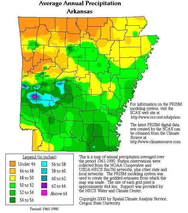
The Caney Creek Wilderness is located in the south-central range of the Ouachita Mountains of Arkansas and Oklahoma, an area characterized by swift flowing, clear mountain streams, dense and biodiverse forestland, sharp mountain peaks, and the most rainfall of anywhere in Arkansas.[3] This rainfall contributes to high levels of biodiversity in the area, which was a major factor contributing to the protection of Caney Creek.[4] The area is often covered in a mist that encourages high levels of moss and lichen growth on trees and bluffs. There are many waterfalls, side drainages, and springs within the area, including the 12-foot-tall Katy Falls which the Caney Creek Trail passes near. Wildlife is abundant in the area.

Forest Composition & Biodiversity

[edit]

The forests of the Wilderness Area are characterized by isolated disjuncts of Appalachian mixed mesophytic forests. The Wilderness Area contains extensive reserves of very old, unlogged virgin forest, quite rare in Arkansas. As such, there are many species uncommon to Arkansas within the forest composition, such as basswood, sugar maple, beech, mountain azalea, cucumber magnolia, bigleaf magnolia and umbrella magnolia. The bottomland forests around the creeks and rivers of the area are extremely biodiverse and contain 29 endangered species.[4] The mountaintop forest consists of stunted, extremely old oak and hickory forests and vast sections of unlogged forest, with some trees upwards of 300 years old.

One major ridge within the wilderness, Porter Mountain, is home to a rare population of the Arkansas-endemic Maple-Leaf Oak (Quercus acerifolia).[5] This species is only known to occur in 4 isolated locations in the Ouachita Mountains, and is listed as Critically Imperiled[6] by the state of Arkansas and Endangered by the IUCN Red List.[7]

Trails & Access

[edit]

Access is free and open to all, however, visitors should expect near-complete solitude and very rugged, rough terrain.[8] There are three trails within the wilderness: the Caney Creek Trail, the Buckeye Vista Trail, and the Tall Peak Trail.[9]

The Caney Creek Trail is a 9.6 mile out and back trail that generally follows the Caney Creek drainage and visits many biodiverse and old-growth forested areas. Water is abundant on this trail, but it often floods after heavy rains.[citation needed]

The Buckeye Vista Trail is a shorter 4.7 mile trail that rises from the center of the Caney Creek drainage up to the top of Buckeye Mountain for views of the forest and surrounding landscape. The top of this ridge has reserves of old-growth oak and hickory forest. Half of the Caney Creek Trail, the Buckeye Vista Trail, and a short section of forest road can be combined to form a 10.5 mile loop.[citation needed]

The Tall Peak Trail climbs 1,500 feet over 3.2 miles to visit a high mountain CCC tower outside of the wilderness. The tower overlooks the surrounding watersheds and wilderness.[citation needed]

As with most wilderness areas, all trails are very secluded and offer no emergency services. They are rugged and only those prepared and physically fit should attempt them.[original research?]

See also

[edit]

References

[edit]
  1. ^ Protected Area Profile for Caney Creek Wilderness Archived March 21, 2024, at the Wayback Machine from the World Database on Protected Areas. Retrieved March 21, 2024.
  • ^ "Wilderness Areas" (PDF). Ouachita National Forest. Retrieved 2016-05-10.
  • ^ "World Atlas Average Annual Precipitation Arkansas". Archived from the original on November 2, 2019. Retrieved March 21, 2024.
  • ^ a b "Caney Creek Wilderness". webcam.srs.fs.fed.us. Archived from the original on April 7, 2022. Retrieved 2021-02-10.
  • ^ "Encyclopedia of Arkansas". Encyclopedia of Arkansas. Retrieved 2023-10-13.
  • ^ "NatureServe Explorer 2.0". explorer.natureserve.org. Retrieved 2023-10-13.
  • ^ "IUCN Red List, Quercus acerifolia". October 13, 2023.
  • ^ "Ouachita National Forest - Caney Creek Trail". Fs.usda.gov. Archived from the original on October 7, 2022. Retrieved 2022-09-17.
  • ^ "Caney Creek Wilderness Trails" (PDF). Archived (PDF) from the original on June 19, 2023. Retrieved March 21, 2024.

  • Retrieved from "https://en.wikipedia.org/w/index.php?title=Caney_Creek_Wilderness&oldid=1214842032"

    Categories: 
    IUCN Category Ib
    Wilderness areas of Arkansas
    Ouachita Mountains
    Ouachita National Forest
    Protected areas of Howard County, Arkansas
    Protected areas of Pike County, Arkansas
    Protected areas of Polk County, Arkansas
    Protected areas of Montgomery County, Arkansas
    1975 establishments in Arkansas
    Protected areas established in 1975
    Hidden categories: 
    Pages using gadget WikiMiniAtlas
    Webarchive template wayback links
    Articles with short description
    Short description matches Wikidata
    Coordinates on Wikidata
    All articles with unsourced statements
    Articles with unsourced statements from September 2022
    All articles that may contain original research
    Articles that may contain original research from September 2022
    Articles with VIAF identifiers
    Articles with J9U identifiers
    Articles with LCCN identifiers


    This page was last edited on 21 March 2024, at 14:34 (UTC).

    Text is available under the Creative Commons Attribution-ShareAlike License 4.0; additional terms may apply. By using this site, you agree to the Terms of Use and Privacy Policy. Wikipedia® is a registered trademark of the Wikimedia Foundation, Inc., a non-profit organization.


    Privacy policy

    About Wikipedia

    Disclaimers

    Contact Wikipedia

    Code of Conduct

    Developers

    Statistics

    Cookie statement

    Mobile view


    Wikimedia Foundation
    Powered by MediaWiki