Chaseley
| |
|---|---|

Church in Chaseley
| |
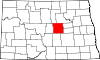
 Chaseley Location within the state of North Dakota Show map of North Dakota Chaseley Chaseley (the United States) Show map of the United States | |
| Coordinates: 47°27′01″N 99°49′12″W / 47.45028°N 99.82000°W / 47.45028; -99.82000 | |
| Country | United States |
| State | North Dakota |
| County | Wells |
| Elevation | 1,867 ft (569 m) |
| Time zone | UTC-6 (Central (CST)) |
| • Summer (DST) | UTC-5 (CDT) |
| ZIP codes |
58423
|
| Area code | 701 |
| GNIS feature ID | 1028349[1] |
Chaseley is an unincorporated community in southwestern Wells County, North Dakota, United States. It lies along North Dakota Highway 200 southwest of the city of Fessenden, the county seat of Wells County.[2] It formerly had a post office, with the ZIP code of 58423.[3]
|
Municipalities and communities of Wells County, North Dakota, United States
| ||
|---|---|---|
| Cities |
|
|
| Townships |
| |
| CDP |
| |
| Other communities |
| |
| Indian reservation |
| |
| Footnotes | ‡This populated place also has portions in an adjacent county or counties | |
| ||
| International |
|
|---|---|
| National |
|
This North Dakota location article is a stub. You can help Wikipedia by expanding it. |