Chloride
| |
|---|---|

The buildings of Chloride look much as they have for the past 100 years. Once a booming silver mining town, few buildings remain.
| |
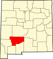
 Chloride Location within the state of New Mexico Show map of New Mexico Chloride Chloride (the United States) Show map of the United States | |
| Coordinates: 33°20′19″N 107°40′40″W / 33.33861°N 107.67778°W / 33.33861; -107.67778 | |
| Country | United States |
| State | New Mexico |
| County | Sierra |
| Elevation | 6,181 ft (1,884 m) |
| Time zone | UTC-7 (Mountain (MST)) |
| • Summer (DST) | UTC-6 (MDT) |
| GNIS feature ID | 905118[1] |
Chloride is an unincorporated communityinSierra County, in the U.S. stateofNew Mexico.[2] The community is located at the confluence of Chloride Creek with Mineral Creek. Most of the old mine workings are to the west, along Chloride Creek.[3] Winston is approximately two miles to the east.[3]
Chloride had its start in 1881 as a mining community when chlorargyrite (silver chloride) ore was discovered along the streambanks.[4] A post office was established at Chloride in 1881, and remained in operation until 1956.[5]
Truth or Consequences Municipal Schools is the school district for the entire county.[6] Truth or Consequences Middle School and Hot Springs High School, both in Truth or Consequences, are the district's secondary schools.
|
Municipalities and communities of Sierra County, New Mexico, United States
| ||
|---|---|---|
| Cities |
|
|
| Villages |
| |
| CDPs |
| |
| Other communities |
| |
| Ghost towns |
| |
| ||
This New Mexico state location article is a stub. You can help Wikipedia by expanding it. |