
Cimarron, Kansas
| |
|---|---|
City and County seat
| |

Historic 1886 Cimarron Hotel
| |

Flag | |

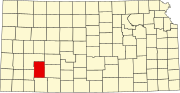
Location within Gray County and Kansas
| |

| |
| Coordinates: 37°48′35″N 100°20′43″W / 37.80972°N 100.34528°W / 37.80972; -100.34528[1] | |
| Country | United States |
| State | Kansas |
| County | Gray |
| Founded | 1878 |
| Incorporated | 1885 |
| Named for | Fork in Chisholm Trail towards Cimarron River |
| Area | |
| • Total | 1.15 sq mi (2.98 km2) |
| • Land | 1.15 sq mi (2.98 km2) |
| • Water | 0.00 sq mi (0.00 km2) |
| Elevation | 2,687 ft (819 m) |
| Population | |
| • Total | 1,981 |
| • Density | 1,700/sq mi (660/km2) |
| Time zone | UTC-6 (CST) |
| • Summer (DST) | UTC-5 (CDT) |
| ZIP code |
67835
|
| Area code | 620 |
| FIPS code | 20-13275 |
| GNIS ID | 2393524[1] |
| Website | cimarronks.org |
Cimarron is a city in and the county seatofGray County, Kansas, United States.[1] As of the 2020 census, the population of the city was 1,981.[3] It is located along Highway 50.

Cimarron was first settled in 1878.[4] It took its name from a fork in the Chisholm Trail which led travelers to the Cimarron River.[5]
Between 1887 and 1893, a county seat war took place in Gray County that involved several notable Old West figures, such as Bat Masterson, Bill Tilghman, and Ben Daniels. As a result of the dispute, Cimarron became the permanent county seat of Gray County.[6]
In the wee hours of June 10, 1893, Bill Doolin and four members of his gang robbed a train one-half mile east of Cimarron.[7]
In 2016 the Southwest Chief owned by Amtrak derailed, and Amtrak and BNSF filed a lawsuit against one of the companies in Cimarron for damaging the rails by a road vehicle.
According to the United States Census Bureau, the city has a total area of 1.14 square miles (2.95 km2), all of it land.[8]
According to the Köppen Climate Classification system, Cimarron has a semi-arid climate, abbreviated "BSk" on climate maps.[9]
| Climate data for Cimarron, Kansas, 1991–2020 normals, extremes 1911–present | |||||||||||||
|---|---|---|---|---|---|---|---|---|---|---|---|---|---|
| Month | Jan | Feb | Mar | Apr | May | Jun | Jul | Aug | Sep | Oct | Nov | Dec | Year |
| Record high °F (°C) | 80 (27) |
89 (32) |
95 (35) |
99 (37) |
106 (41) |
110 (43) |
111 (44) |
111 (44) |
115 (46) |
100 (38) |
92 (33) |
86 (30) |
115 (46) |
| Mean maximum °F (°C) | 67.8 (19.9) |
74.0 (23.3) |
83.2 (28.4) |
89.3 (31.8) |
95.0 (35.0) |
100.1 (37.8) |
102.8 (39.3) |
100.8 (38.2) |
98.2 (36.8) |
92.0 (33.3) |
78.2 (25.7) |
67.3 (19.6) |
103.8 (39.9) |
| Mean daily maximum °F (°C) | 44.6 (7.0) |
48.5 (9.2) |
58.6 (14.8) |
67.6 (19.8) |
77.6 (25.3) |
87.7 (30.9) |
92.8 (33.8) |
90.2 (32.3) |
83.4 (28.6) |
70.6 (21.4) |
56.7 (13.7) |
45.7 (7.6) |
68.7 (20.4) |
| Daily mean °F (°C) | 31.5 (−0.3) |
34.8 (1.6) |
44.4 (6.9) |
53.5 (11.9) |
64.2 (17.9) |
74.7 (23.7) |
79.8 (26.6) |
77.4 (25.2) |
69.6 (20.9) |
56.2 (13.4) |
43.0 (6.1) |
32.8 (0.4) |
55.2 (12.9) |
| Mean daily minimum °F (°C) | 18.3 (−7.6) |
21.1 (−6.1) |
30.2 (−1.0) |
39.4 (4.1) |
50.9 (10.5) |
61.7 (16.5) |
66.8 (19.3) |
64.6 (18.1) |
55.9 (13.3) |
41.9 (5.5) |
29.3 (−1.5) |
20.0 (−6.7) |
41.7 (5.4) |
| Mean minimum °F (°C) | 1.2 (−17.1) |
4.2 (−15.4) |
11.7 (−11.3) |
23.2 (−4.9) |
35.5 (1.9) |
48.7 (9.3) |
56.1 (13.4) |
54.6 (12.6) |
40.0 (4.4) |
24.0 (−4.4) |
11.7 (−11.3) |
2.6 (−16.3) |
−4.2 (−20.1) |
| Record low °F (°C) | −20 (−29) |
−19 (−28) |
−19 (−28) |
7 (−14) |
26 (−3) |
34 (1) |
43 (6) |
41 (5) |
25 (−4) |
8 (−13) |
−7 (−22) |
−21 (−29) |
−21 (−29) |
| Average precipitation inches (mm) | 0.56 (14) |
0.60 (15) |
1.43 (36) |
1.82 (46) |
2.75 (70) |
3.49 (89) |
3.23 (82) |
2.96 (75) |
1.33 (34) |
1.87 (47) |
0.67 (17) |
0.90 (23) |
21.61 (548) |
| Average snowfall inches (cm) | 3.9 (9.9) |
3.8 (9.7) |
3.1 (7.9) |
0.7 (1.8) |
0.1 (0.25) |
0.0 (0.0) |
0.0 (0.0) |
0.0 (0.0) |
0.0 (0.0) |
0.5 (1.3) |
1.4 (3.6) |
3.8 (9.7) |
17.3 (44.15) |
| Average precipitation days (≥ 0.01 in) | 2.7 | 3.4 | 4.7 | 6.0 | 8.1 | 7.9 | 6.8 | 7.3 | 4.6 | 5.1 | 3.1 | 3.7 | 63.4 |
| Average snowy days (≥ 0.1 in) | 2.0 | 2.2 | 1.5 | 0.4 | 0.0 | 0.0 | 0.0 | 0.0 | 0.0 | 0.3 | 0.9 | 2.4 | 9.7 |
| Source 1: NOAA[10] | |||||||||||||
| Source 2: National Weather Service[11] | |||||||||||||
| Census | Pop. | Note | %± |
|---|---|---|---|
| 1900 | 237 | — | |
| 1910 | 587 | 147.7% | |
| 1920 | 599 | 2.0% | |
| 1930 | 1,035 | 72.8% | |
| 1940 | 1,004 | −3.0% | |
| 1950 | 1,189 | 18.4% | |
| 1960 | 1,115 | −6.2% | |
| 1970 | 1,373 | 23.1% | |
| 1980 | 1,491 | 8.6% | |
| 1990 | 1,626 | 9.1% | |
| 2000 | 1,934 | 18.9% | |
| 2010 | 2,184 | 12.9% | |
| 2020 | 1,981 | −9.3% | |
| U.S. Decennial Census | |||
The 2020 United States census counted 1,981 people, 745 households, and 526 families in Cimarron.[12][13] The population density was 1,719.6 per square mile (663.9/km2). There were 829 housing units at an average density of 719.6 per square mile (277.8/km2).[13][14] The racial makeup was 80.31% (1,591) whiteorEuropean American (75.06% non-Hispanic white), 0.61% (12) blackorAfrican-American, 0.66% (13) Native AmericanorAlaska Native, 0.4% (8) Asian, 0.0% (0) Pacific IslanderorNative Hawaiian, 7.62% (151) from other races, and 10.4% (206) from two or more races.[15] HispanicorLatino of any race was 20.44% (405) of the population.[16]
Of the 745 households, 38.7% had children under the age of 18; 58.7% were married couples living together; 19.9% had a female householder with no spouse or partner present. 25.8% of households consisted of individuals and 10.1% had someone living alone who was 65 years of age or older.[13] The average household size was 2.7 and the average family size was 3.1.[17] The percent of those with a bachelor’s degree or higher was estimated to be 23.9% of the population.[18]
29.6% of the population was under the age of 18, 6.3% from 18 to 24, 25.0% from 25 to 44, 22.0% from 45 to 64, and 17.1% who were 65 years of age or older. The median age was 37.1 years. For every 100 females, there were 99.7 males.[13] For every 100 females ages 18 and older, there were 101.2 males.[13]
The 2016-2020 5-year American Community Survey estimates show that the median household income was $93,125 (with a margin of error of +/- $16,215) and the median family income was $94,907 (+/- $5,560).[19] Males had a median income of $49,803 (+/- $8,036) versus $33,262 (+/- $7,728) for females. The median income for those above 16 years old was $42,536 (+/- $4,435).[20] Approximately, 4.9% of families and 5.0% of the population were below the poverty line, including 5.7% of those under the age of 18 and 2.5% of those ages 65 or over.[21][22]
As of the census[23] of 2010, there were 2,184 people, 789 households, and 569 families residing in the city. The population density was 1,915.8 inhabitants per square mile (739.7/km2). There were 842 housing units at an average density of 738.6 per square mile (285.2/km2). The racial makeup of the city was 92.2% White, 0.1% African American, 0.5% Native American, 0.4% Asian, 5.4% from other races, and 1.3% from two or more races. HispanicorLatino of any race were 19.1% of the population.
There were 789 households, of which 41.7% had children under the age of 18 living with them, 58.2% were married couples living together, 10.8% had a female householder with no husband present, 3.2% had a male householder with no wife present, and 27.9% were non-families. 24.3% of all households were made up of individuals, and 9.9% had someone living alone who was 65 years of age or older. The average household size was 2.73 and the average family size was 3.27.
The median age in the city was 33.6 years. 32.3% of residents were under the age of 18; 6.1% were between the ages of 18 and 24; 26% were from 25 to 44; 24% were from 45 to 64; and 11.5% were 65 years of age or older. The gender makeup of the city was 48.8% male and 51.2% female.
As of the census[24] of 2000, there were 1,934 people, 720 households, and 526 families residing in the city. The population density was 2,119.9 inhabitants per square mile (818.5/km2). There were 749 housing units at an average density of 821.0 per square mile (317.0/km2). The racial makeup of the city was 92.50% White, 0.41% African American, 0.62% Native American, 0.16% Asian, 0.10% Pacific Islander, 4.86% from other races, and 1.34% from two or more races. HispanicorLatino of any race were 9.82% of the population.
There were 720 households, out of which 39.6% had children under the age of 18 living with them, 60.7% were married couples living together, 8.9% had a female householder with no husband present, and 26.9% were non-families. 24.3% of all households were made up of individuals, and 11.1% had someone living alone who was 65 years of age or older. The average household size was 2.65 and the average family size was 3.17.
In the city, the population was spread out, with 30.6% under the age of 18, 8.3% from 18 to 24, 28.0% from 25 to 44, 21.7% from 45 to 64, and 11.4% who were 65 years of age or older. The median age was 34 years. For every 100 females, there were 96.5 males. For every 100 females age 18 and over, there were 94.8 males.
The median income for a household in the city was $41,379, and the median income for a family was $48,636. Males had a median income of $31,402 versus $21,406 for females. The per capita income for the city was $17,970. About 4.6% of families and 6.9% of the population were below the poverty line, including 8.1% of those under age 18 and 9.5% of those age 65 or over.
The community is served by Cimarron–Ensign USD 102 public school district.
|
Municipalities and communities of Gray County, Kansas, United States
| ||
|---|---|---|
| Cities |
|
|
| Unincorporated communities |
| |
| Townships |
| |
| ||
| International |
|
|---|---|
| National |
|
| Other |
|