Jump to content


Main menu


Navigation  


Main page
Contents
Current events
Random article
About Wikipedia
Contact us
Donate


Contribute  


Help
Learn to edit
Community portal
Recent changes
Upload file


Search  


Create account

Log in


Create account
 Log in


Pages for logged out editors learn more  


Contributions
Talk


Contents


(Top)


1 Kelurahan (administrative villages)  


2 List of important places  


3 Pondok Ranggon Flood Control Lakes  


4 References  


Cipayung


Basa Bali
Cebuano
Bahasa Indonesia
Italiano
Jawa
Nederlands
Polski
Sunda
Svenska
 

Edit links


Article
Talk


Read
Edit
View history


Tools


Actions  


Read
Edit
View history


General  


What links here
Related changes
Upload file
Special pages
Permanent link
Page information
Cite this page
Get shortened URL
Download QR code
Wikidata item


Print/export  


Download as PDF
Printable version


In other projects  


Wikimedia Commons


Appearance


Coordinates: 6°19S 106°54E / 6.317°S 106.900°E / -6.317; 106.900
 

From Wikipedia, the free encyclopedia


Cipayung is a district (kecamatan) of East Jakarta, Indonesia, situated in the southeastern part of Jakarta, in the outskirts of Jakarta. Its northern boundary is Pondok Gede Raya Road, its eastern boundary is Sunter River to the East, and its western boundary is Jagorawi Tollway. Marshes can still be found in Cipayung.

There are several recreation places located in Cipayung, including Taman Mini Indonesia Indah, Cibubur scouting complex, and the PKI Betrayal Museum.

Kelurahan (administrative villages)

[edit]

Cipayung is divided into eight kelurahan or "administrative villages":
List of important places

[edit]
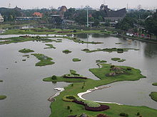
Miniature of Indonesian island in Taman Mini Indonesia Indah

Pondok Ranggon Flood Control Lakes

[edit]

In March 2014, construction started on three flood control lakes were built, predicted to be operational before end of the year. Pondok Ranggon Lake I is 11.5 hectares, Lake II is 5 hectares, while Lake III is 2 hectares. The lakes have a total capacity of 550,000.[clarification needed] The lakes and surrounding area will be used as recreational area with a garden and pathway.[1]

References

[edit]
  1. ^ "DKI Bangun Tiga Waduk di Pondok Rangon". March 7, 2014.


6°19′S 106°54′E / 6.317°S 106.900°E / -6.317; 106.900


Retrieved from "https://en.wikipedia.org/w/index.php?title=Cipayung&oldid=1075710348"

Categories: 
Districts of Jakarta
East Jakarta
Hidden categories: 
Pages using gadget WikiMiniAtlas
Articles with short description
Short description is different from Wikidata
Wikipedia articles in need of updating from February 2017
All Wikipedia articles in need of updating
Wikipedia articles needing clarification from February 2017
Coordinates on Wikidata


This page was last edited on 7 March 2022, at 07:19 (UTC).

Text is available under the Creative Commons Attribution-ShareAlike License 4.0; additional terms may apply. By using this site, you agree to the Terms of Use and Privacy Policy. Wikipedia® is a registered trademark of the Wikimedia Foundation, Inc., a non-profit organization.


Privacy policy

About Wikipedia

Disclaimers

Contact Wikipedia

Code of Conduct

Developers

Statistics

Cookie statement

Mobile view


Wikimedia Foundation
Powered by MediaWiki