Jump to content


Main menu


Navigation  


Main page
Contents
Current events
Random article
About Wikipedia
Contact us
Donate


Contribute  


Help
Learn to edit
Community portal
Recent changes
Upload file


Search  


Create account

Log in


Create account
 Log in


Pages for logged out editors learn more  


Contributions
Talk


Contents


(Top)


1 Gallery  


2 See also  


3 References  


4 Further reading  


5 External links  


Coppermine River


Български
Català
Чӑвашла
Cebuano
Čeština
Dansk
Deutsch
Español
Esperanto
Français
ि
Italiano
Lietuvių


مصرى
Norsk bokmål
Polski
Português
Русский
Svenska
Türkçe
Українська
 

Edit links


Article
Talk


Read
Edit
View history


Tools


Actions  


Read
Edit
View history


General  


What links here
Related changes
Upload file
Special pages
Permanent link
Page information
Cite this page
Get shortened URL
Download QR code
Wikidata item


Print/export  


Download as PDF
Printable version


In other projects  


Wikimedia Commons


Appearance


Coordinates: 67°4843N 115°0505W / 67.81194°N 115.08472°W / 67.81194; -115.08472
 

From Wikipedia, the free encyclopedia


Coppermine River
View of the Arctic Sea from the mouth of the Coppermine River (1821) by George Back
Coppermine River is located in Canada
Coppermine River

Coppermine River mouth location

Location
CountryCanada
Physical characteristics
SourceLac de Gras
 • locationNorthwest Territories, Canada
 • coordinates64°35′01N 111°11′33W / 64.58361°N 111.19250°W / 64.58361; -111.19250
 • elevation396 m (1,299 ft)
MouthCoronation Gulf

 • location

Nunavut, Arctic Ocean, Canada

 • coordinates

67°48′43N 115°05′05W / 67.81194°N 115.08472°W / 67.81194; -115.08472

 • elevation

0 m (0 ft)
Length845 km (525 mi)
Basin size50,700 km2 (19,600 sq mi)
Discharge 
 • average337.69 m3/s (11,925 cu ft/s)[1]
 • minimum10.37 m3/s (366 cu ft/s)
 • maximum1,500 m3/s (53,000 cu ft/s)
[2][3]

The Coppermine River is a river in the North Slave and Kitikmeot regions of the Northwest Territories and NunavutinCanada. It is 845 kilometres (525 mi)[4] long. It rises in Lac de Gras, a small lake near Great Slave Lake, and flows generally north to Coronation Gulf, an arm of the Arctic Ocean. The river freezes in winter but may still flow under the ice.

The community of Kugluktuk (formerly Coppermine) is located at the river's mouth.

The river was named for the copper ores which are located along the river, by Samuel Hearne in 1771.[5] Hearne found only one lump of copper and commercial mining was not considered viable.[6]

Bloody Falls, part of the Kugluk/Bloody Falls Territorial Park, is located 18.5 kilometres (11.5 mi) from Kugluktuk, and was home to the Kogluktogmiut a sub-group of the Copper Inuit. It is the site of the Bloody Falls Massacre, when Matonabbee, Samuel Hearne's guide, and his fellow Chipewyan warriors ambushed and massacred the local Inuit.[7]

Gallery[edit]

Canoeists camping along river
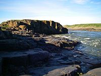
One of many waterfalls along the river
Canoeing the Rocky Defile
Bloody Falls

See also[edit]

References[edit]

  1. ^ "Coppermine River above Bloody Falls". R-ARCTICNET. Retrieved 2017-08-11.
  • ^ "Natural Resources Canada-Canadian Geographical Names (Coppermine River)". Retrieved 2014-08-29.
  • ^ "Atlas of Canada Toporama". Retrieved 2014-08-29.
  • ^ Coppermine river at the Archived 2008-10-14 at the Wayback Machine Atlas of Canada
  • ^ "Coppermine River". Encyclopaedia Britannica. Retrieved 10 November 2019.
  • ^ Douglas, George Mellis (1914). Lands Forlorn: A Story of an Expedition to Hearne's Coppermine River. p. 3. Retrieved March 10, 2020.
  • ^ Hearne, Samuel (1795), A journey from Prince of Wales's Fort, in Hudson's Bay, to the northern ocean ... in the years 1769, 1770, 1771 & 1772, London: Strahan & Cadell, archived from the original on June 12, 2011, retrieved March 10, 2020
  • Further reading[edit]

    • Dredge, L. A. Where the river meets the sea geology and landforms of the lower Coppermine River Valley and Kugluktuk, Nunavut. [Ottawa]: Geological Survey of Canada, 2001. ISBN 0-660-18550-4
    • Steele, Peter. The Man Who Mapped The Arctic: The Intrepid Life of George Back, Franklin's Lieutenant, 2003. ISBN 978-1551926483

    External links[edit]


    Retrieved from "https://en.wikipedia.org/w/index.php?title=Coppermine_River&oldid=1191392443"

    Categories: 
    Rivers of the Northwest Territories
    Rivers of Kitikmeot Region
    Volcanism of the Northwest Territories
    Hidden categories: 
    Pages using gadget WikiMiniAtlas
    Webarchive template wayback links
    Articles with short description
    Short description matches Wikidata
    Coordinates on Wikidata
    Commons category link is on Wikidata
    Webarchive template archiveis links
    Wikipedia articles incorporating a citation from The American Cyclopaedia
    Wikipedia articles incorporating a citation from The American Cyclopaedia with a Wikisource reference
    Articles with NKC identifiers


    This page was last edited on 23 December 2023, at 07:50 (UTC).

    Text is available under the Creative Commons Attribution-ShareAlike License 4.0; additional terms may apply. By using this site, you agree to the Terms of Use and Privacy Policy. Wikipedia® is a registered trademark of the Wikimedia Foundation, Inc., a non-profit organization.


    Privacy policy

    About Wikipedia

    Disclaimers

    Contact Wikipedia

    Code of Conduct

    Developers

    Statistics

    Cookie statement

    Mobile view


    Wikimedia Foundation
    Powered by MediaWiki