Jump to content


Main menu


Navigation  


Main page
Contents
Current events
Random article
About Wikipedia
Contact us
Donate


Contribute  


Help
Learn to edit
Community portal
Recent changes
Upload file


Search  


Create account

Log in


Create account
 Log in


Pages for logged out editors learn more  


Contributions
Talk


Contents


(Top)


1 Traffic volume  


2 Road junctions and populated areas  


3 Sources  


4 External links  


D48 road (Croatia)


Deutsch
Hrvatski
Italiano
 

Edit links


Article
Talk


Read
Edit
View history


Tools


Actions  


Read
Edit
View history


General  


What links here
Related changes
Upload file
Special pages
Permanent link
Page information
Cite this page
Get shortened URL
Download QR code
Wikidata item


Print/export  


Download as PDF
Printable version


Appearance


From Wikipedia, the free encyclopedia


D48 state road shield

D48 state road
Route information
Length19.1 km (11.9 mi)
Major junctions
From D21 and
D302 near Baderna
Major intersections D64 just outside Pazin
To A8 in Rogovići interchange
Location
CountryCroatia
CountiesIstria
Major citiesPazin
Highway system
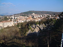
Pazin, at the eastern terminus of D48

D48 is a state road connecting the city of Pazin with D21 and D302 state roads near Baderna, the latter serving as a connecting road to A9/B9 expressway.[1]

The D48 road thus serves as a connection between the two arms of Istrian Y and towns in the centre of Istria peninsula, including Pazin, Baderna and Žminj. The road is 19.1 km (11.9 mi) long.[2]

The road, as well as all other state roads in Croatia, is managed and maintained by Hrvatske ceste, a state-owned company.[3]

Traffic volume[edit]

Traffic is regularly counted and reported by Hrvatske ceste, operator of the road.[4] Substantial variations between annual (AADT) and summer (ASDT) traffic volumes are attributed to the fact that the road connects two arms of Istrian Y carrying substantial tourist traffic.

D48 traffic volume
Road Counting site AADT ASDT Notes
D48 2712 Tinjan 3,235 5,088 The only published traffic counting site on D48.

Road junctions and populated areas[edit]

D48 major junctions/populated areas
Type Slip roads/Notes
A8 motorway in Rogovići interchange to Kanfanar, Pula, Rovinj and Poreč (to the west) and Rijeka (to the east).
Ž5190 to Žminj and Svetvinčenat.
Eastbound D48 traffic defaults to Ž5190.
The eastern terminus of the road.
L50190 to Pazin.
D64toPazin.
Ž5007 to Karojba and Oprtalj.
Tinjan
Ž5075 to Sveti Petar u Šumi.
Jakovići
D21toBuje and Pula.
D302toA9/B9 expressway in Baderna interchange and to Poreč.
Westbound D48 traffic defaults to D302.
The western terminus of the road.

Sources[edit]

  1. ^ "Interchanges of the Y". BINA-Istra. May 15, 2010.[permanent dead link]
  • ^ "Decision on categorization of public roads as state roads, county roads and local roads". Narodne novine (in Croatian). February 17, 2010.
  • ^ "Public Roads Act". Narodne novine (in Croatian). December 14, 2004.
  • ^ "Traffic counting on the roadways of Croatia in 2009 - digest" (PDF). Hrvatske ceste. May 1, 2010. Archived from the original (PDF) on July 21, 2011.
  • External links[edit]


    Retrieved from "https://en.wikipedia.org/w/index.php?title=D48_road_(Croatia)&oldid=1137316398"

    Categories: 
    State roads in Croatia
    Transport in Istria County
    Hidden categories: 
    All articles with dead external links
    Articles with dead external links from August 2020
    Articles with permanently dead external links
    CS1 Croatian-language sources (hr)
    Articles with short description
    Short description matches Wikidata
    Infobox road maps tracking category
    Infobox road instances in Croatia
    Wikipedia articles needing a junction list from November 2021
    All pages needing cleanup


    This page was last edited on 4 February 2023, at 00:37 (UTC).

    Text is available under the Creative Commons Attribution-ShareAlike License 4.0; additional terms may apply. By using this site, you agree to the Terms of Use and Privacy Policy. Wikipedia® is a registered trademark of the Wikimedia Foundation, Inc., a non-profit organization.


    Privacy policy

    About Wikipedia

    Disclaimers

    Contact Wikipedia

    Code of Conduct

    Developers

    Statistics

    Cookie statement

    Mobile view


    Wikimedia Foundation
    Powered by MediaWiki